Leander, Texas facts for kids
Quick facts for kids
Leander, Texas
|
|
|---|---|
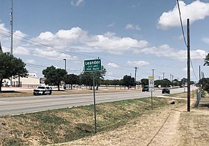
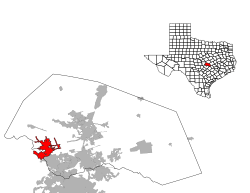
Leander city limit
|
|
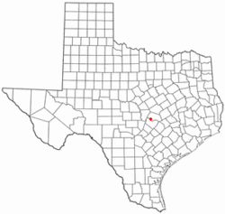
Location of Leander, Texas
|
|
 |
|
| Country | United States |
| State | Texas |
| Counties | Williamson, Travis |
| Incorporated | January 21, 1978 |
| Government | |
| • Type | Council-Manager |
| Area | |
| • Total | 37.70 sq mi (97.65 km2) |
| • Land | 37.50 sq mi (97.13 km2) |
| • Water | 0.20 sq mi (0.52 km2) |
| Elevation | 1,017 ft (310 m) |
| Population
(2020)
|
|
| • Total | 59,202 |
| • Estimate
(2023)
|
81,371 |
| • Density | 1,160.6/sq mi (448.11/km2) |
| Time zone | UTC-6 (Central (CST)) |
| • Summer (DST) | UTC-5 (CDT) |
| ZIP codes |
78641, 78646
|
| Area code(s) | 512 & 737 |
| FIPS code | 48-42016 |
| GNIS feature ID | 2410812 |
| Website | http://www.leandertx.gov/ |
Leander (pronounced lee-AN-der) is a city in Williamson County and Travis County, Texas, United States. It's a suburb located just north of Austin. Leander is part of the larger Greater Austin metropolitan area.
In 2020, about 59,202 people lived in Leander. By 2022, this number grew to an estimated 74,375. Between 2018 and 2019, Leander was actually the fastest-growing city in the entire United States!
Contents
History of Leander
Leander was officially started in 1882. The land for the town was sold by the Austin and Northwestern Railroad Company to people who wanted to live there. The town was named after Leander "Catfish" Brown. He was one of the railroad officials who helped finish the railway line.
Early Settlements and Events
The very first settlement by European Americans in Williamson County was Tumlinson Fort. It was built in early January 1836 near Brushy Creek, about four miles south of where Leander is today. This fort was meant to protect settlers from attacks. Texas Rangers stayed there for a short time. However, they had to leave when the invasion of Santa Anna began, and the fort was later burned.
Another event, called the Webster Massacre, happened near Leander in August 1839. A group of about 30 settlers traveling west were attacked. Most of them did not survive.
An amazing discovery was made near Leander: the Leanderthal Lady. This is a skeleton that is between 10,000 and 13,000 years old! It was one of the oldest complete burial sites ever found in the United States.
In 2011, some large wildfires affected two neighborhoods in Leander. These fires burned about 330 acres and destroyed 26 homes.
Geography of Leander
Leander is located where two main roads meet: Ranch to Market Road 2243 and U.S. Route 183. It's about 22 miles northwest of Downtown Austin. The city of Georgetown is also nearby, about five miles to the east on Route 2243.
The City of Leander covers a total area of about 34.08 square miles (88.27 square kilometers). All of this area is land.
Population and People
| Historical population | |||
|---|---|---|---|
| Census | Pop. | %± | |
| 1980 | 2,179 | — | |
| 1990 | 3,398 | 55.9% | |
| 2000 | 7,596 | 123.5% | |
| 2010 | 26,521 | 249.1% | |
| 2020 | 59,202 | 123.2% | |
| 2023 (est.) | 81,371 | 206.8% | |
| U.S. Decennial Census | |||
Leander has grown a lot over the years. In 1980, there were just over 2,000 people. By 2020, the population had jumped to over 59,000! This shows how quickly the city is expanding.
In 2020, there were 59,202 people living in Leander. There were also 18,505 households and 15,118 families. The average household had about 3 people living in it.
Many families with children live in Leander. About 51.7% of households had children under 18. The city's population is quite young, with 33.5% of people being under 18 years old. The average age in Leander was 30 years old.
In 2019, the average income for a household in Leander was about $101,872. This shows that many people in Leander have good jobs. Only a small percentage of people, about 4.2%, lived in poverty.
Education in Leander
Leander is home to the Leander Independent School District. This school district serves many students in the area.
Schools in Leander ISD
The district includes several high schools, middle schools, and elementary schools:
- High Schools:
* Leander High School * Vista Ridge High School * Cedar Park High School * Charles Rouse High School * Vandegrift High School * Tom Glenn High School
- Middle Schools:
* Wiley Middle School (Bernice Knox Wiley Middle School) * Stiles Middle School (Florence W. Stiles Middle School) * Leander Middle School * Danielson Middle School * Henry Middle School * Running Brushy Middle School * Cedar Park Middle School * Canyon Ridge Middle School
- Elementary Schools:
* Parkside Elementary School * Pleasant Hill Elementary School * Rutledge Elementary School * Whitestone Elementary School * Jim Plain Elementary School * Block House Creek Elementary School * Winkley Elementary School * Reed Elementary School * Camacho Elementary (S.T.E.M.) School * Bagdad Elementary School * Monta Akin Elementary School
Transportation and Infrastructure
Leander is part of the Capital Metropolitan Transportation Authority, also known as Capital Metro. This means Leander has public transportation options.
Public Transport Options
The Capital MetroRail Red Line has its northern end in Leander. The Leander Station and Park & Ride is located on U.S. Highway 183. This station is a great place for people to park their cars and then take the train into Austin.
Leander Station also offers several express bus lines. The park and ride facility has 600 parking spaces, making it easy for commuters to use public transport.
Notable People from Leander
Many interesting people have connections to Leander, including:
- Logan Bearden, a racing driver
- Nate Champion, known for his role in the Johnson County War
- Dan Janjigian, an Olympian, author, and business consultant
- Khiry Shelton, a professional soccer player
- Ramesh Srivastava, the lead singer of the band Voxtrot
- Paul Thompson, a football player
See also
 In Spanish: Leander (Texas) para niños
 | Dorothy Vaughan |
 | Charles Henry Turner |
 | Hildrus Poindexter |
 | Henry Cecil McBay |


