Leesylvania, Virginia facts for kids
Quick facts for kids
Leesylvania, Virginia
|
|
|---|---|

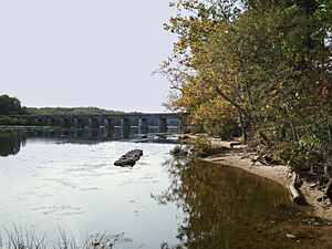
The RF&P Subdivision crossing over Powells Creek at Leesylvania State Park
|
|

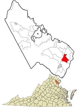
Location in Prince William County and the state of Virginia.
|
|
| Country | United States |
| State | Virginia |
| County | Prince William |
| Elevation | 13 ft (4 m) |
| Population
(2020)
|
|
| • Total | 21,193 |
| Time zone | UTC−5 (Eastern (EST)) |
| • Summer (DST) | UTC−4 (EDT) |
| ZIP codes |
22191
|
| FIPS code | 51-55272 |
| GNIS feature ID | 2629768 |
Leesylvania, once called Neabsco, is a special kind of community in Prince William County, Virginia. It's known as a census-designated place, which means it's an area grouped together for counting people by the government, but it's not an official city or town.
Contents
History of Leesylvania
The historic Leesylvania plantation is located very close by, within Leesylvania State Park. In the 1700s, Henry Lee II lived there with his family. He was the grandfather of the famous general, Robert E. Lee.
People who were enslaved also lived and worked on the plantation. They grew tobacco on the land. Today, not much of the original house foundation remains because of road building in the 1950s.
This area was first named Neabsco in 2000. It was named after Neabsco Creek. Before that, it was the southern part of Woodbridge. In 2020, the community was renamed Leesylvania. This new name honors the nearby state park and the historic plantation.
Population and People
In 2010, when it was still called Neabsco, Leesylvania had about 12,068 people. By 2020, the population had grown quite a bit. The 2020 Census counted 21,193 people living in Leesylvania.
Geography and Natural Features
Leesylvania is located in the southeastern part of Prince William County. It shares borders with several other communities. To the northeast is Woodbridge, and to the northwest is Dale City.
Montclair is to the west, and Cherry Hill is to the south. To the east, you'll find Leesylvania State Park. The community sits at about 13 feet (4 meters) above sea level.
Two important creeks flow through Leesylvania. Neabsco Creek cuts through the middle of the area. Powells Creek passes through the southern part. Both creeks flow from west to east and empty into the Potomac River near the state park.
Getting Around Leesylvania
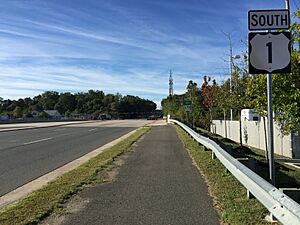
The main part of Leesylvania is where two major roads meet. These are U.S. Route 1, also called Richmond Highway, and SR 610, known as Cardinal Drive or Neabsco Road. Other important roads include SR 638 (Neabsco Mills Road/Blackburn Road) and SR 784 (Dale Boulevard).
VA 394 (College Drive) also serves the area. Interstate 95, a major highway, forms the western edge of Leesylvania. For public transportation, you can use the Virginia Railway Express at the nearby Rippon station. The Potomac and Rappahannock Transportation Commission also offers OmniRide bus service within Leesylvania.
Education in Leesylvania
Leesylvania is home to important educational places. Students can attend Freedom High School. There is also a campus of Northern Virginia Community College located here. This college campus is part of the Woodbridge area.
See also
 In Spanish: Neabsco para niños
 | John T. Biggers |
 | Thomas Blackshear |
 | Mark Bradford |
 | Beverly Buchanan |


