Legendre River facts for kids
Quick facts for kids Legendre River |
|
|---|---|

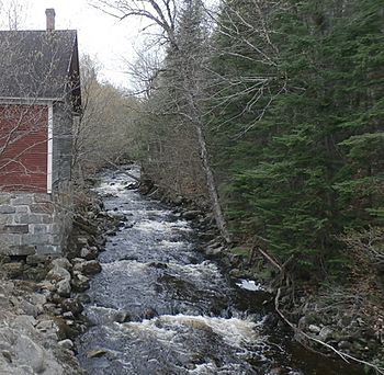
Rivière Legendre près du moulin Legendre à Stornoway.
|
|
| Native name | Rivière Legendre |
| Country | Canada |
| Province | Quebec |
| Region | Estrie |
| MRC | Le Granit Regional County Municipality |
| Municipality | Milan, Stornoway |
| Physical characteristics | |
| Main source | Whitton Lake Milan 518 m (1,699 ft) 45°35′22″N 71°10′01″W / 45.589327°N 71.167044°W |
| River mouth | Felton River Saint-Romain 325 m (1,066 ft) 45°44′20″N 71°08′13″W / 45.73889°N 71.13695°W |
| Length | 25.1 km (15.6 mi) |
| Basin features | |
| Progression | Saint-François River, St. Lawrence River |
| Tributaries |
|
The Legendre River (called rivière Legendre in French) is a small river in Quebec, Canada. It flows into the Felton River. The Felton River then empties into Baie Sauvage, which is part of the big Grand lac Saint François. This lake is where the Saint-François River begins.
The Legendre River travels through the towns of Milan and Stornoway. These towns are in the Le Granit Regional County Municipality (MRC), which is in the Estrie region of Quebec. This area is on the South Shore of the mighty St. Lawrence River.
Where the Legendre River Flows
The Legendre River is surrounded by other rivers and streams. Here are some of the nearby waters:
- To the north: The Felton River and the large Grand lac Saint François.
- To the east: The Felton River again, and the Noire River.
- To the south: The Blanche River, La Loutre brook, and McLeod brook.
- To the west: Caron stream and the Rouge River.
The River's Journey from Source to Mouth
The Legendre River starts high up on the northern side of a mountain in Milan. The top of this mountain is about 550 meters (1,800 feet) high. The river's source is in a forest, just north of Route 214.
From its starting point, the river flows:
- About 2.2 kilometers (1.4 miles) to the west.
- Then, 2.2 kilometers (1.4 miles) north. It reaches the south shore of Petit Lac Legendre. The river flows right through this small lake, which is about 0.8 meters (2.6 feet) long and sits at an altitude of 440 meters (1,440 feet).
- Another 2.0 kilometers (1.2 miles) north. This takes it to the border between Milan and Saint-Romain.
- It continues 7.6 kilometers (4.7 miles) north, until it meets a stream coming from the west.
- Next, it flows 1.6 kilometers (1.0 mile) east and then north. It crosses a road about 1.1 kilometers (0.7 miles) southwest of Stornoway village.
- It travels 2.3 kilometers (1.4 miles) northeast, reaching the Legendre Flour Mill. Here, it crosses another road, about 1.4 kilometers (0.9 miles) northwest of Stornoway.
- It goes 1.0 kilometer (0.6 miles) northeast, to where the outlet of Lake Legendre (coming from the west) joins it.
- Finally, it winds for 5.4 kilometers (3.4 miles) northeast through Parc national de Frontenac before reaching its end.
The Legendre River finishes its journey by emptying into the west bank of the Felton River. This meeting point is about 0.4 kilometers (0.25 miles) upstream from the edge of Parc national de Frontenac. It's also about 3.0 kilometers (1.9 miles) upstream from where the Sauvage River joins the Felton River.
The Name of the River
The name "Rivière Legendre" was officially recorded on December 5, 1968. This was done by the Commission de toponymie du Québec, which is the organization responsible for naming places in Quebec.
 | Roy Wilkins |
 | John Lewis |
 | Linda Carol Brown |

