Sauvage River (Felton River tributary) facts for kids
Quick facts for kids Sauvage River |
|
|---|---|

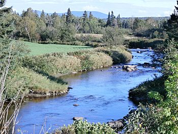
Rivière Sauvage seen from the Highway 108 bridge looking east. The Mont Sainte-Cécile is in the background.
|
|
| Native name | Rivière Sauvage |
| Country | Canada |
| Province | Quebec |
| Region | Estrie |
| MRC | Le Granit Regional County Municipality |
| Municipality | Sainte-Cécile-de-Whitton, Saint-Romain |
| Physical characteristics | |
| Main source | Between Lac de la Souris and Lac à la Sangsue Sainte-Cécile-de-Whitton 513 m (1,683 ft) 45°42′43″N 70°57′02″W / 45.711968°N 70.950488°W |
| River mouth | Felton River Saint-Romain 291 m (955 ft) 45°46′50″N 71°08′20″W / 45.78056°N 71.13889°W |
| Length | 20.6 km (12.8 mi) |
| Basin features | |
| Progression | Saint-François River, St. Lawrence River |
| Tributaries |
|
The Sauvage River (which means Wild River in French) is a river in Quebec, Canada. It flows into the Felton River. The Felton River then joins the Baie Sauvage, which is part of Grand lac Saint François. This large lake is the starting point of the Saint-François River.
The Sauvage River flows through two towns: Sainte-Cécile-de-Whitton and Saint-Romain. These towns are in the Le Granit Regional County Municipality (MRC). This area is part of the Estrie region, located on the South Shore of the St. Lawrence River in Quebec.
Where the Sauvage River Flows
The Sauvage River is surrounded by other important waterways. Here are the main ones nearby:
- North: Grand lac Saint François and Baie Sauvage.
- East: Noire River and Rouge brook.
- South: Blanche River.
- West: Felton River and Legendre River.
Starting Point of the River
The Sauvage River begins in the town of Sainte-Cécile-de-Whitton. Its source is near the border with Lac-Drolet, separated by Highway 263.
The river starts between two small lakes, "Lac à la Sangsue" and "Lac de la Souris." This area is a small valley on the eastern side of a hill called "Montagne de la Craque."
This starting point is located:
- West of lake Mégantic.
- South of Grand lac Saint François.
- North of Mont Sainte-Cécile.
- North of the village of Sainte-Cécile-de-Whitton.
- Southwest of Highway 263.
The River's Journey
The Sauvage River mostly flows through a forest area, heading west. From "Lac à la Sangsue," the river travels about 20.6 kilometers (12.8 miles).
Here's how its journey unfolds:
- For 9.1 kilometers (5.7 miles), it flows northwest, then west. It meets the Isabelle stream, which comes from the north. Along this part, the river goes around "Montagne de la Craque" and runs next to Highway 263.
- Next, it flows southwest for 0.9 kilometers (0.6 miles). Here, it joins the Castor stream, coming from the southeast.
- Then, it travels northwest for 1.4 kilometers (0.9 miles). It meets the Languette stream, which comes from the south.
- It continues northwest for 4.8 kilometers (3.0 miles). It crosses Highway 108, about 2.4 kilometers (1.5 miles) south of the center of Saint-Romain village.
- Finally, it flows northwest for 4.4 kilometers (2.7 miles) until it reaches its end.
The Sauvage River ends by emptying into the eastern bank of the Felton River. This spot is right across from the edge of Parc national de Frontenac. It's also about 1.1 kilometers (0.7 miles) upstream from where the Felton River itself ends.
River's Name
In the past, this river was known as the "Indian river."
The name "Rivière Sauvage" was officially recorded on April 4, 1979. This was done by the Commission de toponymie du Québec, which is the organization in charge of place names in Quebec.
 | Kyle Baker |
 | Joseph Yoakum |
 | Laura Wheeler Waring |
 | Henry Ossawa Tanner |

