Leith-Hatfield, Pennsylvania facts for kids
Quick facts for kids
Leith-Hatfield, Pennsylvania
|
|
|---|---|

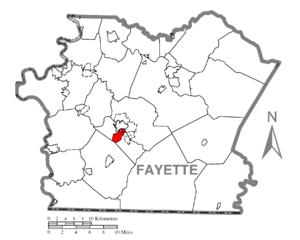
Location of Leith-Hatfield in Fayette County
|
|
| Country | United States |
| State | Pennsylvania |
| County | Fayette |
| Township | South Union |
| Area | |
| • Total | 1.85 sq mi (4.79 km2) |
| • Land | 1.85 sq mi (4.79 km2) |
| • Water | 0.00 sq mi (0.00 km2) |
| Population
(2020)
|
|
| • Total | 2,672 |
| • Density | 1,445.89/sq mi (558.35/km2) |
| Time zone | UTC-4 (EST) |
| • Summer (DST) | UTC-5 (EDT) |
| ZIP code |
15401
|
| Area code(s) | 724 |
| FIPS code | 42-42596 |
Leith-Hatfield is a special kind of community in Fayette County, Pennsylvania, United States. It's called a census-designated place (CDP). This means it's an area that the government counts for population, but it's not officially a city or town.
In 2020, about 2,672 people lived there. Leith-Hatfield is actually made up of two smaller villages: Leith and Hatfield. Both of these villages are located within South Union Township.
Contents
Where is Leith-Hatfield Located?
Leith-Hatfield is found in the middle part of Fayette County. It's right next to Uniontown, which is the main city of the county. To the northeast, you'll find Hopwood. To the south, it borders Georges Township.
Major Roads and Travel
A big highway called the Mon–Fayette Expressway runs through the western part of Leith-Hatfield. This expressway carries important routes like Pennsylvania Route 43, U.S. Route 40, and U.S. Route 119. These roads help people travel around the area and connect to other cities.
For example, the Mon–Fayette Expressway can take you about 43 miles northwest to Jefferson Hills. This area is in the suburbs south of Pittsburgh. If you head southwest on the expressway, you can reach Interstate 68 near Morgantown, West Virginia, which is about 15 miles away.
U.S. Route 119 goes northeast for about 15 miles to Connellsville. U.S. Route 40 travels southeast for about 62 miles to Cumberland, Maryland.
Land Area
The United States Census Bureau says that Leith-Hatfield covers a total area of about 4.79 square kilometers (1.85 square miles). All of this area is land; there are no large bodies of water within the CDP.
Who Lives in Leith-Hatfield?
| Historical population | |||
|---|---|---|---|
| Census | Pop. | %± | |
| 2020 | 2,672 | — | |
| U.S. Decennial Census | |||
Let's look at the people who live in Leith-Hatfield. In the year 2000, there were 2,820 people living there. These people lived in 1,098 different homes. About 802 of these homes were families.
Most of the people in Leith-Hatfield are White (about 97%). There are also smaller groups of African American, Native American, and Asian people.
Households and Families
About 28 out of every 100 homes had children under 18 living there. Most homes (about 62%) were married couples living together. About 8% of homes had a female head of household without a husband present.
The average home had about 2.46 people. For families, the average size was about 2.92 people.
Age Groups
The population in Leith-Hatfield is spread out across different age groups:
- About 21% of the people were under 18 years old.
- About 5% were between 18 and 24 years old.
- About 22% were between 25 and 44 years old.
- About 27% were between 45 and 64 years old.
- About 24% were 65 years old or older.
The average age of people in Leith-Hatfield was 46 years old.
Income Information
In 2000, the average income for a household in Leith-Hatfield was about $50,690 per year. For families, the average income was higher, around $61,786 per year.
The average income for each person in the CDP was about $26,943. About 7% of families and 8.7% of all people were living below the poverty line. This included about 11% of children under 18 and 7% of people aged 65 or older.
See also
 In Spanish: Leith-Hatfield para niños
 | Emma Amos |
 | Edward Mitchell Bannister |
 | Larry D. Alexander |
 | Ernie Barnes |

