Lenox (CDP), Massachusetts facts for kids
Quick facts for kids
Lenox, Massachusetts
|
|
|---|---|

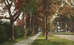
Kemble Street
|
|

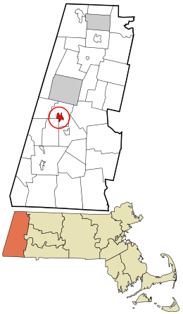
Location in Berkshire County and the state of Massachusetts.
|
|
| Country | United States |
| State | Massachusetts |
| County | Berkshire |
| Town | Lenox |
| Area | |
| • Total | 2.00 sq mi (5.19 km2) |
| • Land | 2.00 sq mi (5.17 km2) |
| • Water | 0.01 sq mi (0.03 km2) |
| Elevation | 1,257 ft (383 m) |
| Population
(2020)
|
|
| • Total | 1,639 |
| • Density | 821.55/sq mi (317.13/km2) |
| Time zone | UTC-5 (Eastern (EST)) |
| • Summer (DST) | UTC-4 (EDT) |
| ZIP code |
01240
|
| Area code(s) | 413 |
| FIPS code | 25-34935 |
| GNIS feature ID | 0607513 |
Lenox, also known as Lenox Center, is a small community in Berkshire County, Massachusetts, in the United States. It's a special kind of area called a census-designated place (CDP). This means it's a place that the United States Census Bureau has defined for gathering population data. In 2010, about 1,675 people lived here. The larger town of Lenox, which includes this area, had about 5,025 residents.
Contents
Where is Lenox Located?
The Lenox CDP is found southwest of the main center of the town of Lenox. It is located at coordinates 42.35722 degrees North and 73.284172 degrees West. To its south and west, it shares a border with the town of Stockbridge.
Roads and Travel
Several roads help people get around Lenox. Massachusetts Route 7A goes right through the middle of the CDP. It travels north on Main Street and south on Kemble Street. Both ends of Route 7A connect to U.S. Route 7. Route 7 goes around the town center and forms the eastern edge of the CDP.
Massachusetts Route 183 also crosses Route 7A in the heart of Lenox. This route leads southeast through Lenox Dale towards East Lee. It also goes southwest into the Interlaken part of Stockbridge.
Land and Water
According to the United States Census Bureau, the Lenox CDP covers a total area of about 4.7 square kilometers (about 1.8 square miles). A very small part of this area, about 0.03 square kilometers (0.01 square miles), is water. This means most of Lenox is land.
Who Lives in Lenox?
| Historical population | |||
|---|---|---|---|
| Census | Pop. | %± | |
| 2020 | 1,639 | — | |
| U.S. Decennial Census | |||
In the year 2000, there were 1,667 people living in the Lenox CDP. These people lived in 885 households. About 15.9% of these households had children under 18 years old. Many people lived alone, especially those who were 65 years or older.
Population Age
The people in Lenox are of different ages. In 2000, about 15.4% of the population was under 18 years old. About 33.7% of the people were 65 years of age or older. The average age of people living in Lenox was 51 years old.
See also
 In Spanish: Lenox (condado de Berkshire) para niños
 | John T. Biggers |
 | Thomas Blackshear |
 | Mark Bradford |
 | Beverly Buchanan |

