Lewis, Indiana facts for kids
Quick facts for kids
Lewis, Indiana
|
|
|---|---|
| Country | United States |
| State | Indiana |
| County | Vigo, Sullivan |
| Township | Pierson, Jackson |
| Platted | 9 September 1838 |
| Elevation | 610 ft (190 m) |
| Time zone | UTC-5 (Eastern) |
| • Summer (DST) | UTC-4 (EDT) |
| ZIP code |
47858
|
| Area code(s) | 812, 930 |
| FIPS code | 18-43020 |
| GNIS feature ID | 437800 |
Lewis, also known as Lewisburg or Centerville, is a small community in Indiana, USA. It's called an unincorporated community because it doesn't have its own local government like a city or town.
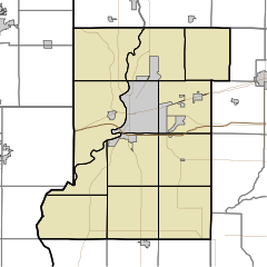
Lewis started in Vigo County. But over time, it grew and now reaches into nearby Sullivan County too. It is also part of the larger Terre Haute area.
Contents
Lewis's Early Days
The community of Lewis was officially planned on September 9, 1838. A person named Addison Williams helped lay out the town. It was built near the southern border of Vigo County.
Lewis was located on the Centerville wagon road. This road was very important back then. It was even used by the Pony Express for a few years!
First Businesses and Homes
The very first business in Lewis was a tannery. This is where animal hides were turned into leather. Joseph Stutman started this business. The first house in Lewis was built in 1842 by Charles Stewart.
Soon after, more businesses opened. The Buskirks ran a shop that made furniture. John B. Smith had a blacksmith shop, where he worked with metal. In 1844, Dodson & Jenkins opened a general store.
Education and Transportation
For many years, Lewis had a school made of logs. This was how children in the community learned. Lewis also became known as a "canal town." Canals were like man-made rivers used for transporting goods.
The post office in Lewis has been open for a very long time. It started operating in 1840.
Where is Lewis Located?
Lewis is found at these coordinates: 39°15′36″N 87°15′27″W / 39.26000°N 87.25750°W. This means it's in the western part of Indiana.
 | Valerie Thomas |
 | Frederick McKinley Jones |
 | George Edward Alcorn Jr. |
 | Thomas Mensah |


