Liberty Peak facts for kids
Quick facts for kids Liberty Peak |
|
|---|---|

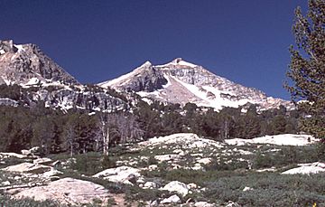
Liberty Peak, looking south from the Road's End Trailhead
|
|
| Highest point | |
| Elevation | 11,037 ft (3,364 m) NAVD 88 |
| Prominence | 752 ft (229 m) |
| Geography | |
| Parent range | Ruby Mountains |
| Topo map | USGS Ruby Dome |
| Climbing | |
| Easiest route | From Liberty Pass, Class 2 scramble west along the ridgeline |
Liberty Peak is a mountain in Elko County, Nevada, United States. It doesn't have an official name, but many people call it Liberty Peak. This mountain is part of the beautiful Ruby Mountains range.
You can find Liberty Peak inside the Ruby Mountains Wilderness. This wilderness area is part of the Humboldt-Toiyabe National Forest. The mountain stands tall at the top of Lamoille Canyon. It's a big part of the amazing view from the Road's End Trailhead.
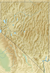
To the southeast of Liberty Peak, you'll find Liberty Lake and Kleckner Canyon. To the northwest, there's Box Canyon. The mountain is about 26 miles (42 km) southeast of the town of Elko.
Views from the Top
When you reach the very top of Liberty Peak, you get an amazing 360-degree view all around you. It's like seeing the whole world from one spot!
 | Isaac Myers |
 | D. Hamilton Jackson |
 | A. Philip Randolph |


