Lamoille Canyon facts for kids
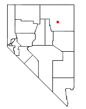
Lamoille Canyon is the biggest valley in the Ruby Mountains. You can find it in the middle of Elko County, in the northeastern part of Nevada. This amazing valley is about 12 miles long. It was shaped a lot by huge sheets of ice called glaciers. These glaciers moved through the area during past ice ages.
Contents
Journey Through Lamoille Canyon
Lamoille Canyon starts high up at Liberty Peak. This peak is about 11,032 feet tall. From there, the canyon quickly goes down into a bowl-shaped area. This area was carved by glaciers and is now home to Lamoille Lake. Close by, you can find a rocky shelf with smaller lakes called the Dollar Lakes.
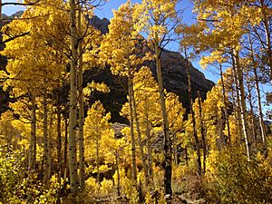
As you go further down the canyon, you'll see many Whitebark pine trees. You'll also reach a spot called Road's End Trailhead. This is the highest point of the Lamoille Canyon Road, which is a special National Forest Scenic Byway. Road's End is also where the long Ruby Crest National Recreation Trail begins. A shorter path to Island Lake also starts here.
Glacial Features and Views
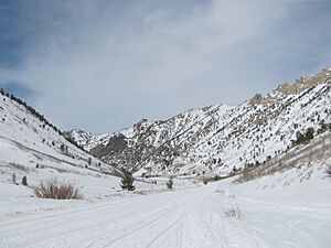
At Road's End, Lamoille Canyon makes a big turn around Thomas Peak. This peak is about 11,325 feet high. The glaciers really dug deep into the canyon here. They left behind a special "U-shaped" valley. High up on the side of Thomas Peak, you can see four "hanging valleys." These are smaller valleys that join the main canyon high above its floor, like Island Lake.
The road then passes the Terraces Picnic Area. Here, you can still see more signs of the old glaciers. You'll also go by Verdi Peak. A nature trail nearby lets you explore the many different plants that grow at the bottom of the canyon.
Lower Canyon and Waterfalls
The canyon keeps going down until it meets Thomas Canyon. Thomas Canyon comes in from the south. At the top of Thomas Canyon is Mount Fitzgerald, which is about 11,215 feet tall. At the bottom of Thomas Canyon, you'll find the Thomas Canyon Campground.
About a mile below the campground, Lamoille Canyon gets very narrow. Then, it drops quickly to meet Right Fork Canyon, which also comes from the south. Near this spot, you can see Lamoille Falls. There's also Camp Lamoille, which groups can rent. You can also see the north side of Mount Gilbert, which is about 11,120 feet tall.
At Camp Lamoille, the canyon is about 7,100 feet high. In the last 3 miles, it drops another 1,000 feet. The canyon then opens up at the Powerhouse Picnic Area. This was once the site of a powerhouse built in 1913. It provided power for the Elko-Lamoille Power Company. The powerhouse burned down in 1971, and only its foundation remains. The towns of Lamoille and Spring Creek are close by.
Panorama
 | Chris Smalls |
 | Fred Hampton |
 | Ralph Abernathy |


