Lingewaal facts for kids
Quick facts for kids
Lingewaal
|
|||
|---|---|---|---|

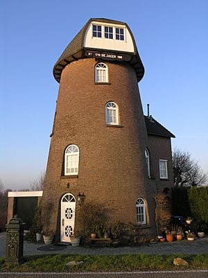
Former windmill in Herwijnen
|
|||
|
|||

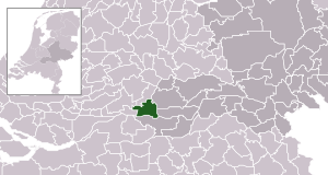
Location in Gelderland
|
|||
| Country | Netherlands | ||
| Province | Gelderland | ||
| Municipality | West Betuwe | ||
| Established | 1 January 1986 | ||
| Merged | 2019 | ||
| Area | |||
| • Total | 54.49 km2 (21.04 sq mi) | ||
| • Land | 50.44 km2 (19.47 sq mi) | ||
| • Water | 4.05 km2 (1.56 sq mi) | ||
| Elevation | 2 m (7 ft) | ||
| Population
(May 2014)
|
|||
| • Total | 11,033 | ||
| • Density | 219/km2 (570/sq mi) | ||
| Time zone | UTC+1 (CET) | ||
| • Summer (DST) | UTC+2 (CEST) | ||
| Postcode |
Parts of 4100 and 4200 ranges
|
||
| Area code | 0183, 0345, 0418 | ||
Lingewaal (Dutch pronunciation: [ˌlɪŋəˈʋaːl]) was a former municipality in the province of Gelderland in the Netherlands. A municipality is like a local government area, similar to a county or district.
On January 1, 2019, Lingewaal joined with two other municipalities, Geldermalsen and Neerijnen. Together, they formed a new, larger municipality called West Betuwe.
A Look Back: The History of Lingewaal
Lingewaal was created in 1986. It was formed by combining several smaller municipalities. These included Asperen, Heukelum, Herwijnen, Spijk, and Vuren.
One part, Dalem, became part of the Gorinchem municipality instead. For a short time after its creation, the new municipality was even called Vuren. This was named after one of its villages.
Then, on January 1, 2019, Lingewaal merged again. This time, it joined with Neerijnen and Geldermalsen. This big merger created the new municipality of West Betuwe.
Towns and Villages in Lingewaal
A municipality is made up of different towns and villages. These are sometimes called "population centres." Lingewaal included the following places:
- Asperen
- Herwijnen
- Heukelum
- Spijk
- Vuren
Exploring the Landscape
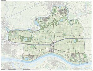
The land of Lingewaal had interesting features. This is what we call its topography. The map below shows the different parts of the area.
 | Audre Lorde |
 | John Berry Meachum |
 | Ferdinand Lee Barnett |


