List of bodies of water in Vancouver facts for kids
Vancouver, a big city in British Columbia, Canada, has many amazing rivers, lakes, and ocean areas.
Long ago, over 30 streams in Vancouver were home to salmon. But as the city grew, many of these streams were buried underground. Now, some of them are being brought back to life! This means plants and wildlife can live there again.
Contents
Creeks and Rivers in Vancouver
Spanish Bank Creek: A Home for Salmon
Spanish Bank Creek flows north through Pacific Spirit Regional Park, close to the UBC. It ends at the beach under the Spanish Bank cliffs. For many years, city growth made it hard for adult fish to swim up this creek. But now, the creek has been restored! Since 2001, sockeye salmon have been returning here to lay their eggs.
Musqueam Creek: Protecting Fish Life
Musqueam Creek and its smaller stream, Cutthroat Creek, start in Pacific Spirit Regional Park. They flow south through the Musqueam Reserve in Vancouver's Southlands area. The two creeks join before flowing into the Fraser River. The Canadian government helps protect these creeks. The Musqueam Band is working to restore Musqueam Creek. Because of their efforts, small numbers of Coho salmon and Chum salmon have started to return.
Still Creek: A Hidden Waterway
Still Creek is a long creek, about 17 kilometers (10.5 miles) in total. It starts in Vancouver, flows into the nearby city of Burnaby, and ends in Burnaby Lake. In Vancouver, Still Creek is found between 1st Avenue, 49th Avenue, Nanaimo Street, and Boundary Road. You can see parts of the creek, and the City of Vancouver is working to uncover more of it. However, most of the Vancouver section is still hidden underground in pipes and storm drains.
Beaver Creek: Flowing Through Stanley Park
Beaver Creek starts at Beaver Lake and flows into the ocean. You can find where it ends under a bridge where Pipeline Road and Stanley Park Drive meet.
Lakes in Vancouver
Beaver Lake: A Changing Ecosystem

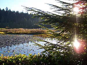
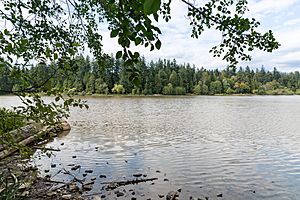
Beaver Lake is a lake located inside Stanley Park. It has walking trails around it and is home to many water birds. This lake is slowly being taken over by the forest because of the water lilies that have been added. The lily pads cover the water, which reduces the amount of oxygen in it. This makes it harder for dead plants and animals to break down. Because of this, the lake is slowly turning into a swamp.
Lost Lagoon: An Artificial Oasis
Lost Lagoon is a man-made lake, about 17 hectares (42 acres) in size. It's located west of Georgia Street, near the entrance to Stanley Park. It was created in 1916 when the Stanley Park causeway was built. This lagoon is a popular nesting spot for many birds, including swans, Canada geese, and great blue heron.
Lost Lagoon used to be connected to the ocean's inlet, so the water levels would change with the tides. Now, it's completely surrounded by land. If it gets very cold, Lost Lagoon can freeze over, and people sometimes go ice skating or play ice hockey on it. The poet Pauline Johnson gave the lagoon its name. She loved to canoe there when the tide was in, but one day, at low tide, the water was gone!
A large fountain called Jubilee Fountain is at the northeast end of the lagoon. It sprays water high into the air and can be seen from many blocks away. The fountain was built in 1936 to celebrate Vancouver's Golden Jubilee (50th anniversary).
Trout Lake: A Community Hub
Trout Lake is a popular spot for swimming and is also a nesting place for many types of birds. In the late 1800s, Trout Lake was a peat bog that supplied water to Hastings Mill, a large sawmill. Trout Lake used to be stocked with rainbow trout and cutthroat trout. Next to the lake, you'll find a community center, a playground, an ice rink, and a summer farmers' market. It's located at East 15th Avenue and Victoria Drive in East Vancouver's John Hendry Park.
The Hastings Mill needed a lot of water. They built a channel to carry water from Trout Lake. Sometimes, the mill had to have a person stay at the lake full-time to stop beavers from building dams that blocked the water flow. This person also had to remove trout from the channel, as it was sometimes full of fish!
False Creek: An Urban Inlet
False Creek is an inlet of the ocean located east of English Bay. It sits between Downtown and the Fairview slopes.
Boundary Waters: Where Vancouver Meets the Ocean
These are the larger bodies of water that form the edges of Vancouver:


