List of historic places in Southwestern Ontario facts for kids
Southwestern Ontario is home to many amazing historic places! These are special spots that have been officially recognized for their importance to Canada's past. They are listed on the Canadian Register of Historic Places (CRHP). These places are protected because they tell us stories about how people lived, worked, and built communities long ago.
You can find more historic places in these areas:
- County of Brant
- Essex County
- Middlesex County
- Perth County
- Regional Municipality of Waterloo
- Wellington County
Contents
- Historic Places in Bruce County
- Historic Places in Chatham-Kent
- Historic Places in Elgin County
- Historic Places in Grey County
- Historic Places in Haldimand County
- Historic Places in Huron County
- Historic Places in Lambton County
- Historic Places in Norfolk County
- Historic Places in Oxford County
- Images for kids
- See also
Historic Places in Bruce County
Bruce County has several historic sites, many of which are lighthouses that guided ships on the Great Lakes.
Lighthouses of Bruce County
- Point Clark Lighthouse National Historic Site of Canada: This tall, beautiful lighthouse is located in Huron-Kinloss. It's a very important landmark that has helped sailors for many years.
- Kincardine Lighthouse: Found in Kincardine, this lighthouse is another key part of the region's maritime history.
- Tower (Cove Island Lighthouse): On Cove Island, near Northern Bruce Peninsula, this tower is part of a lightstation that helped ships navigate the waters.
- Chantry Island Lightstation Tower: Located on Chantry Island near Saugeen Shores, this lighthouse and its keeper's dwelling are historic.
- Saugeen River Front Range Lighthouse: This lighthouse is in Saugeen Shores and worked with another light to guide boats into the Saugeen River.
- Flowerpot Island Lighthouse: This lighthouse is on Flowerpot Island, close to Tobermory. It's a famous spot in a beautiful natural area.
- Light Tower (Big Tub Lighthouse): Also in Tobermory, this lighthouse is a well-known landmark for visitors.
Other Historic Sites in Bruce County
- Donaldson Site National Historic Site of Canada: This site near Chippawa Hill is important for understanding early human history in the area.
- Madison House: A historic home in Kincardine.
- Maple Leaf Cottage: Another historic building in Kincardine.
- McNab Point Lighthouse: Located in Saugeen Shores, this lighthouse also played a role in guiding ships.
- Saugeen River Rear Range Lighthouse: This light worked with the front range light to help ships navigate the river.
- Rear Range Light Tower (Stokes Bay): This tower in Stokes Bay helped guide ships safely.
Historic Places in Chatham-Kent
The Chatham-Kent area holds many sites that tell stories of early settlements and important historical events.
- Buxton Settlement National Historic Site of Canada: This site was a safe haven for Black people escaping slavery in the United States. It's a powerful reminder of the Underground Railroad.
- Canadian National Railways/VIA Rail Station: This old train station in Chatham-Kent shows the history of railways in the region.
- Fairfield on the Thames National Historic Site of Canada: This site marks where a Moravian mission village once stood, important for early European and Indigenous interactions.
- Government of Canada Building: A historic government building in Chatham-Kent.
- Uncle Tom's Cabin - Harris House, Uncle Tom's Cabin - Henson House, and Uncle Tom's Cabin - Pioneer Church: These sites are part of the Uncle Tom's Cabin Historic Site, which tells the story of Josiah Henson, an escaped slave who inspired the famous novel "Uncle Tom's Cabin."
Historic Places in Elgin County
Elgin County features historic lighthouses and important railway heritage.
- Port Burwell Lighthouse: This lighthouse in Bayham helped guide ships on Lake Erie.
- Port Stanley Breakwater Lighthouse: Located in Port Stanley, this lighthouse is part of the town's busy harbour history.
- Port Stanley National Historic Site of Canada: The entire area of Port Stanley is recognized for its historical importance, especially its role as a port.
- Southwold Earthworks National Historic Site of Canada: These ancient earthworks in Southwold are a significant archaeological site, showing early Indigenous life.
- Armoury: A historic military building in St. Thomas.
- Canada Southern Railway Station: This grand railway station in St. Thomas highlights the city's past as a major railway hub.
- St. Thomas City Hall National Historic Site of Canada: The city hall building in St. Thomas is recognized for its architecture and historical role.
- St. Thomas Pioneer Church: An old church in St. Thomas with a rich history.
Historic Places in Grey County
Grey County has historic sites including lighthouses and buildings related to famous Canadians.
- Tower (Griffith Island): This lighthouse tower on Griffith Island, near Georgian Bluffs, helped guide ships.
- Billy Bishop Boyhood Home National Historic Site of Canada: This is the childhood home of Billy Bishop, a famous Canadian flying ace from World War I. It's in Owen Sound.
- Canadian Pacific Railway Station: An old railway station in Owen Sound, showing the importance of trains in the past.
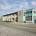
- Former Owen Sound Bus Terminal: A historic building that once served as the bus terminal in Owen Sound.
- Former Reitman's Store: Another historic commercial building in Owen Sound.
Historic Places in Haldimand County
Haldimand County is home to many historic homes, schools, and other buildings that tell the story of its development.
- Caledonia Town Hall: A historic town hall building in Caledonia.
- Campbell-Pine House: A historic house in Haldimand.
- Charles Reicheld House: Another historic home in Haldimand.
- Cook-Peart House: A historic residence in Haldimand.
- Cottonwood Mansion: A grand historic mansion in Haldimand.
- Cranston Post Office: An old post office building in Haldimand.
- Dochstader Hotel: A historic hotel in Haldimand.
- Duff House: A historic home in Cayuga.
- Edmondson-Weaver House: A historic residence in Haldimand.
- Empire School: An old school building in Haldimand.
- Enniskillen Lodge: A historic lodge in Haldimand.
- Furry Tavern: A historic tavern in Haldimand.
- Gibson-Alderson House: A historic home in Haldimand.
- Gibson-Bunn Building: A historic building in Cayuga.
- The Gore School: Another old school building in Haldimand.
- Gypsum Mines School: A historic school in Haldimand.
- Hoover Log House: A historic log house in Haldimand.
- Jeffrey Residence: A historic home in Haldimand.
- John Fry House: A historic residence in Haldimand.
- Jones-Doughty Residence: A historic home in Jarvis.
- Kirkland House: A historic house in Haldimand.
- Lalor Estate: A historic estate in Dunnville.
- Mohawk Island Lighthouse: This lighthouse is on Mohawk Island, part of a National Wildlife Area in Haldimand.
- McKinnon-Smith Residence: A historic home in Caledonia.
- Mooney Residence: A historic house in Dunnville.
- Murray-Walton House and Farm: A historic farm and house in Haldimand.
- Nanticoke National Historic Site of Canada: This site in Nanticoke is important for its historical significance.
- Old Caledonia Mill: A historic mill building in Caledonia.
- Ruthven Gatehouse: Part of the historic Ruthven Park in Cayuga.
- Ruthven Park: A large historic estate in Cayuga, recognized for its buildings and landscape.
- St. John's Parish Hall: A historic church hall in Haldimand.
- Seneca Bridge: A historic bridge in Caledonia.
- Thompson-Colwell House: A historic home in Caledonia.
- Toll House: A historic toll house in Caledonia.
- Upper Farm Cemetery: A historic cemetery in Haldimand.
- Union School: An old school building in Selkirk.
- Vanderburgh House: A historic home in Haldimand.
- Wilson Pugsley MacDonald Museum: This museum in Haldimand is named after a Canadian poet.
Historic Places in Huron County
Huron County has many historic buildings, especially in the town of Goderich, known for its unique town square.
Historic Goderich
The town of Goderich has many historic homes and buildings:
- Acheson House
- Captain Dancy House
- The Cottage
- Ford House
- Former Bank of Upper Canada Building
- Garrow House
- Garvey House
- Geary House
- Gibbons Townhouse
- Goderich Canadian Pacific Railway Station: An old train station.
- Goderich Public Library: A historic library building.
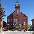
- Goderich Town Hall: The town hall building.
- Hands Bakery: A historic bakery.
- Henry Horton Cottage
- Hunter House
- Huron County Gaol National Historic Site of Canada: A former jail, now a museum.
- Huron County Museum: A museum housed in a historic building.
- Hutchinson House
- Judges' House
- Lawson House
- Menesetung Bridge: A historic bridge.
- Polley's Livery Stable: A historic stable.
- Samuel Platt House
- Seegmiller House
- Sloane-Cooper House
- The Square: The unique octagonal town square of Goderich is a historic district.
- Strachan House
- Thomas Mercer Jones House
- Tom House
- Wellesley House
- West Street Heritage Conservation District: A historic area along West Street.
- Whitely House
Historic Huron East
The municipality of Huron East also has several historic sites:
- Box Residence
- Britton House
- Brussels Library: A historic library in Brussels.
- Cameron House
- Cardno Block
- Carnohan House
- Carroll Residence
- Commercial Hotel
- Cornish Residence
- Doig Residence
- The Former Seaforth Public School: An old school building in Seaforth.
- Hansen Residence
- Harpurhey Cemetery: A historic cemetery.
- Horthy House
- McIver Residence
- Moncrieff Church: A historic church.
- Mullen House
- Pinkney House
- Pletsch Residence
- Round House
- Seaforth Heritage Conservation District: A historic area in Seaforth.
- Seaforth Town Hall: The town hall building in Seaforth.
- The Shepherd Residence
- Van Egmond Residence: A historic home in Egmondville.
- Vanastra Park Gate and Posts: Historic gates at Vanastra Park.
- Victoria Park: A historic park in Seaforth.
Other Historic Sites in Huron County
- Carolinian Oak Tree: A significant tree in Ashfield–Colborne–Wawanosh.
- W.J. Carling House: A historic home in South Huron.
Historic Places in Lambton County
Lambton County is known for its oil history and other important buildings.
- First Commercial Oil Field National Historic Site of Canada: This site in Oil Springs is where Canada's oil industry began. It's a very important place for understanding our industrial past.
- Government of Canada Building: A historic government building in Sarnia.
- Independent Order Odd Fellows Ridgely Lodge #250: A historic lodge building in Oil Springs.
- Langbank Post Office: An old post office in Oil Springs.
- Oil Springs Community Hall: A historic community hall.
- Oil Springs Railway Station: An old train station in Oil Springs.
- Old Post Office: A historic post office in Petrolia.
- Petrolia Orange Hall: Sadly, this historic hall in Petrolia was destroyed by fire in 2004.
- Petrolia Public Library: A historic library in Petrolia.
- VIA Rail Station: The train station in Sarnia.
- Victoria Hall / Petrolia Town Hall National Historic Site of Canada: This grand building in Petrolia serves as the town hall and is a national historic site.
- Walpole Island Lower A32 Lighthouse and Walpole Island Upper A34 Lighthouse: These lighthouses are located off Walpole Island in the St. Clair River.
Historic Places in Norfolk County
Norfolk County has historic lighthouses and sites that tell stories of early settlements.
- Lighttower (Long Point): This lighthouse is at the tip of Long Point, south of Port Dover.
- Backhouse Grist Mill National Historic Site of Canada: This historic mill in Norfolk is a great example of early industry.
- Cliff Site National Historic Site of Canada: This site in Port Dover is important for its archaeological findings.
- Fort Norfolk National Historic Site of Canada: This site marks where a historic fort once stood in Norfolk.
- Lynnwood/Campbell-Reid House National Historic Site of Canada: A historic house in Norfolk recognized for its architecture and history.
- Van Norman-Guiler House: A historic home in Normandale.
- Lighttower (Port Dover Front Range Light): This lighthouse is at the end of the west pier in Port Dover.
Historic Places in Oxford County
Oxford County features historic churches, schools, and railway buildings.
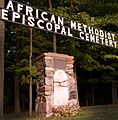
- African Methodist Episcopal Cemetery: A historic cemetery in Otterville, Norwich, important for its connection to the Underground Railroad.
- Annandale House: A beautiful historic house in Tillsonburg.
- Curries United Church: A historic church in Curries, Norwich.
- Knox Presbyterian Church (Norwich): A historic church in Norwich.
- Museum School: An old school building in Burgessville, Norwich.
- Norwich Gore United Church: Another historic church in Norwich.
- Norwich United Church and Manse: A historic church and its parsonage in Norwich.
- Otter Creek Bridge: A historic bridge near Otterville, Norwich.
- Otterville Mill: A historic mill in Otterville, Norwich.
- Otterville Park: A historic park in Otterville, Norwich.
- Otterville Railway Museum: A museum housed in an old railway building in Otterville, Norwich.
- Quaker Meeting House (Norwich Museum): This historic building in Norwich now serves as a museum.
- Quaker Street Burying Ground: A historic cemetery north of Norwich village.
- Woodlawn Place: A historic building in Otterville, Norwich.
- Old St. Paul's Church (Anglican): A historic church in Woodstock.
- Woodstock Railway Station: The train station in Woodstock.
- Old Woodstock Town Hall: The former town hall building in Woodstock.
Images for kids
See also
 | William L. Dawson |
 | W. E. B. Du Bois |
 | Harry Belafonte |


