
List of National Historic Sites of Canada in Ontario facts for kids
Ontario is a big province in Canada, and it's home to many special places called National Historic Sites. These are places that Parks Canada, a government group, has recognized as super important to Canada's history. As of July 2021, Ontario had 274 of these sites, which is more than any other province or territory! About 39 of them are looked after by Parks Canada, and you'll see a beaver icon (![]() ) next to them in this list.
) next to them in this list.
These sites tell stories about important events and people from Canada's past. Sometimes, a plaque might mark a historic event or a famous person, not just a place. For example, the Rideau Canal is a historic site, but the Welland Canal is a historic event. The markers don't always say which one it is, but they all celebrate Canada's rich history.
The names of these sites come from the Historic Sites and Monuments Board. Sometimes, these names might be a bit different from what people usually call them.
* UNESCO World Heritage Site unit
Contents
- Exploring Ontario's Historic Sites
- Homes of Famous Canadians
- Important Forts and Battle Sites
- Amazing Engineering and Industry Sites
- Sites of Indigenous and Community Importance
- Algonquin Provincial Park
- Amherstburg First Baptist Church
- Buxton Settlement
- Christ Church, Her Majesty's Chapel Royal of the Mohawk
- Finnish Labour Temple
- Her Majesty's / St. Paul's Chapel of the Mohawks
- Joseph Schneider Haus
- Kay-Nah-Chi-Wah-Nung (Rainy River Mounds)
- Mnjikaning Fish Weirs
- Nazrey African Methodist Episcopal Church
- Old Hay Bay Church
- Oro African Methodist Episcopal Church
- Peterborough Petroglyphs
- Sandwich First Baptist Church
- Serpent Mounds
- Sharon Temple
- Whitefish Island
- Images for kids
- See also
Exploring Ontario's Historic Sites
Ontario's National Historic Sites cover a wide range of history, from ancient Indigenous communities to important moments in Canada's development. Let's explore some of these amazing places!
Homes of Famous Canadians
Many historic sites are houses where important Canadians lived or where big ideas were born.
Adelaide Hunter Hoodless Homestead

This house, finished in 1839, was the childhood home of Adelaide Hunter Hoodless. She was an amazing activist who helped start groups like the Women's Institutes, the National Council of Women of Canada, and the Victorian Order of Nurses. She was a true leader in education and community work.
Banting House

Located in London, this yellow-brick house was completed around 1900. It's famous because it's where Frederick Banting first thought of the idea that led to the discovery of insulin. This discovery changed medicine forever and has saved countless lives around the world.
Bell Homestead

In Brantford, you'll find the first North American home of Alexander Graham Bell, built in 1858. This is where he first came up with the idea for the telephone and even did some of his first long-distance calls! It's a key spot in the history of communication.
Bethune Memorial House

![]() This house in Gravenhurst, built in 1880, is the birthplace of Dr. Norman Bethune. He was a famous surgeon and humanitarian who did incredible work, especially in China during wartime. His house tells the story of his early life.
This house in Gravenhurst, built in 1880, is the birthplace of Dr. Norman Bethune. He was a famous surgeon and humanitarian who did incredible work, especially in China during wartime. His house tells the story of his early life.
Billy Bishop Boyhood Home

In Owen Sound, this house, completed in 1884, was the childhood home of Billy Bishop. He was a brave Canadian flying ace during the First World War. His home helps us remember his amazing achievements.
McCrae House

This house in Guelph, built around 1858, is the birthplace of John McCrae. He was the author of the famous poem In Flanders Fields, which is read every year to remember soldiers who fought in wars.
Stephen Leacock Museum / Old Brewery Bay

In Orillia, this two-story house, completed in 1928, was the home of Stephen Leacock. He was one of Canada's most beloved authors and humorists. The house and its beautiful surroundings inspired many of his writings.
Woodside

![]() This charming house in Kitchener, built in 1853, was the childhood home of William Lyon Mackenzie King. He later became Canada's longest-serving Prime Minister. His writings often mentioned this special place.
This charming house in Kitchener, built in 1853, was the childhood home of William Lyon Mackenzie King. He later became Canada's longest-serving Prime Minister. His writings often mentioned this special place.
Important Forts and Battle Sites
Ontario has many sites that remember battles and forts that shaped the province and the country.

Established in 1796, this site in Amherstburg was a key shipyard for the British Royal Navy. It was the main place for British ships on the upper Great Lakes until 1813.
Battle Hill

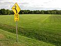
![]() This site in Southwest Middlesex is where the Battle of Longwoods happened in 1814 during the War of 1812. It's a reminder of the conflicts that shaped Canada's borders.
This site in Southwest Middlesex is where the Battle of Longwoods happened in 1814 during the War of 1812. It's a reminder of the conflicts that shaped Canada's borders.
Battle of Crysler's Farm

In South Dundas, this was the site of a major British victory in the War of 1812 in 1813. Even though they were outnumbered, the British won, which made the American forces give up their plan to attack along the St. Lawrence River. The original site is now underwater, but a monument marks the battle's importance.
Battle of the Windmill

![]() This site in Prescott saw a battle in 1838 during the Upper Canada Rebellion. Loyalist forces successfully stopped an invasion attempt by American-based rebels. The old windmill there was even turned into a lighthouse later!
This site in Prescott saw a battle in 1838 during the Upper Canada Rebellion. Loyalist forces successfully stopped an invasion attempt by American-based rebels. The old windmill there was even turned into a lighthouse later!
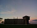
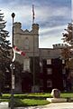
Fort Malden

![]() This British fort in Amherstburg, established in 1799, was super important for defending the western border until 1813. It also played a role during the border troubles of the Upper Canada Rebellion in 1837-38.
This British fort in Amherstburg, established in 1799, was super important for defending the western border until 1813. It also played a role during the border troubles of the Upper Canada Rebellion in 1837-38.
Fort St. Joseph

![]() Established in 1796 on St. Joseph Island, this fort was the British Empire's most western outpost. It was destroyed in 1812, but its ruins still tell us about military and daily life on the frontier.
Established in 1796 on St. Joseph Island, this fort was the British Empire's most western outpost. It was destroyed in 1812, but its ruins still tell us about military and daily life on the frontier.
Fort Wellington

![]() This fort in Prescott, established in 1813, is one of the best-preserved 19th-century forts in Canada. It protected ships traveling along the St. Lawrence River during the War of 1812.
This fort in Prescott, established in 1813, is one of the best-preserved 19th-century forts in Canada. It protected ships traveling along the St. Lawrence River during the War of 1812.
Fort William

Established in 1803 in Thunder Bay, this was a very important trading post for the North West Company. Today, it's a reconstructed site where you can experience what life was like back then.
Fort York

Established in 1793, Fort York in Toronto is considered the birthplace of the city. It was the main defense for what was then called York, Upper Canada. Today, it's a museum with the largest collection of War of 1812 buildings in Canada.
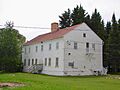
François Bâby House

This house in Windsor, completed in 1812, was used as a headquarters by American forces during the War of 1812. Later, British forces, led by Major-General Isaac Brock, used it to fire on Fort Detroit.
Amazing Engineering and Industry Sites
These sites highlight Canada's cleverness and industrial past.
Algoma Central Engine House

This engine house in Sault Ste. Marie, completed in 1912, is a great example of a brick engine house. It was the first in Canada to have an internal turntable for trains.
Canal Lake Concrete Arch Bridge

Spanning the Trent-Severn Waterway in Bolsover, this bridge was completed in 1905. It's the earliest known reinforced concrete bridge in Canada, showing early engineering skills.
First Commercial Oil Field

In Oil Springs, this site is where the world's first commercial oil well was found in 1858. It was also the first drilled oil well in Canada and the site of Canada's first gas gusher!
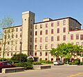
Forbes Textile Mill

Established in 1863 in Cambridge, this wool mill was once the largest woollen mill in Canada. It shows the importance of the textile industry in Canada's past.
Peterborough Lift Lock

![]() Completed in 1904, this huge boat lift on the Trent-Severn Waterway in Peterborough can lift boats 19.8 meters (about 65 feet)! It was the highest hydraulic lift lock in the world when it was built and was a huge engineering success.
Completed in 1904, this huge boat lift on the Trent-Severn Waterway in Peterborough can lift boats 19.8 meters (about 65 feet)! It was the highest hydraulic lift lock in the world when it was built and was a huge engineering success.
Rideau Canal

![]() Completed in 1832, the Rideau Canal stretches from Ottawa to Kingston. It was built to defend against a possible war with the United States. It's the best-preserved example of a 19th-century canal in North America, with most of its original parts still working! It's also a * UNESCO World Heritage Site!
Completed in 1832, the Rideau Canal stretches from Ottawa to Kingston. It was built to defend against a possible war with the United States. It's the best-preserved example of a 19th-century canal in North America, with most of its original parts still working! It's also a * UNESCO World Heritage Site!
Sault Ste. Marie Canal

![]() Completed in 1895, this canal in Sault Ste. Marie was an important part of Canada's canal system. It was also the first electrically-powered lock in the world! Today, it's used for fun and recreation.
Completed in 1895, this canal in Sault Ste. Marie was an important part of Canada's canal system. It was also the first electrically-powered lock in the world! Today, it's used for fun and recreation.
Trent–Severn Waterway

![]() This amazing waterway, completed in 1920, is 386 kilometers (about 240 miles) long! It connects Georgian Bay to the Bay of Quinte. It was a vital transportation route and still has many original structures from when it was built.
This amazing waterway, completed in 1920, is 386 kilometers (about 240 miles) long! It connects Georgian Bay to the Bay of Quinte. It was a vital transportation route and still has many original structures from when it was built.
Sites of Indigenous and Community Importance
These places tell stories of early communities and diverse cultures in Ontario.
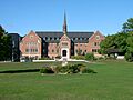
Algonquin Provincial Park

Established in 1893, Algonquin Provincial Park was Canada's first provincial park. It's famous for how it was managed, its programs for visitors, and its beautiful buildings. It also inspired famous artists like the Group of Seven.
Amherstburg First Baptist Church
This modest wooden church, completed in 1849, was a very important stop on the Underground Railroad in Upper Canada. It played a huge role in helping Black communities grow in Ontario.
Buxton Settlement

Established in 1849 in Chatham-Kent, this community was founded by Reverend William King, 15 former American slaves, and others. It was a safe place for enslaved people escaping through the Underground Railroad.
Christ Church, Her Majesty's Chapel Royal of the Mohawk

Completed in 1843 in Deseronto, this historic chapel is linked to the Mohawk nation in Ontario. It's one of only two Royal Chapels in Canada, showing the special bond between the British Crown and the Mohawk people.
Finnish Labour Temple

This two-story brick building in Thunder Bay, completed in 1910, was a very important social and community center for Finnish immigrants in Canada.
Her Majesty's / St. Paul's Chapel of the Mohawks

Completed in 1785 in Brantford, this was the first Protestant church in Upper Canada and is now the oldest surviving church in Ontario. It's another of the two Royal Chapels in Canada, symbolizing the important role of the Loyalist Mohawks in the province's early days.
Joseph Schneider Haus

This house in Kitchener, completed in 1816, is a museum that tells the story of German Mennonites who moved to Waterloo County in the early 19th century. It's a great example of a typical Mennonite house from that time.
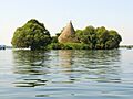
Kay-Nah-Chi-Wah-Nung (Rainy River Mounds)
Established around 3000 BCE in Morley, this is one of Canada's most important centers for early human life and ceremonial burials. It has evidence of 5,000 years of human activity, including burial mounds from ancient cultures. It's a key cultural and historic spot for the Rainy Lake and River Bands of Saulteaux.
Mnjikaning Fish Weirs

![]() Located in Ramara, these are the largest and best-preserved wooden fish weirs in eastern North America. They were used for fishing from about 3300 BCE until recently!
Located in Ramara, these are the largest and best-preserved wooden fish weirs in eastern North America. They were used for fishing from about 3300 BCE until recently!
Nazrey African Methodist Episcopal Church

This simple stone chapel in Amherstburg, completed in 1848, is now part of the North American Black Historical Museum. It's important because of its connection to Bishop Willis Nazery, who led the first all-Canadian church group started by Underground Railroad refugees.
Old Hay Bay Church

Built by United Empire Loyalist settlers in 1792 in Greater Napanee, this is the oldest surviving Methodist building in Canada. It shows how important Methodists were in the early development of Upper Canada.
Oro African Methodist Episcopal Church

This log church in Edgar, completed in 1849, is the last remaining building of a community of Black Canadians who had United Empire Loyalist roots. It also has an unmarked cemetery.
Peterborough Petroglyphs

Dating from around 900 to 1400 CE, this site in Otonabee-South Monaghan has hundreds of ancient rock carvings, called petroglyphs. They show human and animal shapes, as well as symbols. It's one of the largest collections of pre-contact petroglyphs in Canada.
Sandwich First Baptist Church

Completed in 1851 in Windsor, this is one of the oldest Baptist churches from that time in Ontario. It represents the churches built in border towns to welcome communities formed by Underground Railroad refugees.
Serpent Mounds

Dating from around 50 BCE to 300 CE in Keene, this site has a group of six burial mounds shaped like a serpent, about 60 meters (nearly 200 feet) long. It's the only one of its kind in Canada!
Sharon Temple

Completed in 1831 in Sharon, this unique temple was built by the The Children of Peace, a Quaker group. Its design shows their beliefs. It's also important for being part of Canada's early efforts to save historic places.
Whitefish Island

First occupied around 300 BCE in Sault Ste. Marie, this small island was home to eight different Indigenous cultures, leading to the development of the Ojibwa nation. Its location made it a key spot for trade and settlement before Europeans arrived.
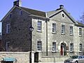
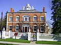
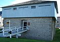
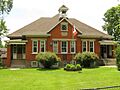
Images for kids
-
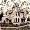
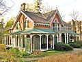
Exterior view of Annandale House
-
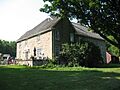
Backhouse Grist Mill NHS near Port Rowan, ON
-
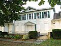
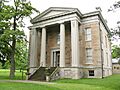
Exterior view of Barnum House
-
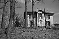
Belle Vue NHS in Amherstburg, ON, in a neglected state in 2011
-
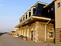
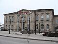
Exterior view of the Belleville Railway Station
-
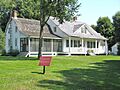
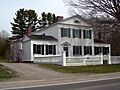
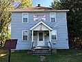
Bethune-Thompson House/White House NHS, Elora, ON
-
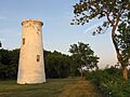
The lighthouse forms part of Bois Blanc Island Lighthouse and Blockhouse NHS, Boblo Island, ON
-
The blockhouse forms part of Bois Blanc Island Lighthouse and Blockhouse NHS, Boblo Island, ON
-

Contemporary image of the Canadian-built Hurricane IIB taking off
-
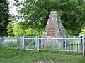
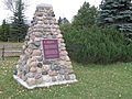
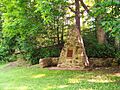
Cairn at Carrying Place
-

Exterior view of the front facade of Castle Kilbride
-
Black and white exterior view of Chiefswood and surrounding trees
-
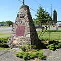
The cross and plaques at Cliff Site mark the first commemoration of a national historic site in the country.
-
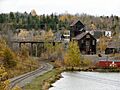
Historic mines in Cobalt
-

View of front of Cox Terrace
-
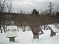
Plaques at the Darlingside site
-
-

Exterior view of Ermatinger House in winter
-
Exterior view of a replica of a cottage from the original village of Fairfield
-
Exterior view of the former Almonte post office
-

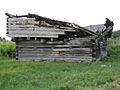
Exterior view of the derelict camp buildings with broken windows
-
-
Former Elora Drill Shed NHS, Elora, ON
-
Exterior view of Former Galt Post Office
-
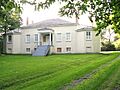
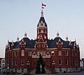
Former Port Perry Town Hall NHS, Port Perry, ON
-
Former Shingwauk Residential School NHS, Sault Ste. Marine, ON
-
Fort Norfolk NHS, Turkey Point Prov. Park, ON
-
-
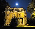
Glanmore/Phillips-Faulkner House NHS, Belleville, ON
-
Glengarry Cairn NHS, Cairn Island, ON
-
Stone cairn marking location of Glengarry Landing
-
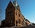
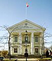
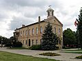
Exterior view of Guelph City Hall
-
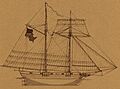
Sketch of the USS Scourge
-
Hillary House NHS, Aurora, ON
-

Front facade of the Homer Watson House
-
Exterior view of Homewood
-
Exterior view of the Huron County Gaol
-
Inverarden House NHS, Cornwall, ON
-
Exterior view of Leaskdale Manse
-
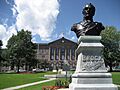
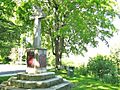
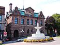
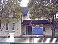
View of the Isaac Brock bust in front of the Leeds and Grenville County Court House
-
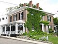
Lynnwood/Campbell-Reid House NHS, Simcoe, ON
-
Exterior view of Macdonell-Williamson House
-
Exterior view of Matheson House from the street
-
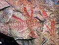
View of pictographs on Mazinaw Rock
-
Exterior view of McMartin House
-
Exterior view of the Merrickville Blockhouse
-
Middleport Site NHS, Middleport, ON
-
Exterior view of the Middlesex County Court House
-
Altar at Mission of St. Ignace II
-
Former Hudson's Bay Company staff house in Moose Factory, Ontario, Canada, now a museum and tourism office
-
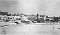
Nanticoke NHS, Nanticoke, ON
-
Exterior view of Napanee Town Hall
-
Normandale Furnace NHS, Normandale, ON
-
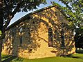
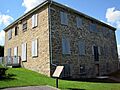
Old Stone Church NHS, Beaverton, ON
-
Exterior view of the Old Stone Mill
-
Exterior view of the Old Woodstock Town Hall
-
Exterior view of the church in May
-

Exterior view of house at Parkwood Estate
-
Winter scene of the Penman mill in Paris, circa 1900
-
Exterior view of Perth Town Hall
-
A detail of the exterior of the Peterborough armoury
-
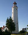
Exterior view of Point Clark Lighthouse
-
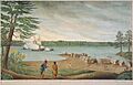
The Outaouaise being captured by the British in 1760 near Pointe au Baril
-
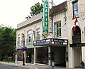
The Capitol Theatre exterior, Port Hope
-
Federal cairn marking Port Stanley NHS, Port Stanley, ON
-
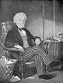
Portrait of Thomas Talbot
-
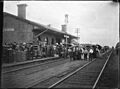
The railway station in 1905
-
Ridout Street Complex NHS, London, ON
-
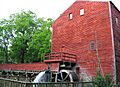
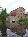
Main mill after reconstruction
-
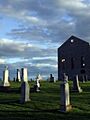
View of the St. Raphael's ruins and surrounding gravestones
-
Ruthven Park NHS, Cayuga, ON
-
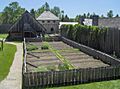
View of a vegetable garden, buildings and stockades at the reconstructed Sainte-Marie Among the Hurons Mission
-
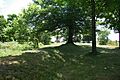
View of mounds and trees at the Southwold Earthworks
-
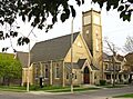
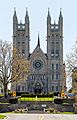
St. Jude's Anglican Church NHS, Brantford, ON
-
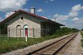
View of the St. Marys Junction Railway Station and adjacent tracks
-
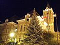
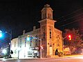
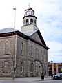
View of the St. Thomas City Hall at night
-
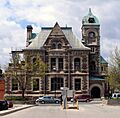
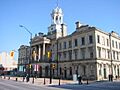
View of Stratford City Hall
-
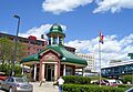
View of Thunder Bay Tourist Pagoda and surrounding buildings
-
Victoria Hall Cobourg
-
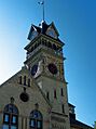
View of the clock tower of Petrolia Town Hall
-
Walker Site NHS, Onondaga, ON
-

View of the Wellington County Museum
-
-
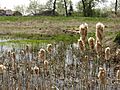
Wintering Site NHS, Port Dover, ON
-
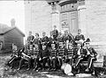
Black and white photograph of band members in uniform on front steps of stone township hall in 1894


See also
- History of Ontario
- List of historic places in Ontario
- Ontario Heritage Act, legislation under which heritage sites of provincial or municipal significance are designated
