List of lakes in Minneapolis facts for kids

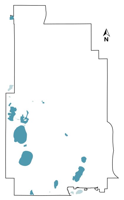
Minneapolis is often called the "City of Lakes" because it has many beautiful bodies of water. There are 13 main lakes within the city limits, each at least 5 acres in size. The largest and deepest of these is Bde Maka Ska. It covers about 421 acres and goes down about 90 feet! Lake Hiawatha has a very large watershed, which means a huge area of land drains into it. Ryan Lake is unique because it sits partly in Minneapolis and partly in the nearby city of Robbinsdale.
Long ago, many of Minneapolis's lakes formed in big holes left by giant blocks of ice. This happened after the last ice age. Before European settlers arrived, the Dakota harvested wild rice from these lakes. In the early 1800s, the lake shores were marshy. This made it hard for people to build homes there. However, a Dakota farming community called Ḣeyate Otuŋwe was founded on Bde Maka Ska in 1829.
In the 1880s, a smart landscape architect named Horace Cleveland had a great idea. He saw that Minneapolis would grow a lot. He suggested that the city buy land around the lakes and along Minnehaha Creek. His goal was to create a connected system of parks. This system would make the city more beautiful and benefit everyone living there.
The head of the park board, Charles M. Loring, listened to Cleveland's advice. He bought the land, and later, Theodore Wirth helped develop it into a wonderful park system. During this time, many lakes were changed. Workers drained parts of them, dug out the bottoms, and made the shorelines stronger. They also built roads, called parkways, around the lakes.
Homes near the lakes became very popular. Especially famous is the "Chain of Lakes." This group includes five lakes in the southwest part of the city. These are Bde Maka Ska, Lake Harriet, Lake of the Isles, Cedar Lake, and Brownie Lake. They are all connected by man-made channels.
The lakes are a big part of Minneapolis's identity. You can see a sailboat in the city's logo and a ship's wheel on its flag. These symbols show how important the lakes are to the city. Unlike many other cities, most of Minneapolis's lakeshore is public parkland. This means everyone can enjoy it!
Since they were improved, the lakes have been a magnet for fun activities. People love to swim, sail, and go yachting. You can also canoe, bike, jog, and ice skate there. The 76-mile (122.3 km) Grand Rounds National Scenic Byway is a scenic route that goes around many of Minneapolis's lakes.
Lakes of Minneapolis
| Lake | Image | Area | Maximum depth | Watershed area | Location | Notes | Refs. |
|---|---|---|---|---|---|---|---|
| Brownie Lake |  |
18 acres (0.07 km2) | 49.9 feet (15.2 m) | 369 acres (1.49 km2) | 44°58′03″N 93°19′27″W / 44.9675428°N 93.3242747°W |
|
|
| Cedar Lake |  |
170 acres (0.69 km2) | 50.9 feet (15.5 m) | 1,956 acres (7.92 km2) | 44°57′36″N 93°19′16″W / 44.9600374°N 93.3209776°W |
|
|
| Cemetery Lake |  |
11 acres (0.04 km2) | Unknown | Unknown | 44°55′58″N 93°18′22″W / 44.9327725°N 93.3060642°W |
|
|
| Diamond Lake |  |
41 acres (0.17 km2) | 6.9 feet (2.1 m) | 669 acres (2.71 km2) | 44°54′02″N 93°16′09″W / 44.9006469°N 93.2692419°W | ||
| Grass Lake |  |
27 acres (0.11 km2) | 4.9 feet (1.5 m) | 386 acres (1.56 km2) | 44°53′34″N 93°17′54″W / 44.8927159°N 93.2982813°W | ||
| Lake Harriet |  |
353 acres (1.43 km2) | 82.0 feet (25.0 m) | 1,139 acres (4.61 km2) | 44°55′19″N 93°18′22″W / 44.9219536°N 93.3061669°W |
|
|
| Lake Hiawatha |  |
54 acres (0.22 km2) | 23.0 feet (7.0 m) | 115,840 acres (468.79 km2) | 44°55′16″N 93°14′10″W / 44.9211849°N 93.2360063°W |
|
|
| Lake of the Isles |  |
103 acres (0.42 km2) | 30.8 feet (9.4 m) | 735 acres (2.97 km2) | 44°57′18″N 93°18′35″W / 44.955087°N 93.3096144°W |
|
|
| Loring Lake |  |
8 acres (0.03 km2) | 17.4 feet (5.3 m) | 24 acres (0.10 km2) | 44°58′08″N 93°17′04″W / 44.9689373°N 93.2844032°W |
|
|
| Bde Maka Ska |  |
421 acres (1.70 km2) | 89.9 feet (27.4 m) | 2,992 acres (12.11 km2) | 44°56′31″N 93°18′42″W / 44.9418644°N 93.3117332°W |
|
|
| Lake Nokomis |  |
204 acres (0.83 km2) | 33.1 feet (10.1 m) | 869 acres (3.52 km2) | 44°54′31″N 93°14′31″W / 44.9086107°N 93.2420323°W |
|
|
| Powderhorn Lake |  |
11 acres (0.04 km2) | 20.0 feet (6.1 m) | 286 acres (1.16 km2) | 44°56′30″N 93°15′24″W / 44.9417498°N 93.2568019°W | ||
| Ryan Lake |  |
18 acres (0.07 km2) | 35.1 feet (10.7 m) | 5,510 acres (22.30 km2) | 45°02′28″N 93°19′20″W / 45.0410713°N 93.3221358°W |
Other Water Bodies in Minneapolis
Some lists, including the City of Minneapolis's own data, count up to 22 lakes. However, some of these are not truly within the city or are smaller than what is usually called a lake.
For example, some "lakes" on these lists are actually outside Minneapolis's borders:
- Mother Lake (48 acres)
- Wirth Lake (39 acres)
- Taft Lake (14 acres)
Other bodies of water are counted but are smaller than five acres:
- Birch Lake (3.2 acres)
- Spring Lake (2.3 acres)
- Lake Mead (1.8 acres)
- Legion Lake (0.5 acres)
The Minneapolis data also lists two channels connecting larger lakes as "lakes":
- Cedar–Isles Channel (5.4 acres)
- Maka Ska–Isles Channel (3.4 acres)
Besides these, Minneapolis also has 46 ponds.
See also
- List of lakes in Minnesota
- Trails in Minneapolis


