List of prehistoric scheduled monuments in Gwynedd (former Merionethshire) facts for kids
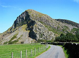
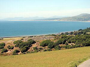
Gwynedd is a big, beautiful county in North Wales, full of mountains, farms, and hills. It's like a giant outdoor museum! This area is home to many amazing old sites, especially in the southern part, which used to be called Merionethshire.
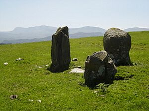
Gwynedd has a huge number of these special places, called scheduled monuments. These are important historical sites that are protected by law, meaning no one can dig them up or change them without permission. It's like they have a special shield to keep them safe for future generations!
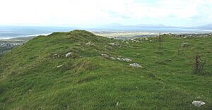
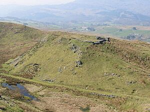
Because there are so many, we've split them into different lists. This article focuses on the 171 prehistoric sites found in the old Merionethshire area. Prehistoric means they are from a time before written history, like the Stone Age, Bronze Age, and Iron Age.
Many of these sites are burial places, where ancient people were laid to rest. These include things like:
- Chambered tombs: Stone structures where people were buried.
- Cairns and mounds: Piles of stones or earth covering burials.
- Barrows: Large earth mounds, also for burials.
Other sites are domestic, which means they were places where people lived. These often include:
- Hut circles: The stone foundations of ancient round houses.
- Enclosures: Areas surrounded by walls or ditches, often protecting homes or farms.
You'll also find defensive sites, which were built to protect communities. These include:
- Hillforts: Large forts built on hilltops for defense.
- Promontory forts: Forts built on pieces of land sticking out, often by the coast.
These sites help us understand how people lived, worked, and even fought thousands of years ago! Organizations like Cadw (Welsh Historic Monuments) and RCAHMW help find, protect, and study these incredible pieces of history.
Discovering Ancient Sites in Merionethshire
This section lists some of the fascinating prehistoric scheduled monuments you can find in the historic Merionethshire part of Gwynedd. Each one tells a unique story about the past.
| Image | Name | Site type | Community | Location | Details | Period | SAM No & Refs |
|---|---|---|---|---|---|---|---|
| Afon Arthog cup-marked rock | Cup-marked stone | Arthog | 52°42′01″N 3°58′51″W / 52.7002°N 3.9809°W, SH662132 |
A stone with ancient carved marks. | Prehistoric |
ME235 |
|
| Afon Arthog standing stone | Standing stone | Arthog | 52°41′57″N 3°59′25″W / 52.6993°N 3.9902°W, SH656131 |
A tall stone placed upright by ancient people. | Prehistoric |
ME234 |
|
| Arthog Standing Stone | Kerb cairn | Arthog | 52°42′22″N 3°59′44″W / 52.7061°N 3.9955°W, SH652139 |
A stone circle or kerb around a burial mound. | Prehistoric |
ME105 |
|
| Bedd-y-Brenin Round Cairn | Round cairn | Arthog | 52°41′02″N 4°01′18″W / 52.6838°N 4.0216°W, SH634115 |
A circular pile of stones, likely a burial site. | Prehistoric |
ME102 |
|
| Bron-Llety-Ifan cairns and cup-marked rock | Kerb cairn | Arthog | 52°41′39″N 4°01′25″W / 52.6941°N 4.0237°W, SH633126 |
Ancient stone mounds and a rock with carved cups. | Prehistoric |
ME242 |
|
| Bryn Seward Standing Stones and Field System with Associated Cairns | Stone alignment | Arthog | 52°41′11″N 4°02′03″W / 52.6863°N 4.0343°W, SH626117 |
Rows of standing stones and ancient farm fields. | Prehistoric |
ME083 |
|
| Craig Las cairn | Round cairn | Arthog | 52°42′24″N 3°57′12″W / 52.7068°N 3.9534°W, SH681139 |
A circular stone mound. | Prehistoric |
ME239 |
|
| Hut Circle (and Early Field System) on Bryn Seward | Unenclosed hut circle | Arthog | 52°41′10″N 4°02′12″W / 52.6861°N 4.0367°W, SH623117 |
Foundations of an ancient house and old fields. | Prehistoric |
ME085 |
|
| Hut Circle South of Cyfannedd Fawr | Unenclosed hut circle | Arthog | 52°41′10″N 4°01′21″W / 52.6861°N 4.0226°W, SH633117 |
Foundations of an ancient house. | Prehistoric |
ME177 |
|
| Hut Group 530m SSE of Cyfannedd Fawr | Hut circle settlement | Arthog | 52°41′05″N 4°01′34″W / 52.6846°N 4.026°W, SH631115 |
A group of ancient house foundations. | Prehistoric |
ME103 |
|
| Llynnau Cregennen Standing Stone | Standing stone | Arthog | 52°42′21″N 3°58′55″W / 52.7057°N 3.982°W, SH662138 |
A tall stone placed upright. | Prehistoric |
ME068 |
|
| The Cregennen Cairns and Standing Stones | Round cairn | Arthog | 52°42′13″N 3°58′44″W / 52.7035°N 3.9788°W, SH660132 |
Stone mounds and upright stones. | Prehistoric |
ME151 |
|
| Tyddyn-y-Coed Camp | Hillfort | Arthog | 52°43′26″N 3°56′06″W / 52.724°N 3.9349°W, SH694157 |
An ancient fort on a hill. | Prehistoric |
ME008 |
|
| Waen Bant Standing Stone | Standing stone | Arthog | 52°42′00″N 3°59′48″W / 52.7001°N 3.9967°W, SH651132 |
A tall stone placed upright. | Prehistoric |
ME125 |
|
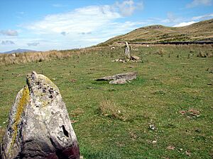
| Cerrig Arthur Stone Circle | Stone circle | Barmouth | 52°45′01″N 4°01′43″W / 52.7502°N 4.0287°W, SH631188 |
A circle of standing stones. | Prehistoric |
ME114 |
|
| Ffridd Fechan Fort | Hillfort | Barmouth | 52°44′26″N 4°03′09″W / 52.7405°N 4.0526°W, SH615178 |
An ancient fort on a hill. | Prehistoric |
ME127 |
|
| Hut Circle at Gellfawr | Unenclosed hut circle | Barmouth | 52°43′52″N 4°02′47″W / 52.731°N 4.0465°W, SH619168 |
Foundations of an ancient house. | Prehistoric |
ME179 |
|
| Standing Stone S of Cerrig-y-Cledd | Standing stone | Barmouth | 52°45′28″N 4°00′45″W / 52.7577°N 4.0124°W, SH642196 |
A tall stone placed upright. | Prehistoric |
ME139 |
|
| Dolddeuli Standing Stone | Standing stone | Brithdir and Llanfachreth | 52°47′50″N 3°44′33″W / 52.7972°N 3.7426°W, SH826236 |
A tall stone placed upright. | Prehistoric |
ME226 |
|
| Moel Offrwm Camp | Hillfort | Brithdir and Llanfachreth | 52°46′19″N 3°51′17″W / 52.7719°N 3.8548°W, SH749210 |
An ancient fort on a hill. | Prehistoric |
ME021 |
|
| Moel Offrwm Lower Camp | Hillfort | Brithdir and Llanfachreth | 52°46′07″N 3°51′26″W / 52.7686°N 3.8573°W, SH747206 |
Another ancient fort on a hill. | Prehistoric |
ME035 |
|
| Nant Helygog ring cairn | Ring cairn | Brithdir and Llanfachreth | 52°45′05″N 3°46′35″W / 52.7515°N 3.7763°W, SH802185 |
A circular stone mound. | Prehistoric |
ME247 |
|
| Tyddyn Bach Round Barrow | Round barrow | Brithdir and Llanfachreth | 52°46′51″N 3°51′39″W / 52.7807°N 3.8607°W, SH745219 |
A circular earth mound, likely a burial site. | Prehistoric |
ME212 |
|
| Crop marks (revealed by aerial photography) SE of Pen-y-Sarn, Bryn-Crug | Enclosed hut circle | Bryn-crug | 52°36′39″N 4°03′48″W / 52.6108°N 4.0632°W, SH604034 |
Ancient house foundations seen from the air. | Prehistoric |
ME106 |
|
| Enclosed Hut Circle Settlement North of Coed Gwlyb | Enclosed hut circle | Dolbenmaen | 52°55′35″N 4°10′12″W / 52.9265°N 4.1699°W, SH542387 |
A group of ancient houses within an enclosure. | Prehistoric |
ME184 |
|
| Llyn Gafr Hut Circle | Hut circle settlement | Dolgellau | 52°42′30″N 3°54′32″W / 52.7082°N 3.9089°W, SH711139 |
Foundations of an ancient house. | Prehistoric |
ME218 |
|
| Llyn Gafr Standing stone | Standing stone | Dolgellau | 52°42′37″N 3°54′20″W / 52.7102°N 3.9055°W, SH713142 |
A tall stone placed upright. | Prehistoric |
ME219 |
|
| Maes Coch Hut Circles | Hut circle settlement | Dolgellau | 52°43′16″N 3°51′40″W / 52.7211°N 3.8611°W, SH744153 |
A group of ancient house foundations. | Prehistoric |
ME195 |
|
| Tal y Waen Cairns | Kerb cairn | Dolgellau | 52°43′54″N 3°55′56″W / 52.7318°N 3.9323°W, SH696166 |
Ancient stone mounds. | Prehistoric |
ME244 |
|
| Berth Ddu Hut Circles | Enclosed hut circle | Dyffryn Ardudwy | 52°47′02″N 4°05′27″W / 52.7839°N 4.0907°W, SH591227 |
Ancient house foundations within an enclosure. | Prehistoric |
ME004 |
|
| Bron-y-Foel West Burial Chamber | Chambered long cairn | Dyffryn Ardudwy | 52°48′05″N 4°04′00″W / 52.8013°N 4.0667°W, SH607246 |
A long stone burial mound with chambers. | Prehistoric |
ME065 |
|
| Bwlch y Rhiwgyr cairn | Round cairn | Dyffryn Ardudwy | 52°45′38″N 4°02′09″W / 52.7605°N 4.0359°W, SH627200 |
A circular stone mound. | Prehistoric |
ME237 |
|
| Bwlch y Rhiwgyr, cairn 350m to SW of | Round cairn | Dyffryn Ardudwy | 52°45′20″N 4°02′29″W / 52.7555°N 4.0414°W, SH623194 |
Another circular stone mound. | Prehistoric |
ME238 |
|
| Byrllysg promontory fort | Promontory fort - inland]] | Dyffryn Ardudwy | 52°47′46″N 4°05′02″W / 52.7962°N 4.0839°W, SH595241 |
A fort built on a piece of land sticking out. | Prehistoric |
ME064 |
|
| Carneddau Hengwm Long Cairns | Chambered long cairn | Dyffryn Ardudwy | 52°45′53″N 4°03′24″W / 52.7647°N 4.0566°W, SH613205 |
Long stone burial mounds with chambers. | Prehistoric |
ME007 |
|
| Ceunant Egryn Enclosed Settlement | Enclosed hut circle | Dyffryn Ardudwy | 52°45′55″N 4°04′06″W / 52.7652°N 4.0682°W, SH605206 |
An ancient village with houses inside a protective wall. | Prehistoric |
ME099 |
|
| Ceunant Egryn Hut Group | Enclosed hut circle | Dyffryn Ardudwy | 52°45′58″N 4°03′36″W / 52.7662°N 4.0599°W, SH611207 |
A group of ancient houses within an enclosure. | Prehistoric |
ME154 |
|
| Cors-y-Gedol Burial Chamber | Chambered long cairn | Dyffryn Ardudwy | 52°47′05″N 4°04′21″W / 52.7848°N 4.0725°W, SH603228 |
A long stone burial mound with chambers. | Prehistoric |
ME038 |
|
| Cors-y-Gedol Settlements & Field System | Enclosed hut circle | Dyffryn Ardudwy | 52°47′12″N 4°03′51″W / 52.7866°N 4.0642°W, SH608229 |
Ancient villages and farm fields within an enclosure. | Prehistoric |
ME128 |
|
| Craig-y-Ddinas Camp | Hillfort | Dyffryn Ardudwy | 52°47′16″N 4°02′28″W / 52.7878°N 4.0412°W, SH624230 |
An ancient fort on a hill. | Prehistoric |
ME020 |
|
| Dyffryn Ardudwy Burial Chamber |
Chambered long cairn | Dyffryn Ardudwy | 52°47′05″N 4°05′37″W / 52.7846°N 4.0937°W, SH588228 |
A long stone burial mound with chambers, cared for by Cadw. | Prehistoric |
ME003 |
|
| Enclosed Hut Circle North of Tyddyn Mawr | Enclosed hut circle | Dyffryn Ardudwy | 52°45′57″N 4°05′25″W / 52.7657°N 4.0904°W, SH590207 |
Ancient house foundations within an enclosure. | Prehistoric |
ME159 |
|
| Enclosed Hut Circle Settlement and Long huts E of Egryn Abbey | Enclosed Hut circle settlement | Dyffryn Ardudwy | 52°45′36″N 4°04′35″W / 52.7601°N 4.0763°W, SH599200 |
An ancient village with houses and long huts inside a protective wall. | Prehistoric |
ME153 |
|
| Enclosure near Bron y Foel, Moelfre | Enclosure | Dyffryn Ardudwy | 52°47′51″N 4°04′00″W / 52.7974°N 4.0666°W, SH607242 |
An ancient area surrounded by a wall or ditch. | Prehistoric |
ME155 |
|
| Fron-Galed Homestead | Enclosed hut circle | Dyffryn Ardudwy | 52°46′53″N 4°05′21″W / 52.7815°N 4.0891°W, SH591224 |
An ancient farm or living area with houses inside an enclosure. | Prehistoric |
ME113 |
|
| Hengwm Stone Circles | Stone circle | Dyffryn Ardudwy | 52°46′18″N 4°03′09″W / 52.7717°N 4.0524°W, SH616212 |
Circles made of standing stones. | Prehistoric |
ME136 |
|
| Hut Group and Enclosures on SW Slope of Moelfre | Unenclosed hut circle | Dyffryn Ardudwy | 52°45′36″N 4°04′35″W / 52.7601°N 4.0763°W, SH620239 |
A group of ancient houses and enclosed areas. | Prehistoric |
ME152 |
|
| Llecheiddior Round Cairns | Round cairn | Dyffryn Ardudwy | 52°46′40″N 4°03′36″W / 52.7779°N 4.0599°W, SH612220 |
Circular stone mounds. | Prehistoric |
ME055 |
|
| Llecheiddior Stone Circle | Stone circle | Dyffryn Ardudwy | 52°46′31″N 4°03′37″W / 52.7754°N 4.0603°W, SH611217 |
A circle made of standing stones. | Prehistoric |
ME129 |
|
| Llwyn du Parc cairn | Cairn circle | Dyffryn Ardudwy | 52°45′23″N 4°03′16″W / 52.7564°N 4.0545°W, SH614196 |
A circular stone mound. | Prehistoric |
ME240 |
|
| Mynydd Egryn Ring Cairn | Ring cairn | Dyffryn Ardudwy | 52°45′45″N 4°03′09″W / 52.7626°N 4.0524°W, SH616203 |
A circular stone mound. | Prehistoric |
ME156 |
|
| Mynydd Egryn Settlement | Enclosed hut circle | Dyffryn Ardudwy | 52°45′45″N 4°03′07″W / 52.7626°N 4.0519°W, SH616203 |
An ancient village with houses inside a protective wall. | Prehistoric |
ME157 |
|
| Pen y Ddinas Camp | Hillfort | Dyffryn Ardudwy | 52°46′02″N 4°04′03″W / 52.7673°N 4.0676°W, SH606208 |
An ancient fort on a hill. | Prehistoric |
ME076 |
|
| Pen y Dinas Cairn | Round cairn | Dyffryn Ardudwy | 52°46′18″N 4°03′37″W / 52.7716°N 4.0602°W, SH611213 |
A circular stone mound. | Prehistoric |
ME236 |
|
| Settlement and Field System at Bron y Foel Uchaf | Unenclosed hut circle | Dyffryn Ardudwy | 52°48′18″N 4°03′50″W / 52.8051°N 4.0638°W, SH609250 |
An ancient village and farm fields. | Prehistoric |
ME162 |
|
| Bryn-y-Castell Hillfort | Hillfort | Ffestiniog | 52°58′08″N 3°53′43″W / 52.9689°N 3.8953°W, SH728429 |
An ancient fort on a hill. | Prehistoric |
ME104 |
|
| Gamallt Hut Circle Settlement | Hut circle settlement | Ffestiniog | 52°58′35″N 3°53′08″W / 52.9763°N 3.8856°W, SH734438 |
A group of ancient house foundations. | Prehistoric |
ME137 |
|
| Hut Circle at Llyn Morwynion, Ffestiniog | Hut circle settlement | Ffestiniog | 52°57′56″N 3°52′49″W / 52.9655°N 3.8804°W, SH738425 |
Foundations of an ancient house. | Prehistoric |
ME194 |
|
| Hut Circle East of Cymerau Uchaf | Unenclosed hut circle | Ffestiniog | 52°58′20″N 3°56′29″W / 52.9723°N 3.9413°W, SH697434 |
Foundations of an ancient house. | Prehistoric |
ME172 |
|
| Hut Circle Settlement at Gelli Gonan | Unenclosed hut circle | Ffestiniog | 52°59′29″N 3°56′59″W / 52.9914°N 3.9496°W, SH692455 |
A group of ancient house foundations. | Prehistoric |
ME173 |
|
| Hut Circle Settlement at Nant Ddu | Enclosed hut circle | Ffestiniog | 52°58′31″N 3°58′33″W / 52.9752°N 3.9758°W, SH674438 |
A group of ancient houses within an enclosure. | Prehistoric |
ME164 |
|
| Cefn Coch Cairn and Cist | Round cairn | Ganllwyd | 52°46′50″N 3°53′52″W / 52.7805°N 3.8979°W, SH720220 |
A circular stone mound with a stone box (cist) inside. | Prehistoric |
ME220 |
|
| Craig y Ganllwyd Cairn and Cist | Platform Cairn | Ganllwyd | 52°48′44″N 3°54′08″W / 52.8122°N 3.9023°W, SH718255 |
A flat-topped stone mound with a stone box (cist) inside. | Prehistoric |
ME221 |
|
| Hut Groups S of Bwlch-y-Ffordd | Enclosed hut circle | Ganllwyd | 52°50′06″N 3°53′57″W / 52.8351°N 3.8991°W, SH721281 |
Groups of ancient houses within enclosures. | Prehistoric |
ME046 |
|
| Cefnfilltir Enclosed Homestead | Enclosed hut circle | Harlech | 52°51′23″N 4°05′43″W / 52.8563°N 4.0952°W, SH590308 |
An ancient farm or living area with houses inside an enclosure. | Prehistoric |
ME098 |
|
| Erw Wen Prehistoric and Medieval Settlement | Enclosed hut circle | Harlech | 52°52′13″N 4°04′17″W / 52.8704°N 4.0714°W, SH606322 |
An ancient village with houses, used in both prehistoric and medieval times. | Prehistoric |
ME188 |
|
| Groes Las Prehistoric Settlement & Field System | Enclosed hut circle | Harlech | 52°50′56″N 4°06′39″W / 52.8489°N 4.1108°W, SH579300 |
An ancient village and farm fields within an enclosure. | Prehistoric |
ME095 |
|
| Hut Circle West of Merthyr Farm | Unenclosed hut circle | Harlech | 52°52′00″N 4°05′08″W / 52.8668°N 4.0856°W, SH597319 |
Foundations of an ancient house. | Prehistoric |
ME176 |
|
| Moel Goedog Camp | Hillfort | Harlech | 52°52′20″N 4°03′40″W / 52.8721°N 4.0612°W, SH614325 |
An ancient fort on a hill. | Prehistoric |
ME059 |
|
| Moel Goedog Round Cairns & Standing Stones | Ring cairn | Harlech | 52°52′12″N 4°04′03″W / 52.87°N 4.0675°W, SH609323 |
Circular stone mounds and upright stones. | Prehistoric |
ME058 |
|
| Muriau'r Gwyddelod Ancient Village | Courtyard house | Harlech | 52°51′06″N 4°06′05″W / 52.8516°N 4.1013°W, SH586303 |
An ancient village with houses built around courtyards. | Prehistoric |
ME010 |
|
| Clogwyn Arllef Hillfort & Field System | Hillfort | Llanbedr | 52°50′10″N 4°05′11″W / 52.836°N 4.0863°W, SH595286 |
An ancient fort on a hill with old farm fields nearby. | Prehistoric |
ME123 |
|
| Hut Circle Settlement at Bwlch Tyddiad | Hut circle settlement | Llanbedr | 52°51′19″N 4°00′15″W / 52.8552°N 4.0042°W, SH651305 |
A group of ancient house foundations. | Prehistoric |
ME182 |
|
| Hut Circle Settlement East of Caer-Cynog | Hut circle settlement | Llanbedr | 52°49′40″N 4°02′35″W / 52.8278°N 4.0431°W, SH624275 |
A group of ancient house foundations. | Prehistoric |
ME180 |
|
| Hut Circle West of Pen-y-Bryn | Unenclosed hut circle | Llanbedr | 52°49′02″N 4°04′52″W / 52.8173°N 4.081°W, SH598264 |
Foundations of an ancient house. | Prehistoric |
ME160 |
|
| Llanbedr Standing Stones | Standing stone | Llanbedr | 52°49′19″N 4°06′14″W / 52.8219°N 4.1039°W, SH583270 |
Tall stones placed upright by ancient people. | Prehistoric |
ME056 |
|
| Caer Euni Camp | Hillfort | Llandderfel | 52°57′35″N 3°29′21″W / 52.9597°N 3.4893°W, SJ000412 |
An ancient fort on a hill. | Prehistoric |
ME015 |
|
| Caer Euni Stone Circles | Kerb cairn | Llandderfel | 52°57′25″N 3°30′01″W / 52.9569°N 3.5003°W, SH993410 |
Stone circles or kerbs around burial mounds. | Prehistoric |
ME040 |
|
| Carnedd y Filiast Cairn | Round cairn | Llandderfel | 52°59′12″N 3°40′58″W / 52.9868°N 3.6828°W, SH871445 |
A circular stone mound. | Prehistoric |
ME253 |
|
| Cefn Caer Euni Round Cairn | Round cairn | Llandderfel | 52°57′12″N 3°30′23″W / 52.9532°N 3.5064°W, SH988405 |
A circular stone mound. | Prehistoric |
ME227 |
|
| Cefn Ddwysarn Camp | Enclosure | Llandderfel | 52°55′52″N 3°32′18″W / 52.9311°N 3.5383°W, SH967381 |
An ancient area surrounded by a wall or ditch. | Prehistoric |
ME063 |
|
| Garnedd Wen Cairn | Round cairn | Llandderfel | 52°57′29″N 3°41′08″W / 52.958°N 3.6856°W, SH868414 |
A circular stone mound. | Prehistoric |
ME254 |
|
| Maen y Rhos Standing Stone | Standing stone | Llandderfel | 52°56′52″N 3°32′21″W / 52.9478°N 3.5393°W, SH966400 |
A tall stone placed upright. | Prehistoric |
ME228 |
|
| Mynydd Mynyllod Enclosure | Enclosure | Llandderfel | 52°56′50″N 3°29′11″W / 52.9471°N 3.4863°W, SJ002398 |
An ancient area surrounded by a wall or ditch. | Prehistoric |
ME090 |
|
| Allt Lwyd Bronze Age Ritual Complex | Cairn | Llanegryn | 52°38′55″N 4°02′57″W / 52.6487°N 4.0493°W, SH614076 |
A group of stone mounds used for ancient ceremonies. | Prehistoric |
ME213 |
|
| Allt Lwyd Cairn I | Round cairn | Llanegryn | 52°39′00″N 4°02′56″W / 52.65°N 4.0489°W, SH614077 |
A circular stone mound. | Prehistoric |
ME214 |
|
| Allt Lwyd Cairn II | Round cairn | Llanegryn | 52°39′07″N 4°02′46″W / 52.6519°N 4.046°W, SH616079 |
Another circular stone mound. | Prehistoric |
ME215 |
|
| Twll y Darren Round Barrow | Round barrow | Llanegryn | 52°39′29″N 4°02′06″W / 52.658°N 4.0351°W, SH624086 |
A circular earth mound, likely a burial site. | Prehistoric |
ME222 |
|
| Waen Fach Standing Stone | Standing stone | Llanegryn | 52°37′25″N 4°04′42″W / 52.6235°N 4.0782°W, SH594048 |
A tall stone placed upright. | Prehistoric |
ME223 |
|
| Coed Pen-y-Bryn Defended Settlement | Enclosure, Defensive | Llanelltyd | 52°45′27″N 3°53′13″W / 52.7574°N 3.887°W, SH727194 |
An ancient village with defenses. | Prehistoric |
ME266 |
|
| Foel Faner Defended Enclosure | Enclosure, Defensive | Llanelltyd | 52°46′00″N 3°52′47″W / 52.7667°N 3.8797°W, SH732204 |
An ancient enclosed area with defenses. | Prehistoric |
ME267 |
|
| Fortified Settlement at Bryn Castell | Enclosure | Llanelltyd | 52°45′52″N 4°00′04″W / 52.7645°N 4.0011°W, SH650204 |
An ancient village with strong defenses. | Prehistoric |
ME138 |
|
| Pentre Farm Barrow | Round barrow | Llanelltyd | 52°45′18″N 3°53′45″W / 52.7549°N 3.8959°W, SH721191 |
A circular earth mound, likely a burial site. | Prehistoric |
ME248 |
|
| Bedd Gorfal Ring Cairn | Ring cairn | Llanfair | 52°51′35″N 4°03′42″W / 52.8598°N 4.0616°W, SH612311 |
A circular stone mound. | Prehistoric |
ME135 |
|
| Brwyn-Llynau Enclosed Settlement | Enclosure | Llanfair | 52°50′42″N 4°06′01″W / 52.8449°N 4.1002°W, SH586295 |
An ancient enclosed area. | Prehistoric |
ME097 |
|
| Enclosure and Early Field System North of Fronhill, Llanfair | Enclosure | Llanfair | 52°50′51″N 4°06′23″W / 52.8474°N 4.1064°W, SH583298 |
An ancient enclosed area with early farm fields. | Prehistoric |
ME158 |
|
| Ffridd Fron Kerb Cairn | Kerb cairn | Llanfair | 52°52′18″N 4°02′04″W / 52.8716°N 4.0345°W, SH631324 |
A stone circle or kerb around a burial mound. | Prehistoric |
ME208 |
|
| Fonlief Hir Standing Stones | Standing stone | Llanfair | 52°51′40″N 4°04′44″W / 52.861°N 4.0788°W, SH601313 |
Tall stones placed upright. | Prehistoric |
ME057 |
|
| Garreg Round Cairn | Cairn | Llanfair | 52°51′28″N 4°04′56″W / 52.8578°N 4.0822°W, SH599309 |
A circular stone mound. | Prehistoric |
ME107 |
|
| Gwern Einion Burial Chamber | Chambered tomb | Llanfair | 52°50′11″N 4°05′55″W / 52.8364°N 4.0986°W, SH587286 |
An ancient burial place with stone chambers. | Prehistoric |
ME011 |
|
| Hengaeau Standing Stone | Standing stone | Llanfair | 52°50′24″N 4°06′12″W / 52.8401°N 4.1032°W, SH584290 |
A tall stone placed upright. | Prehistoric |
ME207 |
|
| Hut Circle near Gerddi Bluog | Unenclosed hut circle | Llanfair | 52°51′18″N 4°02′54″W / 52.855°N 4.0483°W, SH621305 |
Foundations of an ancient house. | Prehistoric |
ME165 |
|
| Hut Circle Settlement North-East of Moel-y-Gerddi | Unenclosed hut circle | Llanfair | 52°52′04″N 4°02′11″W / 52.8679°N 4.0365°W, SH630319 |
A group of ancient house foundations. | Prehistoric |
ME166 |
|
| Hut Circle South of Tyddyn-Du | Unenclosed hut circle | Llanfair | 52°50′43″N 4°05′25″W / 52.8453°N 4.0902°W, SH593295 |
Foundations of an ancient house. | Prehistoric |
ME161 |
|
| Settlement 400m SE of Moel Goedog | Enclosed hut circle | Llanfair | 52°52′09″N 4°03′29″W / 52.8691°N 4.058°W, SH615321 |
An ancient village with houses inside an enclosure. | Prehistoric |
ME133 |
|
| Settlement 500m SE of Moel Goedog | Hut circle settlement | Llanfair | 52°52′08″N 4°03′22″W / 52.8688°N 4.056°W, SH616321 |
A group of ancient house foundations. | Prehistoric |
ME134 |
|
| Tyddyn Du Enclosed Settlement | Enclosed hut circle | Llanfair | 52°50′51″N 4°05′42″W / 52.8474°N 4.0951°W, SH590298 |
An ancient village with houses inside an enclosure. | Prehistoric |
ME120 |
|
| Carnedd Lwyd cairns | Round cairn | Llanfihangel-y-Pennant | 52°42′12″N 3°57′04″W / 52.7033°N 3.951°W, SH682135 |
Circular stone mounds. | Prehistoric |
ME241 |
|
| Craig yr Aderyn Hillfort | Hillfort | Llanfihangel-y-Pennant | 52°38′32″N 4°00′15″W / 52.6422°N 4.0042°W, SH644068 |
An ancient fort on a hill. | Prehistoric |
ME075 |
|
| Hut Circle Settlement at Craig Ty'n-y-Cornel | Unenclosed hut circle | Llanfihangel-y-Pennant | 52°39′24″N 4°00′53″W / 52.6567°N 4.0147°W, SH637084 |
A group of ancient house foundations. | Prehistoric |
ME167 |
|
| Defended Settlement 150m NW of Plas Ynysfor | Enclosure, Defensive | Llanfrothen | 52°57′50″N 4°05′13″W / 52.9638°N 4.0869°W, SH599427 |
An ancient village with defenses. | Prehistoric |
ME265 |
|
| Unenclosed Hut Circle Settlement at Bryn Derw | Hut circle settlement | Llanfrothen | 52°57′53″N 4°03′08″W / 52.9648°N 4.0523°W, SH622428 |
A group of ancient house foundations. | Prehistoric |
ME178 |
|
| Unenclosed Hut Circle Settlement East of Garth-y-Foel | Unenclosed hut circle | Llanfrothen | 52°58′41″N 4°02′54″W / 52.978°N 4.0484°W, SH625442 |
Foundations of an ancient house. | Prehistoric |
ME170 |
|
| Castell y Gaer | Hillfort | Llangelynin | 52°39′38″N 4°05′00″W / 52.6606°N 4.0832°W, SH592090 |
An ancient fort on a hill. | Prehistoric |
ME053 |
|
| Castell-Mawr | Hillfort | Llangelynin | 52°37′21″N 4°05′55″W / 52.6224°N 4.0986°W, SH580048 |
A large ancient fort on a hill. | Prehistoric |
ME073 |
|
| Group of Standing Stones 810m South West of Bryn Seward | Stone alignment | Llangelynin | 52°40′53″N 4°02′48″W / 52.6814°N 4.0467°W, SH617113 |
A group of tall stones placed in a line. | Prehistoric |
ME084 |
|
| Hut Enclosure and Early Field System South of Mynydd Graigwen | Field system | Llangelynin | 52°40′59″N 4°02′58″W / 52.683°N 4.0494°W, SH616115 |
An ancient enclosed area with early farm fields. | Prehistoric |
ME087 |
|
| Llechrwyd Hillfort | Hillfort | Llangelynin | 52°36′27″N 4°06′33″W / 52.6075°N 4.1093°W, SH572031 |
An ancient fort on a hill. | Prehistoric |
ME124 |
|
|
|
Parth-y-Gwyddwch, Standing Stones 150m N of | Standing stone | Llangelynin | 52°40′21″N 4°04′12″W / 52.6725°N 4.0701°W, SH601103 |
Tall stones placed upright. | Prehistoric |
ME259 |
| Tal-y-Gareg Camp | Hillfort | Llangelynin | 52°36′41″N 4°06′26″W / 52.6113°N 4.1072°W, SH574035 |
An ancient fort on a hill. | Prehistoric |
ME074 |
|
| Foel Cwm-Sian Llwyd cairn | Round cairn | Llangywer | 52°52′25″N 3°29′29″W / 52.8737°N 3.4915°W, SH997317 |
A circular stone mound. | Prehistoric |
ME243 |
|
| Foel y Geifr Cairn | Round cairn | Llangywer | 52°50′05″N 3°34′45″W / 52.8347°N 3.5793°W, SH937275 |
A circular stone mound. | Prehistoric |
ME245 |
|
| Aran Fawddwy Cairn | Round cairn | Llanuwchllyn | 52°47′13″N 3°41′16″W / 52.787°N 3.6878°W, SH862223 |
A circular stone mound. | Prehistoric |
ME258 |
|
| Bancian Duon Hut Circle Settlement and Deserted Rural Settlement | Unenclosed hut circle | Llanuwchllyn | 52°52′48″N 3°45′33″W / 52.8801°N 3.7593°W, SH816328 |
An ancient village with house foundations, now deserted. | Prehistoric |
ME197 |
|
| Cairn 200m SE of Foel Ystrodur Fawr | Round cairn | Llanuwchllyn | 52°53′23″N 3°45′40″W / 52.8898°N 3.7612°W, SH816339 |
A circular stone mound. | Prehistoric |
ME256 |
|
| Cairn 225m S of Moel Caws | Round cairn | Llanuwchllyn | 52°49′53″N 3°42′54″W / 52.8313°N 3.715°W, SH845273 |
A circular stone mound. | Prehistoric |
ME081 |
|
| Cairn 300m SE of Bryn Cau | Round cairn | Llanuwchllyn | 52°52′55″N 3°45′20″W / 52.882°N 3.7556°W, SH819330 |
A circular stone mound. | Prehistoric |
ME255 |
|
| Hut Group & Enclosures 117m S of Moel Caws | Hut group | Llanuwchllyn | 52°49′56″N 3°42′55″W / 52.8321°N 3.7154°W, SH845274 |
A group of ancient houses and enclosed areas. | Prehistoric |
ME082 |
|
| Llechwedd Erwent Hut Circle Settlement | Unenclosed hut circle settlement | Llanuwchllyn | 52°53′23″N 3°45′00″W / 52.8898°N 3.7499°W, SH822339 |
A group of ancient house foundations. | Prehistoric |
ME199 |
|
| Arenig Fawr Cairn | Round cairn | Llanycil | 52°55′02″N 3°44′46″W / 52.9171°N 3.746°W, SH827369 |
A circular stone mound. | Prehistoric |
ME257 |
|
| Coed Cae Fali Hut Circle Settlement | Enclosed hut circle | Maentwrog | 52°56′33″N 4°02′28″W / 52.9425°N 4.0412°W, SH629402 |
A group of ancient houses within an enclosure. | Prehistoric |
ME149 |
|
| Ffridd Braich Llwyd Bronze Age Ritual Complex | Ring cairn | Mawddwy | 52°42′38″N 3°36′43″W / 52.7105°N 3.6119°W, SH912137 |
A circular stone mound used for ancient ceremonies. | Prehistoric |
ME217 |
|
| Fridd round barrows | Round barrow | Pennal | 52°36′06″N 3°50′43″W / 52.6018°N 3.8452°W, SH751020 |
Circular earth mounds, likely burial sites. | Prehistoric |
ME231 |
|
| Tarren Hendre Cairn | Round cairn | Pennal | 52°37′03″N 3°56′44″W / 52.6175°N 3.9456°W, SH683039 |
A circular stone mound. | Prehistoric |
ME041 |
|
| Ty'n y Berllan Settlement | Enclosed hut circle | Penrhyndeudraeth | 52°56′00″N 4°05′02″W / 52.9333°N 4.084°W, SH600393 |
An ancient village with houses inside an enclosure. | Prehistoric |
ME096 |
|
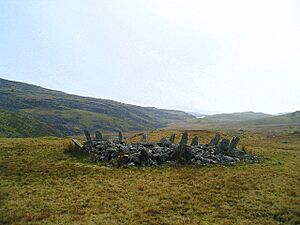
| Bryn Cader-Faner Round Cairn | Round cairn | Talsarnau | 52°53′54″N 4°00′41″W / 52.8982°N 4.0113°W, SH647353 |
A circular stone mound. | Prehistoric |
ME061 |
|
| Coety Bach Homestead | Enclosed hut circle | Talsarnau | 52°54′18″N 4°02′18″W / 52.905°N 4.0383°W, SH630361 |
An ancient farm or living area with houses inside an enclosure. | Prehistoric |
ME109 |
|
| Coety Mawr Round Hut and Enclosure | Unenclosed hut circle | Talsarnau | 52°54′15″N 4°02′14″W / 52.9043°N 4.0372°W, SH631360 |
Foundations of an ancient round house and an enclosed area. | Prehistoric |
ME110 |
|
| Cwm Moch Settlement | Enclosed hut circle | Talsarnau | 52°54′25″N 3°59′14″W / 52.9069°N 3.9872°W, SH664362 |
An ancient village with houses inside an enclosure. | Prehistoric |
ME132 |
|
| Deserted Rural Settlement North of Llyn y Fedw | Hut circle settlement | Talsarnau | 52°52′52″N 4°02′06″W / 52.8811°N 4.0351°W, SH631334 |
A group of ancient house foundations, now abandoned. | Prehistoric |
ME189 |
|
| Enclosed Hut Circle Settlement South East of Yr Onen | Enclosed hut circle | Talsarnau | 52°54′53″N 4°00′43″W / 52.9147°N 4.012°W, SH648371 |
A group of ancient houses within an enclosure. | Prehistoric |
ME140 |
|
| Enclosed Hut Group at Nurse Cae Du | Enclosed hut circle | Talsarnau | 52°56′03″N 3°57′07″W / 52.9341°N 3.9519°W, SH688391 |
A group of ancient houses within an enclosure. | Prehistoric |
ME163 |
|
| Ffridd Fedw Round Hut, Enclosure, Ancient Fields and Kerb Cairn | Kerb cairn | Talsarnau | 52°52′34″N 4°03′25″W / 52.8761°N 4.057°W, SH616329 |
An ancient round house, enclosed area, old farm fields, and a circular stone mound. | Prehistoric |
ME111 |
|
| Hut Circle North-East of Moel Goedog | Unenclosed hut circle | Talsarnau | 52°52′27″N 4°03′10″W / 52.8743°N 4.0528°W, SH619329 |
Foundations of an ancient house. | Prehistoric |
ME183 |
|
| Hut Circle Settlement and Cairn Field West of Llyn Eiddew Bach | Hut circle settlement | Talsarnau | 52°53′24″N 4°01′31″W / 52.8899°N 4.0252°W, SH638344 |
A group of ancient house foundations and an area with many stone mounds. | Prehistoric |
ME141 |
|
| Hut Circles East of Moel Geifr | Hut circle settlement | Talsarnau | 52°54′05″N 4°01′00″W / 52.9013°N 4.0168°W, SH644356 |
A group of ancient house foundations. | Prehistoric |
ME181 |
|
| Llyn Eiddew Bach Ring Cairn I | Ring cairn | Talsarnau | 52°53′42″N 4°00′50″W / 52.8951°N 4.014°W, SH646349 |
A circular stone mound. | Prehistoric |
ME209 |
|
| Llyn Eiddew Bach Ring Cairn II | Ring cairn | Talsarnau | 52°53′25″N 4°01′03″W / 52.8903°N 4.0174°W, SH643344 |
Another circular stone mound. | Prehistoric |
ME210 |
|
| Llyn Eiddew Bach Round Cairns | Kerb cairn | Talsarnau | 52°53′24″N 4°01′26″W / 52.8901°N 4.0238°W, SH639344 |
Circular stone mounds with stone kerbs. | Prehistoric |
ME060 |
|
| Maes y Caerau Homestead | Concentric enclosed hut circle | Talsarnau | 52°54′21″N 4°01′51″W / 52.9059°N 4.0309°W, SH635362 |
An ancient farm or living area with houses inside multiple enclosures. | Prehistoric |
ME117 |
|
| Moel y Glo Homestead & Burnt Mound | Enclosed hut circle | Talsarnau | 52°53′20″N 4°02′39″W / 52.889°N 4.0442°W, SH625343 |
An ancient farm or living area with houses inside an enclosure, and a mound of burnt stones. | Prehistoric |
ME118 |
|
| Settlement E of Eisingrug | Hut circle settlement | Talsarnau | 52°53′27″N 4°03′06″W / 52.8908°N 4.0516°W, SH620345 |
A group of ancient house foundations. | Prehistoric |
ME143 |
|
| Settlements SW of Bryn Cader Faner | Hut circle settlement | Talsarnau | 52°53′46″N 4°00′55″W / 52.8962°N 4.0152°W, SH645351 |
Groups of ancient house foundations. | Prehistoric |
ME144 |
|
| Tyddyn Sion Wyn Ring Cairn | Ring cairn | Talsarnau | 52°52′36″N 4°03′37″W / 52.8766°N 4.0602°W, SH614330 |
A circular stone mound. | Prehistoric |
ME200 |
|
| Y Gyrn Round Cairns | Round cairn | Talsarnau | 52°54′11″N 4°01′18″W / 52.903°N 4.0218°W, SH641359 |
Circular stone mounds. | Prehistoric |
ME062 |
|
| Afon Prysor, cairn to NW of | Round cairn | Trawsfynydd | 52°56′15″N 3°50′12″W / 52.9375°N 3.8367°W, SH766393 |
A circular stone mound. | Prehistoric |
ME246 |
|
| Cefn Clawdd Early Settlement and Fields | Field system | Trawsfynydd | 52°53′06″N 3°57′01″W / 52.885°N 3.9503°W, SH688336 |
An ancient village and farm fields. | Prehistoric |
ME130 |
|
| Cefn Clawdd Ring Cairn | Ring cairn | Trawsfynydd | 52°53′20″N 3°57′27″W / 52.8888°N 3.9576°W, SH683341 |
A circular stone mound. | Prehistoric |
ME211 |
|
| Enclosed Hut Circle Settlement at Dolbelydr | Enclosed hut circle | Trawsfynydd | 52°55′22″N 3°53′41″W / 52.9227°N 3.8948°W, SH727378 |
A group of ancient houses within an enclosure. | Prehistoric |
ME174 |
|
| Enclosed Hut Circle Settlement at Fridd Bodyfyddau | Enclosed hut circle | Trawsfynydd | 52°53′28″N 3°53′15″W / 52.8911°N 3.8874°W, SH730342 |
A group of ancient houses within an enclosure. | Prehistoric |
ME168 |
|
| Hut Circle 800m West of Moelfryn-Isaf | Unenclosed hut circle | Trawsfynydd | 52°54′13″N 3°58′18″W / 52.9036°N 3.9717°W, SH674358 |
Foundations of an ancient house. | Prehistoric |
ME131 |
|
| Hut Circle and Field System at Craiglaseithin | Unenclosed hut circle | Trawsfynydd | 52°53′11″N 3°53′10″W / 52.8863°N 3.886°W, SH732337 |
Foundations of an ancient house and old farm fields. | Prehistoric |
ME169 |
|
| Hut Circle at Afon Graig Wen | Unenclosed hut circle | Trawsfynydd | 52°55′45″N 3°52′57″W / 52.9291°N 3.8825°W, SH735385 |
Foundations of an ancient house. | Prehistoric |
ME175 |
|
| Hut Circle Settlement at Crawcwellt South | Hut circle settlement | Trawsfynydd | 52°50′49″N 3°55′52″W / 52.847°N 3.9311°W, SH700295 |
A group of ancient house foundations. | Prehistoric |
ME171 |
|
| Llech Idris | Standing stone | Trawsfynydd | 52°51′44″N 3°53′11″W / 52.8622°N 3.8863°W, SH731310 |
A tall stone placed upright. | Prehistoric |
ME072 |
|
| Maen Llwyd Standing Stones | Standing stone | Trawsfynydd | 52°52′43″N 3°55′21″W / 52.8786°N 3.9226°W, SH707329 |
Tall stones placed upright. | Prehistoric |
ME115 |
|
| Bryn Dinas Cairn | Round barrow | Tywyn | 52°34′38″N 4°00′38″W / 52.5771°N 4.0105°W, SN638995 |
A circular earth mound, likely a burial site. | Prehistoric |
ME232 |
|
| Capel Maethlon round barrow | Round barrow | Tywyn | 52°34′00″N 4°01′32″W / 52.5667°N 4.0256°W, SN628984 |
A circular earth mound, likely a burial site. | Prehistoric |
ME230 |
|
| Croes Faen Standing Stone | Standing stone | Tywyn | 52°35′37″N 4°04′22″W / 52.5935°N 4.0729°W, SH596015 |
A tall stone placed upright. | Prehistoric |
ME088 |
|
| Dysyrnant Platform Cairn | Platform Cairn | Tywyn | 52°34′55″N 3°59′54″W / 52.5819°N 3.9983°W, SH647001 |
A flat-topped stone mound. | Prehistoric |
ME233 |
|
| Eglwys Gwyddelod Stone Circle | Stone circle | Tywyn | 52°34′58″N 3°58′31″W / 52.5828°N 3.9752°W, SH662001 |
A circle made of standing stones. | Prehistoric |
ME229 |
More About Gwynedd's History
If you're interested in learning more about the history of Gwynedd and Wales, check out these other lists:


