
List of recumbent stone circles facts for kids
_(cropped).jpg)
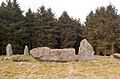
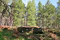
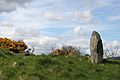
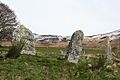
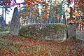
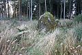
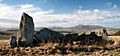
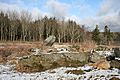
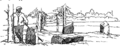
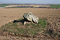
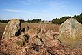
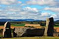
Recumbent stone circles are special ancient stone circles found mostly in northeast Scotland, especially in Aberdeenshire. What makes them unique is a very large stone lying on its side, usually facing south-southwest. This big stone is part of the circle's edge. These circles are believed to have been built during the Bronze Age, thousands of years ago. Their unusual design and the idea that they might have been used to watch the stars or sun have made them a popular topic for studies since the early 1900s.
In 2011, the Royal Commission on the Ancient and Historical Monuments of Scotland (RCAHMS) published an important book about these monuments and created an online list of them. Since then, archaeologists have found two more recumbent stone circles.
Contents
What are Recumbent Stone Circles?
_(geograph_4407419).jpg)
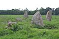
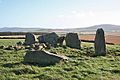
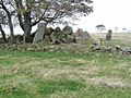
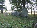
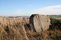
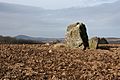
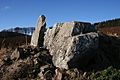
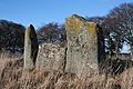
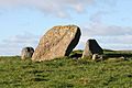
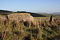
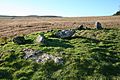
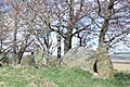
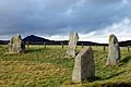
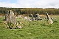
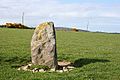
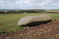
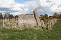
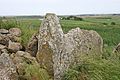
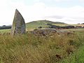
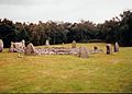
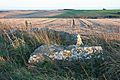
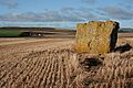
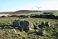
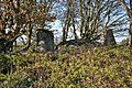
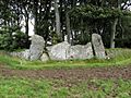
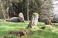
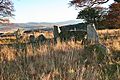
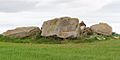
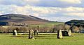
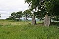
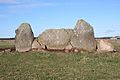
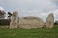
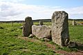
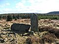
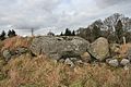
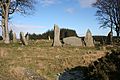
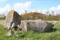
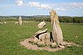
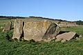
Recumbent stone circles are rings of upright stones, but they have a special feature. Along the circle's edge, usually towards the south or southwest, there is a very large stone lying down. On each side of this large stone are two especially tall upright stones. These three stones – the large lying stone and the two tall ones next to it – are called the "recumbent setting."
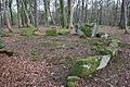
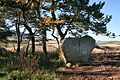
As you move around the rest of the circle, the other upright stones get shorter and are placed closer together. Inside the stone ring, there's often a low mound of stones called a ring cairn, which is surrounded by smaller stones.
Studying These Ancient Circles

People think these circles were built during the Bronze Age. Over many centuries, many of these circles have become damaged. In the 1700s and 1800s, during big changes in farming, many stones were knocked over or taken away. Because of this, only about half of the circles still show signs of their stone mounds without needing archaeologists to dig them up.
People have been writing about stone circles in Scotland for a long time. As early as 1527, Hector Boece mentioned them in his book Scottorum Historia. For many years, people thought these circles were "Druidical Temples" or similar magical places.
Frederick Coles was the first person to study them carefully. He published his findings in a series of papers from 1900 to 1907. Even though Coles was very careful, he sometimes made mistakes when identifying circles that were very damaged. Similar stone circles were later found in southwest Ireland. At first, they were also called recumbent stone circles, but because they had some important differences, they are now known as axial stone circles.

Many researchers, including Alexander Thom, Aubrey Burl, and Clive Ruggles, have studied these circles in northeast Scotland. They wanted to see if the way the stones were placed, especially the recumbent setting, had anything to do with watching the stars or the sun.
Most of these recumbent stone circles are found in the historic areas of Aberdeenshire and Kincardineshire. Only a few are just over the border in Angus and Banffshire. Today, almost all of them are located within the Aberdeenshire council area.
In 2011, the Royal Commission on the Ancient and Historical Monuments of Scotland (RCAHMS) published an important book specifically about recumbent stone circles. They also created an online list that confirmed 71 circles as recumbent and listed another 85 that did not fit the description.
Recently Discovered Circles

Archaeologists are still finding and studying these ancient sites. In 2013, a site called Hillhead was dug up and confirmed to be a recumbent stone circle. This site had been noticed in 1998, but people thought it was the remains of an old roundhouse. The digging showed holes in the ground where the two tall flanker stones once stood, and a dip where the large recumbent stone probably lay.
Another circle, Nether Coullie, was first listed by RCAHMS in 2011 as *not* being a recumbent stone circle. However, after looking closely at old records and visiting the site again in 2015, it was reclassified as one.
Other stone circles have been looked at recently, but they turned out to be much more modern, not ancient. These include Mill of Birkenbower and Holmhead.
Images for kids
-
Aikey Brae Stone Circle
-
Aquhorthies Recumbent Stone Circle
-
Ardlair Recumbent Stone Circle
-
Site of Ardtannes Cottages Recumbent Stone Circle
-
Auchlee Recumbent Stone Circle
-
Remains Auchmachar Stone Circle
-
Auchmaliddie Recumbent Stone Circle
-
Balnacraig Recumbent Stone Circle
-
Inveramsay Stone Circle
-
Bankhead, Clatt
-

Bellmans Wood Recumbent Stone Circle
-
Berrybrae Stone Circle
-
Binghill Recumbent Stone Circle
-
Blue Cairn of Ladieswell
-
Braehead Recumbent Stone Circle
-
Carlin Stone
-
Cairnton Recumbent Stone Circle
-
Candle Hill Recumbent Stone Circle
-
Castle Fraser Recumbent Stone Circle
-
The Cloch Recumbent Stone Circle
-
Clune Wood Recumbent Stone Circle
-
Colmeallie Recumbent Stone Circle
-
Corrie Cairn Recumbent Stone Circle
-
Corrstone Wood Recumbent Stone Circle
-
Corrydown Recumbent Stone Circle
-
Cothiemuir Wood Recumbent Stone Circle
-
Druidstone Recumbent Stone Circle
-
Dunnideer Remnants of Recumbent Stone Circle
-
Aquhorthies Stones
-
Eslie the Greater Recumbent Stone Circle
-
Frendraught Recumbent Stone Circle
-
Gaval Recumbent Stone Circle
-
The Gray Stone of Clochforbie
-
Hatton of Ardoyne Recumbent Stone Circle
-
Hill of Fiddes Recumbent Stone Circle
-
Site of Hill of Milleath Recumbent Stone Circle
-
Inschfield Stone Circle
-
Kirkton of Bourtie Stone Circle
-
Loanend Recumbent Stone Circle
-
Loanhead of Daviot
-
Loudon Wood Recumbent Stone Circle
-
Mains of Hatton Recumbent Stone Circle
-
Midmar Stone Circle
-
Millplough Recumbent Stone Circle
-
Montgoldrum Recumbent Stone Circle
-
Nether Dumeath Recumbent Stone Circle
-
Netherton of Logie Recumbent Stone Circle
-
Recumbent Stone
-
The Nine Stanes Recumbent Stone Circle
-
North Strone Stone Circle
-
Old Keig Recumbent Stone Circle
-
Old Kirk o Tough Recumbent Stone Circle
-
Old Rayne Recumbent Stone Circle
-
Pitglassie Recumbent Stone Circle
-
Temple Stones, Potterton
-
The Ringing Stane Recumbent Stone Circle
-
The Stone Circle at Rothiemay
-
St Brandan's Stanes
-
South Fornet Recumbent Stone Circle
-
South Leylodge Recumbent Stone Circle
-
Stonehead Recumbent Stone Circle
-
Strichen House Recumbent Stone Circle
-
Sunhoney Recumbent Stone Circle
-
Whitehill Stone Circle
-
Tilquhillie Recumbent Stone Circle
-

Tamnagorn Recumbent Stone Circle
-
Tomnaverie Stone Circle
-
Tyrebagger Recumbent Stone Circle
-
Wantonwells Recumbent Stone Circle
-
Wester Echt Recumbent Stone Circle
-
Yonder Bognie Recumbent Stone Circle
-
Junction of tracks to Alamein and Pett
-
Nether Coullie Recumbent Stone Circle
.jpg)
_(geograph_4551791).jpg)
_(geograph_4712192).jpg)
.jpg)
_(geograph_4551903).jpg)

_(geograph_4468345).jpg)
_(geograph_4955883)_(cropped).jpg)
.jpg)
.png)
_(geograph_4743220).jpg)

_(geograph_4452923).jpg)
_(geograph_4951460).jpg)
_(geograph_4729412).jpg)
.jpg)
_(geograph_4743341).jpg)
_(geograph_4452210).jpg)
_(geograph_4834164).jpg)
_(geograph_5176735).jpg)
_(geograph_4492692).jpg)
_(geograph_4929022).jpg)
_(geograph_4712713).jpg)
_(geograph_4711812).jpg)
_(geograph_4423393).jpg)
_(geograph_4729704).jpg)
_(geograph_4729654).jpg)

.jpg)
_(geograph_4446221).jpg)
_(geograph_4743350).jpg)
_(geograph_4468812).jpg)
_(geograph_4467826).jpg)
_(geograph_4452825).jpg)
_(geograph_5014018).jpg)
.jpg)


_(geograph_4729461).jpg)

_(geograph_4468451).jpg)
_(geograph_4743380).jpg)

_(geograph_5176813).jpg)
_(geograph_5176948).jpg)
.jpg)
_(geograph_4469161).jpg)

_(geograph_4444540).jpg)
_(geograph_4729775).jpg)
_(geograph_4955986).jpg)
_(geograph_4440325).jpg)
_(geograph_4423622).jpg)
.jpg)
_(geograph_4742653).jpg)
.jpg)

_(geograph_4604088).jpg)
_(geograph_4834055).jpg)
_(geograph_4452270).jpg)
_(geograph_4468664).jpg)


_(geograph_4844789).jpg)
_(geograph_4447581).jpg)

_(geograph_4844309).jpg)
_(geograph_4452798).jpg)
_(geograph_4493708).jpg)
_(geograph_4743288).jpg)

_(geograph_5501900).jpg)
See also
