Aberdeenshire (historic) facts for kids
Quick facts for kids
Aberdeenshire
|
||
|---|---|---|
|
||
 |
||
| Country | Scotland | |
| County town | Aberdeen | |
| Area | ||
| • Total | 1,950 sq mi (5,050 km2) | |
| Ranked 6th of 34 | ||
| Chapman code |
ABD
|
|
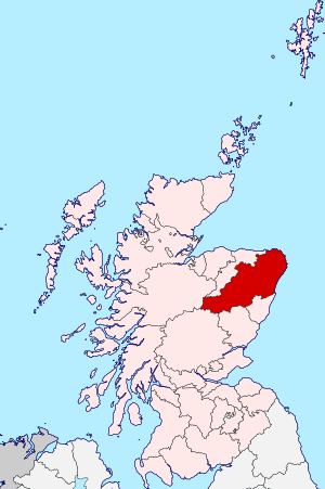
Aberdeenshire or the County of Aberdeen is a historic county in Scotland. It is also a "registration county," which means it's used for things like land records. The area, not including Aberdeen City, is also a special "lieutenancy area."
Aberdeenshire shares borders with Kincardineshire, Angus, and Perthshire to the south. To the west, it borders Inverness-shire and Banffshire. The North Sea is to its north and east, giving it a coastline about 65 miles (105 km) long. The name "Aberdeenshire" is also used for a modern council area, which is a bit larger than the historic county.
The land in Aberdeenshire is generally hilly. The Grampians, a large mountain range, stretch out from the southwest.
Contents
Symbols of Aberdeenshire
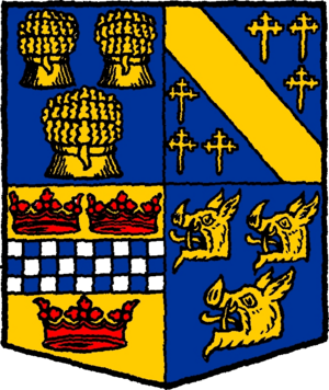
The Aberdeenshire County Council had its own coat of arms, given in 1890. The four parts of the shield showed the different areas: Buchan, Mar, Garioch, and Strathbogie.
In 2023, a contest was held to choose a flag for the county. Local school students designed the winning flag. It was first raised at Castle Fraser on April 22, 2023.
Representing Aberdeenshire in Parliament
For a long time, Aberdeenshire had a special area (called a constituency) that elected a person to represent it in the UK Parliament. This started in 1708. The city of Aberdeen had its own representatives.
Over the years, the boundaries of these areas changed many times. Sometimes Aberdeenshire was split into "East" and "West" parts. Later, it was even combined with parts of Kincardineshire for elections.
These changes happened in 1868, 1885, 1918, 1950, and 1955. Finally, in 1983, new constituencies were created. This was eight years after the old Aberdeenshire county council was officially ended.
Exploring Aberdeenshire's Geography
Historic Aberdeenshire is traditionally divided into five main areas:
- Mar: This area is mostly between the Dee and Don rivers. It covers the southern half of the county and includes Aberdeen. It's very mountainous, especially the Braemar part, which has some of the highest land in the British Isles.
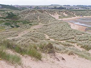
- Formartine: Located between the lower Don and Ythan rivers. It has sandy beaches, then fertile farmland, followed by low hills and moors.
- Buchan: North of the Ythan river, this is the northeast part of the county. The coast is rocky, but inland it's mostly flat and sometimes boggy. The famous Bullers of Buchan, a sea basin, are here. Buchan Ness is the most easterly point in Scotland.
- Garioch: In the middle of the county, this is a fertile valley. It used to be called the "granary of Aberdeen" because of all the grain grown there.
- Strathbogie: This area is south of the Deveron river. It mainly consists of hills, moors, and bogs.
Mountains of Aberdeenshire
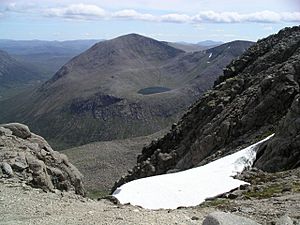
The Cairngorms mountains are a major feature of the county. Some of the tallest mountains include:
- Ben Macdhui: 1,309 m (4,295 ft), the second-highest mountain in the United Kingdom.
- Braeriach: 1,295 m (4,249 ft).
- Cairn Toul: 1,293 m (4,242 ft).
- Beinn a' Bhùird: 1,196 m (3,924 ft).
- Ben Avon: 1,171 m (3,842 ft).
- "Dark" Lochnagar: 1,154 m (3,786 ft).
Further north, you'll find other hills like the Buck of Cabrach, Tap o' Noth, and Bennachie. Bennachie is a well-known landmark because you can see it from many parts of the county.
Rivers and Lochs
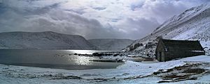
The main rivers are the Dee (90 miles (140 km) long) and the Don (82 miles (132 km) long). Other important rivers include the Ythan and the Ugie. The Deveron river forms part of the border with Banffshire.
In the past, these rivers were full of salmon and trout. Pearls were even found in the Ythan and Don rivers.
Loch Muick is the largest lake in the county. It's about 399 m (1,309 ft) above sea level and is 2+1⁄2 miles (4.0 km) long. A royal hunting lodge, Altnagiuthasach, is near its southwestern end. Loch Strathbeg is another notable lake, very close to the sea.
Understanding the Geology
Most of Aberdeenshire is made of crystalline schists. These are metamorphic rocks, meaning they changed due to heat and pressure.
The rocks show layers that have been folded. This means the same types of rocks appear again and again across the area. There are also many granite rocks, especially in the Cairngorms and near Aberdeen. These granites have been used for building for a long time.
You can also find narrow bands of Old Red Sandstone. These rocks are much younger and sit on top of the older schists.
The area also has many glacial deposits. These are materials left behind by ancient glaciers. For example, red clay deposits show how ice moved across the land.
Economy and Industries
Farming in Aberdeenshire
Aberdeenshire has a fairly mild climate, especially near the coast. This helps with farming. The upper Dee and Don valleys are known for having a dry and refreshing climate in summer.
Farmers here have worked hard to make the soil productive, even though it can be poor. They use modern farming methods. In the past, about two-thirds of the people depended on farming.
Oats used to be the main crop. Today, spring barley is very common. In lowland areas, you'll also find winter wheat, oilseed rape, and potatoes. Carrots are also grown.
Aberdeenshire is famous for raising cattle. Farmers used to fatten many cattle for markets in London. Now, most cattle are continental breeds, and they are usually processed in Scotland. The pig industry is also important, though it has become smaller. While fewer farmers raise horses, many private owners and specialists keep them.
Fishing Industry
Fishing has always been a very important industry in Aberdeenshire, second only to farming. Many coastal villages have fishing communities.
The fishing industry grew a lot with the introduction of steam trawlers. In the past, the annual catch was worth a lot of money, with herring being a big part of it. Fishermen also produced "speldings" (salted haddocks) and "finnans" (smoked haddocks).
The main fishing ports are Peterhead, Fraserburgh, and Aberdeen. The herring season runs from June to September. Salmon fishing is also important on rivers like the Dee, Don, Ythan, and Ugie.
Other Industries
Many factories are located in or near Aberdeen. However, in the countryside, you'll find:
- Milling of grain
- Brick and tile making
- Metalwork (smith-work)
- Brewing and distilling
- Making carts and farm tools
- Cutting and drying peat (for fuel)
- Timber felling (cutting down trees) for things like pit-props and railway sleepers.
Several paper-making factories are on the Don river near Aberdeen.
Aberdeenshire is famous for its strong granite. This stone is quarried in places like Aberdeen, Kemnay, and Peterhead. It's used for building and paving. The county imports coal, timber, and raw materials for its industries. It exports granite, textiles, paper, and farm products like oats and cattle.
More recently, the North Sea oil industry became a huge employer. Many of the facilities for this industry are based in Aberdeen.
Getting Around Aberdeenshire
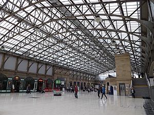
Aberdeen has train connections to the south, like Stonehaven and Dundee. To the north-west, a train line goes to Inverness.
In the past, many smaller train lines connected towns like Ballater, Fraserburgh, and Peterhead. However, most of these lines closed in the 1960s. Now, many of them are used as walking or cycling paths.
By sea, Aberdeenshire has regular boat services to the Orkney Islands and the Shetland Islands.
Roads have also improved a lot over the years. The highest main road crossing the eastern Grampians reaches about 2,200 ft (670 m) above sea level.
Aberdeen Airport is an international airport located at Dyce, near Aberdeen. It's a busy airport, with millions of passengers using it each year.
People and Government
In 1901, Aberdeenshire had a population of over 300,000 people. The main towns included Aberdeen, Fraserburgh, Peterhead, and Huntly.
In the past, the main court for the area was in Aberdeen. The county was also overseen by a "sheriff" and "sheriffs-substitute."
Education has always been important here. Students often went straight from local schools to university.
The people of Aberdeenshire are known for their quick, sharp accent. The local Scots dialect is called the Doric. It's known for its unique sounds and words. While Gaelic was once spoken in Braemar, it was rarely used by the early 20th century.
A Look at Aberdeenshire's History
The area that became Aberdeenshire was once home to the northern Picts, an ancient people of Scotland. The Romans explored here, and traces of their camps have been found. However, there isn't much evidence that the Romans stayed for long.
More often, we find signs of the native people. These include "weems" (underground houses), "crannogs" (lake dwellings), and "duns" (forts on hills). There are also many ancient standing stones and stone circles from the pagan period. Later, Christian carved stones appeared.
Missionaries tried to convert the Picts to Christianity starting in the 5th century. But progress was slow. The Vikings also raided the coast sometimes.
Later, the influence of the Norman Conquest in England reached Aberdeenshire. People from different places, like Anglo-Saxons, Flemings, and Scandinavians, settled here. They brought new skills like farming and sailing.
The town of Aberdeen got its first official charter in 1179. This gave its citizens special trading rights. Around this time, important families like the Earls of Mar and the Leslies became powerful.
During the Scottish Wars of Independence, Aberdeenshire mostly supported Scotland. Robert Bruce even made Aberdeen his headquarters for a while. He defeated his enemies, the Comyns, at Inverurie in 1308.
For a hundred years after Bruce's death, there were many conflicts. The English burned Aberdeen in 1336. Highland chiefs also caused trouble, leading to the Battle of Harlaw in 1411, where the Earl of Mar defeated Donald, Lord of the Isles.
In the 15th century, the Forbes and Gordon families became very powerful. They had many feuds, but the Gordons grew very strong.
Trade with other countries grew, and education improved with the founding of King's College, Aberdeen in 1497. When the Reformation happened, bringing Protestantism to Scotland, it came to Aberdeenshire without too much trouble.
However, Aberdeenshire remained a stronghold for Episcopacy (a form of church government with bishops) for many years, rather than Presbyterianism. This led to more conflicts. In 1638, people were asked to sign the National Covenant, which many in Aberdeenshire did not want to do. This led to the "Trot of Turriff" in 1639, where the first blood of the civil war was shed.
Later, James Graham, 1st Marquess of Montrose fought battles in the area, including at Alford in 1645. After the Restoration of the monarchy in 1660, Episcopacy returned.
After the Glorious Revolution in 1688, Episcopacy lost power again. This led to many people in Aberdeenshire supporting the Jacobite cause, which wanted to restore the Stuart kings. In 1715, the Earl of Mar started a rebellion in Braemar. The "Pretender" (James Francis Edward Stuart) even landed at Peterhead. But the rebellion failed.
Thirty years later, in 1745, another Jacobite rebellion happened. Aberdeenshire was mostly quiet, but the rebels did hold Aberdeen for five months. Prince Charles Edward Stuart (Bonnie Prince Charlie) won a small victory at Inverurie. However, the Duke of Cumberland soon arrived, and the rebellion ended.
After these conflicts, the people of Aberdeenshire focused on farming, industry, and trade. These areas grew quickly, along with education. This made Aberdeenshire one of the most successful parts of Scotland.
From 1890 to 1975, Aberdeenshire was an official "administrative county" with its own council. In 1975, Scotland's local government changed. Aberdeenshire was merged with other areas to form the Grampian Region.
In 1996, local government changed again. The name "Aberdeenshire" was used for a new "council area," which has different boundaries from the historic county.
Towns and Villages in Aberdeenshire
- Aberdeen
- Aboyne
- Alford
- Auchnagatt
- Ballater
- Balmedie
- Barthol Chapel
- Belhelvie
- Bieldside
- Blackburn
- Boddam
- Boyndie
- Braegarie
- Braemar
- Braeside
- Bridge of Alford
- Bridge of Don
- Broomhill
- Buchanhaven
- Cabrach
- Cairnbulg
- Clatt
- Collieston
- Cornhill
- Craigiebuckler
- Crimond
- Cruden Bay
- Crudie
- Cults
- Cuminestown
- Cummings Park
- Danestone
- Daviot
- Dinnet
- Dunecht
- Dyce
- Echt
- Ellon
- Ferrydee
- Fetterangus
- Finzean
- Footdee
- Foresterhill
- Fraserburgh
- Fyvie
- Garthdee
- Gartly
- Hatton
- Hatton of Fintray
- Hazlehead
- Heugh Head
- Hilton
- Huntly
- Insch
- Inverallochy
- Inverugie
- Kaimhill
- Keig
- Kemnay
- Kennethmont
- Kincardine O'Neil
- Kingseat
- Kingswells
- Kintore
- Kirkton of Bourtie
- Kirkton of Skene
- Little Lynturk
- Logie Coldstone
- Longhaven
- Longside
- Lonmay
- Lumphanan
- Lumsden
- Lyne of Skene
- Mannofield
- Mastrick
- Maud
- Memsie
- Methlick
- Midstocket
- Milltimber
- Mintlaw
- Monymusk
- Muir of Fowlis
- New Byth
- Newburgh
- New Deer
- New Leeds
- New Pitsligo
- Newmachar
- Northfield
- Old Deer
- Oldmeldrum
- Old Rayne
- Peterculter
- Peterhead
- Pitmedden
- Pittulie
- Port Elphinstone
- Potterton
- Rhynie
- Rosehearty
- Rosemount
- Rothienorman
- Rubislaw
- Ruthven
- St. Comb's
- St Fergus
- Stoneywood
- Strathdon
- Strichen
- Stuartfield
- Tarland
- Tarves
- Tillydrone
- Torphins
- Turriff
- Tyrie
- Udny Green
- West End
- Westhill
- Whiteford
- Woodside
Places to Visit
|
|
|
See Also
 | James Van Der Zee |
 | Alma Thomas |
 | Ellis Wilson |
 | Margaret Taylor-Burroughs |


