Tap o' Noth facts for kids
Quick facts for kids Tap o' Noth |
|
|---|---|
| Highest point | |
| Elevation | 563 m (1,847 ft) |
| Prominence | 247 m (810 ft) |
| Listing | Marilyn |
| Geography | |
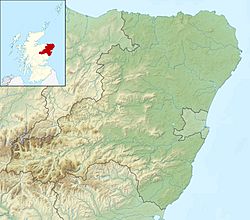
| Location | Aberdeenshire, Scotland |
| Parent range | Grampian Mountains |
| OS grid | NJ48408293 |
| Topo map | OS Landranger 37 |

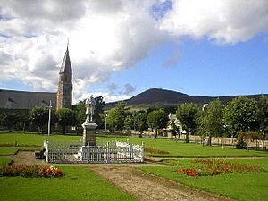
Tap o' Noth seen from Rhynie
|
|
| Coordinates | 57°21′05″N 2°51′31″W / 57.3514°N 2.8586°W |
|---|---|
| Type | Hill fort |
The Tap o' Noth is a famous hill and an ancient fort in Aberdeenshire, Scotland. It is located about 8 miles south of the town of Huntly. This amazing place is known for being the second highest fort in Scotland. It also has a very special and well-preserved wall.
Contents
Discovering Tap o' Noth
Tap o' Noth stands tall at 563 meters (about 1,847 feet) above sea level. It is a significant historical site. The fort itself is a scheduled ancient monument. This means it is a nationally important site protected by law.
The Amazing Vitrified Wall
The main feature of Tap o' Noth is its unique and well-preserved vitrified wall. A vitrified wall is made of stones that have been heated so intensely that they melted and fused together. This creates a very strong, glass-like barrier. The wall at Tap o' Noth encloses an area of about 100 meters by 30 meters. This is roughly the size of a football field.
Life at the Fort: Ancient Discoveries
Archaeologists have found many interesting things at Tap o' Noth. They discovered a stone axe head that is very old, dating back to between 2000 BC and 800 BC. They also found a decorated bronze rein-ring from the 1st to 3rd century AD. These finds tell us that people lived and worked here a very long time ago.
A Large Ancient Settlement
The vitrified fort is actually the center of a much larger settlement. This bigger area is surrounded by another rampart, which is a defensive wall or bank. This outer rampart covers about 7 hectares, which is like 17 football fields. This larger settlement was built around the 5th or 6th century AD. However, people might have lived here even earlier, around the 3rd century AD, during the time of the Picts. The Picts were an ancient group of people who lived in eastern and northern Scotland.
Huts and Homes
New technologies like drones and lidar (a way to map surfaces using light) have helped scientists learn more. They suggest there might have been as many as 800 huts at Tap o' Noth. Many of these huts were grouped together, often with a larger hut in the middle. This suggests a very organized community. It has been called the largest known settlement in early-Medieval (post-Roman) Britain. This means it was a huge and important place after the Roman Empire left Britain.
The Rhynie Man and Valley Discoveries
Close to Tap o' Noth, in the nearby valley, another important discovery was made. This is the Rhynie Man, a famous Pictish image carved on a standing stone. It was found on Barflat farm.
Signs of High Status
Archaeologists also found a post-Roman settlement in the valley. Evidence shows that people there drank wine from the Mediterranean region. They also used glass vessels from western France. There was also a lot of metalwork being done. These findings suggest that the people living there had a high social status. They might even have had connections to royalty.
See also
 In Spanish: Tap O' Noth para niños
 | Audre Lorde |
 | John Berry Meachum |
 | Ferdinand Lee Barnett |


