
Beinn a' Bhùird facts for kids
Quick facts for kids Beinn a' Bhùird |
|
|---|---|
 |
|
| Highest point | |
| Elevation | 1,197 m (3,927 ft) |
| Prominence | c. 456 m |
| Parent peak | Cairn Gorm |
| Listing | Munro, Marilyn |
| Naming | |
| English translation | Mountain of the table |
| Language of name | Gaelic |
| Geography | |
| Location | Moray / Aberdeenshire |
| Parent range | Cairngorms |
| OS grid | NJ092006 |
| Topo map | OS Landranger 36 |
Beinn a' Bhùird is a tall mountain in the Cairngorms in Scotland. It's known as a Munro, which is a Scottish mountain over 3,000 feet (914.4 meters) high. Its name comes from Gaelic and means "Mountain of the table." This is because its top is quite flat, like a table!
Some people used to call it "Beinn Bòrd," which also means "table hill." Older local people even had slightly different ways of saying its name.
The nearest village to Beinn a' Bhùird is Braemar in Aberdeenshire. Most visitors travel through this village to reach the mountain. You can drive along the Linn of Dee road. This road goes along the River Dee to a place called Linn of Dee. Then it loops back to the car park at Allanaquoich. You can even camp there! The drive from Braemar to Allanaquoich is about 10 miles.
In 2006, something exciting happened on the mountain. A pilot flying a glider crashed on the hillside. He was stuck in his plane for a whole day! Luckily, the RAF found him and rescued him.
Contents
Climbing Beinn a' Bhùird
Most people who climb Beinn a' Bhùird start from the car park at Allanaquoich. From there, they walk up a valley called Glen Quoich. There's a new path that follows an old road. This path goes up a section called An Diollaid.
Other Ways to Climb
Another way to climb the mountain is to follow the Quoich Water. This route goes through an area called Am Beitheachan. It leads to a mountain pass known as The Sneck. This pass is located between Beinn a' Bhùird and another mountain called Ben Avon.
Skiing on Beinn a' Bhùird
Did you know there was once a plan for a big ski resort on Beinn a' Bhùird? This happened in the early 1960s. Two brothers from Switzerland, Gerald and Jhon Panchaud, bought the land. They wanted to build a ski area because skiing was very popular in Scotland at the time.
The Mar Lodge Ski Area
The new ski area was going to be called Mar Lodge. It opened in 1963 after a lot of snow fell. There were two special ski lifts called T-bars. One was 620 feet long, and the other was 2050 feet long. Together, they could carry 1,400 people up the mountain every hour!
Why the Ski Resort Closed
Sadly, the next two winters (1963-64 and 1964-65) didn't have much snow. This meant the ski lifts were hardly ever used. Because of this, the ski resort had to close in 1965. When it closed, both T-bars were moved to another ski center called Glenshee. They were used there for many years.
Images for kids
-
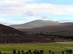
Beinn a' Bhùird from Linn of Dee road
-
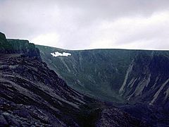
Garbh Choire on Beinn a' Bhùird
-
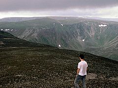
Beinn a' Bhùird from Ben Avon
-
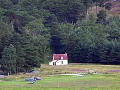
Parking at Allanaquoich


