
Little Belt Mountains facts for kids
Quick facts for kids Little Belt Mountains |
|
|---|---|
 |
|
| Highest point | |
| Peak | Big Baldy Mountain |
| Elevation | 9,175 ft (2,797 m) |
| Geography | |
| Country | United States |
| State/Province | Montana |
| Range coordinates | 46°45′N 110°24′W / 46.750°N 110.400°W |
| Parent range | Rocky Mountains |
The Little Belt Mountains are a beautiful part of the Rocky Mountains in Montana, U.S.. Most of these mountains are found within the Lewis and Clark National Forest. People visit them for fun outdoor activities like skiing and enjoying nature.
The Showdown is a popular place to ski here. It's located right off US Highway 89, which cuts through the mountains. This highway connects the towns of White Sulphur Springs and Belt. The tallest point in the Little Belt Mountains is Big Baldy Mountain, which stands at about 2,797 meters (9,175 feet) high.
Contents
What's in a Name?
The Little Belt Mountains got their name from a special hill called Belt Butte. This butte has a unique band of white rock that goes all the way around it, like a belt!
Mining for Treasures
People have been mining in the Little Belt Mountains for a long time. They started looking for silver way back in the 1880s. Later, in 1896, they began mining for beautiful sapphire gemstones.
Yogo Sapphires
The sapphires found here are very special. They are called Yogo sapphires because they are mined near a place called Yogo Creek. These precious stones are found in a long, narrow rock formation. It stretches for about 5 kilometers (3 miles) and is about 2.4 meters (8 feet) wide.
Skiing Fun
The Showdown Ski Area is famous for its snow! It holds the record for the most snowfall in Montana during one winter. Imagine, they once had about 10 meters (33 feet) of snow in a single season! That's a lot of snow for skiing and snowboarding.
Exploring the Wild Areas
Even though the Little Belt Mountains have gentle, rolling peaks and many conifer trees, they also have large areas where there are no roads. These are wild places where nature thrives.
Middle Fork-Judith Wilderness
One of these wild places is called the Middle Fork-Judith Wilderness Study Area. It's about 372 square kilometers (92,000 acres) in size. This area protects the Middle and Lost Forks of the Judith River. These rivers have carved deep canyons through colorful limestone cliffs.
The Middle Fork-Judith area has over 47 kilometers (29 miles) of streams. These streams are home to different kinds of fish, including Yellowstone cutthroat and rainbow trout. Higher up in the mountains, you'll find lodgepole pine and whitebark pine trees. Lower down, there are ponderosa pine and Douglas fir trees mixed with open grassy areas.
Tenderfoot Creek Area
Another large wild area is found in the western part of the mountains. It's called the Tenderfoot Creek drainage. This area is about 437 square kilometers (108,000 acres) in size. Most of it, about 397 square kilometers (98,000 acres), is part of the Lewis and Clark National Forest. The Smith River Canyon, a popular spot for floating down the river, is right next to this area.
Plants and Animals
The main trees you'll see in the Little Belts are ponderosa pine and Douglas fir. These mountains are also home to many different animals. You might spot black bears, elk, and both white-tailed and mule deer roaming through the forests.
Images for kids
-
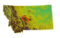
A map showing the location of the Little Belt Mountains in Montana.
