Little Etobicoke Creek facts for kids
Quick facts for kids Little Etobicoke Creek |
|
|---|---|

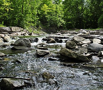
Little Etobicoke Creek north of The Queensway in Mississauga
|
|
|
Location of the mouth of Little Etobicoke Creek in southern Ontario
|
|
| Country | Canada |
| Province | Ontario |
| Region | Greater Toronto Area |
| Regional Municipality | Peel |
| Municipality | Mississauga |
| Physical characteristics | |
| Main source | 169 m (554 ft) 43°38′50″N 79°39′23″W / 43.64722°N 79.65639°W |
| River mouth | Etobicoke Creek 106 m (348 ft) 43°36′37″N 79°34′02″W / 43.61028°N 79.56722°W |
| Length | 10 km (6.2 mi) |
| Basin features | |
| River system | Great Lakes Basin |
Little Etobicoke Creek is a small river located in Mississauga, Ontario, Canada. It is part of the larger Great Lakes Basin, which means its waters eventually flow into the Great Lakes. This creek is a branch of Etobicoke Creek, and its journey ends when it joins the bigger creek before both flow into Lake Ontario.
The Creek's Journey
Little Etobicoke Creek starts its journey from a culvert (a tunnel that carries water under a road or railway) on the south side of Britannia Road East. This is just east of Tomken Road.
Flowing South and East
From its start, the creek flows mostly towards the southeast. Along its path, it passes underneath several busy roads and highways. These include Highway 401, Eglinton Avenue, Eastgate Parkway, Burnhamthorpe Road, and Bloor Street.
For a short distance, the creek turns northeast, going under Dixie Road. But it quickly returns to its southeast direction. It then flows under Dundas Street and the GO Transit Milton line, which is a train route.
Meeting Etobicoke Creek
Finally, Little Etobicoke Creek turns east. It reaches its end point, called its "mouth," where it joins Etobicoke Creek. This meeting point is just north of the Queensway (Peel Regional Road 20).


