Little Nerang Dam facts for kids
Quick facts for kids Little Nerang Dam |
|
|---|---|

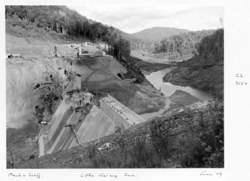
Little Nerang dam site, June 1959
|
|
|
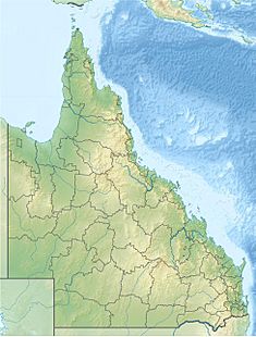
Location of the Little Nerang Dam
in Queensland |
|
| Country | Australia |
| Location | South East Queensland |
| Coordinates | 28°8′37″S 153°17′6″E / 28.14361°S 153.28500°E |
| Purpose | Potable water supply |
| Status | Operational |
| Opening date | 1962 |
| Operator(s) | SEQ Water |
| Dam and spillways | |
| Type of dam | Gravity dam |
| Impounds | Little Nerang Creek |
| Height | 44 m (144 ft) |
| Length | 201 m (659 ft) |
| Dam volume | 68×103 m3 (2.4×10⁶ cu ft) |
| Spillway type | Uncontrolled |
| Spillway capacity | 570 m3/s (20,000 cu ft/s) |
| Reservoir | |
| Creates | Lake Macdonald |
| Total capacity | 8,390 ML (1.85×10⁹ imp gal; 2.22×10⁹ US gal) |
| Catchment area | 35 km2 (14 sq mi) |
| Surface area | 50 ha (120 acres) |
The Little Nerang Dam is a special wall built across the Little Nerang Creek. It is located in the South East region of Queensland, Australia. This dam is a type called a concrete gravity dam. This means its own weight helps it hold back the water.
Its main job is to provide clean drinking water for the Gold Coast area. The big lake behind the dam is also called Little Nerang Dam. The dam was closed to visitors in 2013 because of safety reasons.
Where is the Dam Located?
The Little Nerang Dam is about 9 kilometres (5.6 mi) west of Tugun. It is also about 25 kilometres (16 mi) by car from Mudgeeraba. The dam is located just upstream from another dam called the Hinze Dam.
Before the Hinze Dam was built, the Little Nerang Dam was the main source of water for the Gold Coast. Water from the dam flows through pipes using gravity to the Mudgeeraba Water Treatment Plant. This plant cleans the water.
How the Dam Works
The Mudgeeraba Water Treatment Plant was finished in 1969. It can clean up to 110 megalitres (24,000,000 imp gal; 29,000,000 US gal) of water every day. After the water is cleaned, it flows by gravity to the city's storage tanks.
The dam itself was completed in 1962. It is 44 metres (144 ft) high and 201 metres (659 ft) long. The dam wall holds back a large amount of water, about 8,390 megalitres (1.85×10⁹ imp gal; 2.22×10⁹ US gal) when it's full.
The dam collects water from a catchment area of 35 square kilometres (14 sq mi). This area includes parts of the Springbrook Plateau. The dam creates a lake with a surface area of 50 hectares (120 acres).
The dam has an un-gated spillway. This is like a natural overflow area. When the dam gets too full, extra water flows over this spillway. It can release up to 570 cubic metres per second (20,000 cu ft/s) of water.
Who Manages the Dam?
The Little Nerang Dam was first managed by Gold Coast Water. In July 2008, the management of the dam was moved to Seqwater. Seqwater is a company that manages water supply in South East Queensland.
Can You Visit the Dam?
No, you cannot visit the Little Nerang Dam for recreation. Since 2019, access to the dam and Little Nerang Dam Road has been restricted. Only Seqwater employees and people who live on the road can enter. A large security gate blocks public access.
 | Delilah Pierce |
 | Gordon Parks |
 | Augusta Savage |
 | Charles Ethan Porter |


