Little Rock River facts for kids
Quick facts for kids Little Rock River |
|
|---|---|
|
Mouth of the Little Rock River
|
|
| Country | US |
| State | Iowa, Minnesota |
| District | Lyon County, Iowa, Osceola County, Iowa, Nobles County, Minnesota |
| Physical characteristics | |
| Main source | 43°36′55″N 95°41′24″W / 43.61528°N 95.69000°W |
| River mouth | Rock River Doon, Iowa, US 1,250 ft (380 m) 43°15′51″N 96°14′48″W / 43.26417°N 96.24667°W |
The Little Rock River is a river that flows for about 74.5 miles (120 km). It is a tributary of the Rock River. This means it's a smaller river that flows into a larger one.
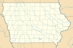
The Little Rock River is located in the southwestern part of Minnesota and the northwestern part of Iowa in the United States. It is part of a huge watershed that eventually leads to the Mississippi River. This river has also been called "Little Rock Creek" in the past.
Where Does the Little Rock River Flow?
The Little Rock River begins in Nobles County, Minnesota. Its starting point is about 3 miles (4.8 km) west of the town of Worthington.
Journey Through Iowa
From Minnesota, the river generally flows towards the southwest. It travels through two counties in Iowa: Osceola County and Lyon County. Along its path, it passes by the towns of Little Rock and George.
Joining the Rock River
Finally, the Little Rock River flows into the Rock River. This meeting point is about 1.5 miles (2.4 km) southwest of the town of Doon. This connection makes it part of the larger Mississippi River system.
 | George Robert Carruthers |
 | Patricia Bath |
 | Jan Ernst Matzeliger |
 | Alexander Miles |


