
Livingstone, Zambia facts for kids
Quick facts for kids
Livingstone
|
||
|---|---|---|
|
City
|
||
 |
||
|
||

Livingstone, Zambia
Location in Zambia

Livingstone, Zambia
Location in Africa
|
||
| Country | ||
| Province | Southern Province | |
| District | Livingstone District | |
| Area | ||
| • | 695 km2 (268 sq mi) | |
| Elevation | 986 m (3,235 ft) | |
| Population
(2010 census)
|
||
| • Total | 134,349 | |
| • Ethnicities | Tonga Baleya (Leya people) Toka people and Lunda people | |
| • Languages | English (official language) Tonga language and Lozi language | |
| Time zone | UTC+2 (CAT) | |
| Climate | BSh | |

Livingstone is a city in Zambia, a country in southern Africa. It's located about 10 kilometers (6 miles) north of the Zambezi River. The city is a major tourist spot because it's very close to the amazing Victoria Falls. It also serves as a border town, connecting Zambia to Zimbabwe with roads and railways.
Livingstone was once a very important British colonial city. It is named after David Livingstone, a Scottish explorer and missionary. He was the first European to explore this area. The city's population was around 177,393 people in 2022. Until 2011, Livingstone was the capital of Zambia's Southern Province.
Contents
History of Livingstone
Early History of the Area
Before Livingstone was built, the biggest village nearby was Mukuni. It was about 9.6 kilometers (6 miles) southeast of where the city is now. The people living there were called the Baleya. They were conquered by Chief Mukuni in the 16th century. Another group, the Batoka, lived north of the area. They are similar to the Baleya people.
In 1855, the Scottish explorer David Livingstone became the first European to see the Victoria Falls. Local chiefs showed him the incredible waterfall.
Livingstone as a Colonial City
In the 1890s, the British South Africa Company started to rule the land north of the Zambezi River. They were looking for minerals and other natural resources. The main way to cross the Zambezi River was at a place called the Old Drift. People used canoes and then a larger boat to cross.
A British settlement grew at the Old Drift around 1897. But many people got sick from malaria because of mosquitoes. So, after 1900, the Europeans moved to higher ground. This new area grew into the town we know today, named Livingstone to honor the explorer.

In 1904, a railway line reached the Victoria Falls from the south. Construction of the Victoria Falls Bridge began. This bridge was important for connecting different parts of the British Empire. The railway helped Livingstone grow as a trading center.
.jpg)
The city was officially founded in 1905. In 1907, the British South Africa Company made Livingstone the capital of the territory. This territory later became Northern Rhodesia. Livingstone became wealthy from trade and farming. Many old colonial buildings from this time are still standing.
In 1935, the capital was moved to Lusaka. This was done to be closer to the mining areas. However, industries like timber, leather, and cotton continued to grow in Livingstone. A power plant was also built using water from the Victoria Falls.
During this time, Livingstone had different areas for different groups of people. This was a common practice in many colonial cities.
Livingstone After Independence
During World War II, many Polish refugees came to Livingstone in 1941. They were escaping from German and Soviet-occupied Poland.
When Zambia gained independence from British rule in 1964, many people who had moved from Europe left the country. After independence, the government made changes to how businesses were owned. This also caused some people to leave.
In the 1970s, Livingstone faced some economic challenges. This was partly because of changes in industries and partly because the border with Rhodesia (now Zimbabwe) was closed for a while.
Since the early 2000s, Livingstone has seen a big increase in tourism. Many new hotels and restaurants have opened. It has become the top place for people visiting Victoria Falls. The city also benefits from new roads and bridges that help with trade.
Climate in Livingstone
Livingstone has a hot, semi-arid climate. This means it has hot, rainy seasons and very hot periods before the rains. The dry seasons are mild, but there can be big differences between day and night temperatures.
| Climate data for Livingstone (1991–2020, extremes 1918–present) | |||||||||||||
|---|---|---|---|---|---|---|---|---|---|---|---|---|---|
| Month | Jan | Feb | Mar | Apr | May | Jun | Jul | Aug | Sep | Oct | Nov | Dec | Year |
| Record high °C (°F) | 39.9 (103.8) |
38.4 (101.1) |
43.6 (110.5) |
37.0 (98.6) |
36.0 (96.8) |
35.0 (95.0) |
32.6 (90.7) |
37.5 (99.5) |
40.1 (104.2) |
41.3 (106.3) |
41.1 (106.0) |
39.5 (103.1) |
43.6 (110.5) |
| Mean daily maximum °C (°F) | 30.9 (87.6) |
30.7 (87.3) |
31.1 (88.0) |
30.6 (87.1) |
29.0 (84.2) |
26.5 (79.7) |
26.1 (79.0) |
29.8 (85.6) |
33.6 (92.5) |
35.6 (96.1) |
33.9 (93.0) |
31.5 (88.7) |
30.8 (87.4) |
| Daily mean °C (°F) | 25.2 (77.4) |
24.9 (76.8) |
24.6 (76.3) |
22.9 (73.2) |
20.1 (68.2) |
17.4 (63.3) |
16.9 (62.4) |
20.4 (68.7) |
24.5 (76.1) |
27.4 (81.3) |
27.0 (80.6) |
25.6 (78.1) |
23.0 (73.4) |
| Mean daily minimum °C (°F) | 19.4 (66.9) |
19.0 (66.2) |
18.0 (64.4) |
15.1 (59.2) |
11.1 (52.0) |
8.2 (46.8) |
7.6 (45.7) |
10.9 (51.6) |
15.4 (59.7) |
19.2 (66.6) |
20.0 (68.0) |
19.6 (67.3) |
15.3 (59.5) |
| Record low °C (°F) | 9.8 (49.6) |
8.0 (46.4) |
7.0 (44.6) |
4.3 (39.7) |
0.5 (32.9) |
−5.9 (21.4) |
−3.0 (26.6) |
−1.7 (28.9) |
1.0 (33.8) |
8.1 (46.6) |
11.0 (51.8) |
10.8 (51.4) |
−5.9 (21.4) |
| Average precipitation mm (inches) | 175.2 (6.90) |
133.2 (5.24) |
83.3 (3.28) |
19.5 (0.77) |
2.4 (0.09) |
0.2 (0.01) |
0.1 (0.00) |
0.3 (0.01) |
1.4 (0.06) |
11.1 (0.44) |
77.7 (3.06) |
141.9 (5.59) |
646.3 (25.44) |
| Average relative humidity (%) | 74.8 | 77.3 | 72.2 | 65.1 | 57.7 | 55.0 | 51.8 | 43.3 | 35.1 | 41.7 | 55.2 | 71.0 | 58.4 |
| Mean monthly sunshine hours | 213.9 | 196.0 | 251.1 | 273.0 | 303.8 | 288.0 | 310.0 | 319.3 | 297.0 | 279.0 | 228.0 | 207.7 | 3,166.8 |
| Source 1: NOAA (humidity and sun 1961–1990) | |||||||||||||
| Source 2: Meteo Climat (record highs and lows) | |||||||||||||
Getting Around Livingstone
Livingstone is a hub for travel and trade. It has an airport, railway lines, and major roads.
Air Travel

The city has its own airport, Harry Mwanga Nkumbula International Airport. You can fly here from Lusaka (Zambia's capital) and from other countries like South Africa and Kenya.
Train Connections
Livingstone is part of the Cape to Cairo Railway network. This railway connects it to Lusaka in the northeast and Bulawayo in Zimbabwe to the southeast. There's also the Mulobezi Railway, which helps transport timber from the west.
Road Network
The main road, the Lusaka-Livingstone road (T1), links Livingstone to Lusaka and other towns in Zambia. This road also crosses into Zimbabwe over the Victoria Falls Bridge. Another important road, the M10, goes west to Kazungula. Here, the Kazungula Bridge connects Zambia to Botswana. This road is part of a larger route that helps trade across southern Africa.
Places of Worship
Livingstone has many different places of worship. Most are Christian churches, like the Roman Catholic Diocese of Livingstone and the United Church in Zambia. There are also Muslim mosques and Hindu temples. This shows the diverse community living in the city.
Culture and Museums
_Krzysztof_B%C5%82a%C5%BCyca_2011.jpg)
Livingstone is home to several interesting museums.
- The Livingstone Museum teaches you about the area's history, culture, and archaeology. It also has items related to David Livingstone.
- The Maramba Cultural Museum showcases traditional dancing, singing, and costumes.
- The Railway Museum tells the story of the Mulobezi Railway.
- The Victoria Falls Field Museum focuses on the geology and archaeology around the Victoria Falls.
Education
For students in Livingstone, there are secondary schools like Hillcrest Technical Secondary School and Linda Secondary School.
Sister Cities
Livingstone has special connections with other cities around the world, called "sister cities." This helps promote cultural exchange and friendship.
Images for kids
-
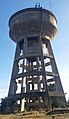
Livingstone Water Tank
-
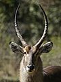
Ellipsen Waterbuck at Mosi-oa-Tunya National Park, Livingstone, Zambia.
.jpg)
.jpg)
See also
 In Spanish: Livingstone (Zambia) para niños
