
Lorimor, Iowa facts for kids
Quick facts for kids
Lorimor, Iowa
|
|
|---|---|

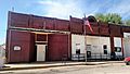
City Hall
|
|
| Motto(s):
Where The Mississippi and Missouri Divide
|
|

Location of Lorimor, Iowa
|
|
| Country | |
| State | |
| County | Union |
| Area | |
| • Total | 0.43 sq mi (1.12 km2) |
| • Land | 0.43 sq mi (1.12 km2) |
| • Water | 0.00 sq mi (0.00 km2) |
| Elevation | 1,234 ft (376 m) |
| Population
(2020)
|
|
| • Total | 386 |
| • Density | 895.59/sq mi (345.44/km2) |
| Time zone | UTC-6 (Central (CST)) |
| • Summer (DST) | UTC-5 (CDT) |
| ZIP code |
50149
|
| Area code(s) | 641 |
| FIPS code | 19-46515 |
| GNIS feature ID | 2395765 |
| Website | https://www.lorimor.org/ |
Lorimor is a small city located in Union County, Iowa, in the United States. In 2020, about 386 people lived there.
Contents
A Look Back in Time: Lorimor's History
Lorimor was started by a person named J.S. Lorimor. He helped the town grow a lot. He gave land to the railroads. In return, the railroads put a water stop in the town. This helped the town become busy. Mr. Lorimor also had a large farm. He grew bluegrass seed on about 2,000 acres (8.1 km²). Because of the railroads and his farm, the town did very well in its early years.
Where is Lorimor? Geography Facts
Lorimor is located in the state of Iowa. The United States Census Bureau says the city covers a total area of about 0.43 square miles (1.12 square kilometers). All of this area is land, with no water.
Who Lives in Lorimor? Population Details
| Historical populations | ||
|---|---|---|
| Year | Pop. | ±% |
| 1900 | 587 | — |
| 1910 | 645 | +9.9% |
| 1920 | 678 | +5.1% |
| 1930 | 577 | −14.9% |
| 1940 | 614 | +6.4% |
| 1950 | 505 | −17.8% |
| 1960 | 460 | −8.9% |
| 1970 | 346 | −24.8% |
| 1980 | 405 | +17.1% |
| 1990 | 377 | −6.9% |
| 2000 | 427 | +13.3% |
| 2010 | 360 | −15.7% |
| 2020 | 386 | +7.2% |
| Source: and Iowa Data Center Source: |
||
2020 Census: A Closer Look
In 2020, the census counted 386 people living in Lorimor. There were 158 households and 97 families. This means there were about 895 people per square mile (345 per km²). There were also 193 housing units in the city.
Most of the people living in Lorimor were White (95.9%). A small number were Black or African American (0.5%), Native American (0.5%), or Asian (0.5%). About 2.6% of people were from two or more races. About 2.3% of the population was Hispanic or Latino.
About 34.8% of households had children under 18 living with them. About 43.0% were married couples. Some households had a female householder without a spouse (24.1%). Others had a male householder without a spouse (21.5%).
The average age in Lorimor was 35.3 years old. About 31.6% of residents were under 20. About 14.5% were 65 years old or older. The city had slightly more males (52.3%) than females (47.7%).
2010 Census: What Changed?
In 2010, the census showed 360 people lived in Lorimor. There were 160 households and 104 families. The population density was about 947 people per square mile (366 per km²). There were 211 housing units.
Most residents were White (98.1%). A small number were African American (0.3%), Native American (0.8%), or from two or more races (0.8%). About 0.8% of the population was Hispanic or Latino.
About 28.8% of households had children under 18. About 43.8% were married couples. The average household had 2.25 people. The average family had 2.72 people.
The average age in 2010 was 42.2 years. About 22.5% of residents were under 18. About 16.4% were 65 or older. In 2010, 45.8% of the city was male and 54.2% was female.
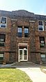
Lorimor in Pictures
-
Lorimor Post Office
-
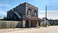
Historic structure in Downtown Lorimor
-
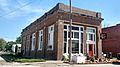
Historic structure in Downtown Lorimor
-
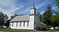
Baptist Church
-
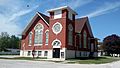
Methodist Church
-
Lorimor School


See also
 In Spanish: Lorimor (Iowa) para niños
