Lost Hills, California facts for kids
Quick facts for kids
Lost Hills
|
|
|---|---|

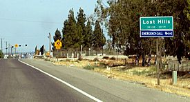
Lost Hills's town sign at its western border, seen from SR 46
|
|

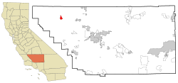
Location in Kern County and the state of California
|
|
| Country | United States |
| State | California |
| County | Kern |
| Area | |
| • Total | 5.564 sq mi (14.409 km2) |
| • Land | 5.552 sq mi (14.379 km2) |
| • Water | 0.012 sq mi (0.031 km2) 0.21% |
| Elevation | 305 ft (93 m) |
| Population
(2010)
|
|
| • Total | 2,412 |
| • Density | 433.50/sq mi (167.40/km2) |
| Time zone | UTC-8 (PST) |
| • Summer (DST) | UTC-7 (PDT) |
| ZIP code |
93249
|
| Area code(s) | 661 |
| FIPS code | 06-44280 |
| GNIS feature ID | 1660956 |
Lost Hills is a small community in Kern County, California, United States. It used to be called "Lost Hill." This town is about 42 miles (68 km) west-northwest of Bakersfield. It sits at an elevation of 305 feet (93 m) above sea level. In 2010, about 2,412 people lived here. This was more than the 1,938 people counted in 2000.
A rest stop is located about one-mile (1.6 km) from Lost Hills. It is right by Interstate 5. This stop has restaurants, gas stations, and motels for travelers.
Contents
Lost Hills Location and Features
Lost Hills is found at 35°36′59″N 119°41′39″W / 35.61639°N 119.69417°W. It is on the east side of the California Aqueduct. This aqueduct is a large canal that carries water across California. Interstate 5, a major highway, is close to Lost Hills. The town is also where State Route 46 meets Lost Hills Road.
Lost Hills Oil Field
West and northwest of the town is the huge Lost Hills Oil Field. This oil field is one of the largest in California. It stretches for about ten miles (16 km) along the low Lost Hills mountain range. The town itself was named after this mountain range.
Land and Water Area
The United States Census Bureau says that Lost Hills covers about 5.6 square miles (15 km2) of land. Most of this area is land, with only a very small part (0.21%) being water.
Local Climate
Lost Hills has a semi-arid climate. This means it is usually dry with not much rain. On climate maps, this type of weather is shown as "BSk."
Lost Hills History
The first post office in Lost Hills opened in 1911. It closed for a short time in 1912 but reopened in 1913. It had moved from another place called Cuttens. In 1937, the post office moved again. For a while, it was just a small room inside a local cafe and bar. Later, it became a small building that looked like a mobile home.
In the early 2000s, a company called Paramount Farms built new homes and a park in Lost Hills. This helped the community grow.
Lost Hills Population Facts
In 2010, the population of Lost Hills was 2,412 people. Most of the people living in Lost Hills were from other races (92.5%). About 97.6% of the people were of Hispanic or Latino background.
There were 448 households in Lost Hills. A household is a group of people living together in one home. Many households (78.8%) had children under 18 living with them. The average household had about 5.38 people.
Age Groups in Lost Hills
The population of Lost Hills is quite young.
- About 40.2% of the people were under 18 years old.
- Around 14.8% were between 18 and 24 years old.
- About 30.3% were between 25 and 44 years old.
- Only a small number of people (2.5%) were 65 years or older.
The average age in Lost Hills was 22.6 years.
Housing in Lost Hills
There were 469 housing units in Lost Hills. A housing unit is a house, apartment, or other place where people live. About 39.7% of these homes were owned by the people living in them. The other 60.3% were rented.
See also
 In Spanish: Lost Hills para niños
 | Aaron Henry |
 | T. R. M. Howard |
 | Jesse Jackson |


