Lost River Peak facts for kids
Quick facts for kids Lost River Peak |
|
|---|---|
| Highest point | |
| Elevation | 12,078 ft (3,681 m) |
| Prominence | 678 ft (207 m) |
| Parent peak | Mount Breitenbach |
| Geography | |
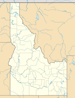
| Location | Custer County, Idaho, U.S. |
| Parent range | Lost River Range |
| Topo map | USGS Leatherman Peak |
| Climbing | |
| Easiest route | Scrambling, class 3 |
Lost River Peak, also known as Lost River Mountain, is a very tall mountain located in the state of Idaho, USA. It stands at about 12,078 feet (or 3,681 meters) above sea level. This makes it the sixth-highest peak in Idaho and the fifth-highest mountain in its own mountain range, called the Lost River Range.
Where is Lost River Peak Located?
This impressive mountain is found in Custer County, Idaho. It's part of the huge Salmon-Challis National Forest. Imagine a vast area of trees and wilderness – that's where Lost River Peak stands tall! It's also quite close to another big mountain, Mount Breitenbach, which is about 1.8 miles (or 2.9 kilometers) to its southeast.
How Tall is Lost River Peak?
Lost River Peak reaches an amazing height of 12,078 feet (3,681 meters). To give you an idea, that's taller than many famous skyscrapers! Its height makes it one of the most important peaks in the Lost River Range.
How Can You Climb Lost River Peak?
The easiest way to reach the top of Lost River Peak is by a method called scrambling. Scrambling is like a mix between hiking and rock climbing. It means you'll need to use both your hands and feet to get up the mountain, but you usually don't need special climbing ropes or gear. It's a challenging adventure for experienced hikers!
 | Madam C. J. Walker |
 | Janet Emerson Bashen |
 | Annie Turnbo Malone |
 | Maggie L. Walker |


