Lougheed, Alberta facts for kids
Quick facts for kids
Lougheed
|
|
|---|---|
|
Village
|
|
| Village of Lougheed | |
 |
|
| Country | Canada |
| Province | Alberta |
| Region | Central Alberta |
| Census Division | No. 7 |
| Municipal district | Flagstaff County |
| Incorporated | |
| • Village | November 7, 1911 |
| Founded by | Canadian Pacific Railway |
| Named for | Sir James Lougheed |
| Area
(2021)
|
|
| • Land | 2 km2 (0.8 sq mi) |
| Elevation | 660 m (2,170 ft) |
| Population
(2021)
|
|
| • Total | 225 |
| • Density | 112.5/km2 (291/sq mi) |
| Time zone | UTC−7 (MST) |
| • Summer (DST) | UTC−6 (MDT) |
| Highways | 13 870 |
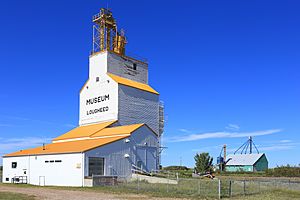
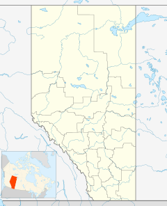
Lougheed is a small village located in the middle of Alberta, Canada. You can find it about 94 kilometers (58 miles) southeast of a city called Camrose, right along Highway 13. The village got its name from Sir James Lougheed, who was an important senator (a type of government leader) for Alberta from 1889 to 1925.
How Many People Live Here?
Every few years, Canada counts how many people live in different places. This is called a census. It helps us understand how communities are growing or changing.
Recent Population Counts
- In the 2021 census, Lougheed had 225 people living there. They lived in 95 homes out of 117 total houses.
- This was a small decrease from 2016, when 256 people lived in the village.
- The village covers an area of 2 square kilometers (about 0.77 square miles). This means there were about 112.5 people per square kilometer in 2021.
Looking Back at Past Years
- In the 2016 census, Lougheed had 256 people. This was a bit more than in 2011, when the population was 233.
- The village also does its own counts sometimes. In 2013, a local census showed 273 people. This was an increase from 254 people in 2010.
Black History Month on Kiddle
Famous African-American Activists:
 | William L. Dawson |
 | W. E. B. Du Bois |
 | Harry Belafonte |

All content from Kiddle encyclopedia articles (including the article images and facts) can be freely used under Attribution-ShareAlike license, unless stated otherwise. Cite this article:
Lougheed, Alberta Facts for Kids. Kiddle Encyclopedia.

