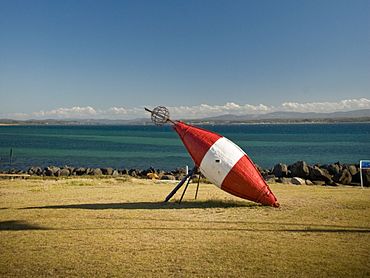
Low Head facts for kids
Quick facts for kids Low HeadTasmania |
|||||||||||||||
|---|---|---|---|---|---|---|---|---|---|---|---|---|---|---|---|

Low Head Pilot Station
|
|||||||||||||||
| Population | 572 (2016 census) | ||||||||||||||
| Postcode(s) | 7253 | ||||||||||||||
| Elevation | 28 m (92 ft) | ||||||||||||||
| Location |
|
||||||||||||||
| LGA(s) | George Town Council | ||||||||||||||
| Region | Launceston | ||||||||||||||
| State electorate(s) | Bass | ||||||||||||||
| Federal Division(s) | Bass | ||||||||||||||
|
|||||||||||||||
Low Head is a quiet, mostly residential area in Tasmania, Australia. It's part of the George Town region. You can find it about 5 kilometers north of the town of George Town. In 2016, about 572 people lived here.
Low Head is located on a small piece of land that sticks out. This land is at the mouth of the Tamar River. This is where the river meets the big ocean, the Bass Strait.
It's a very popular place for activities like snorkeling and scuba diving. People enjoy the wide, natural beaches almost all year round.
The area is also home to a famous lighthouse. You can also find a colony of small little penguins here.
The lighthouse has a special foghorn. It's called a "Type G" diaphone foghorn. This is the only working foghorn of its kind. Many visitors love to hear it. It sounds off at noon every Sunday.
History of Low Head
Low Head was officially named as a locality in 1967. This means it became a recognized place on maps.
The first post office in Low Head opened a long time ago. It started on September 12, 1887. However, it closed just a few years later in 1894.
In 1996, a ship called the MV Iron Baron had an accident. It ran aground near Low Head. This caused a large oil spill. It was a serious event for Australia's environment at the time.
Geography and Nature
Low Head is surrounded by water on three sides. The Tamar River estuary is to the west and southwest. An estuary is where a river meets the sea. The Bass Strait is to the north and northeast.
The George Town Aerodrome is also located within the Low Head area. This is a small airport.
Climate and Weather
Low Head has a mild ocean climate. This means it usually has warm summers and cool, wet winters. The weather is generally pleasant throughout the year.
| Climate data for Low Head | |||||||||||||
|---|---|---|---|---|---|---|---|---|---|---|---|---|---|
| Month | Jan | Feb | Mar | Apr | May | Jun | Jul | Aug | Sep | Oct | Nov | Dec | Year |
| Record high °C (°F) | 27.3 (81.1) |
28.7 (83.7) |
25.8 (78.4) |
23.1 (73.6) |
20.4 (68.7) |
18.0 (64.4) |
15.9 (60.6) |
17.2 (63.0) |
19.2 (66.6) |
21.2 (70.2) |
24.8 (76.6) |
25.7 (78.3) |
28.7 (83.7) |
| Mean daily maximum °C (°F) | 20.6 (69.1) |
21.1 (70.0) |
20.1 (68.2) |
17.8 (64.0) |
15.4 (59.7) |
13.5 (56.3) |
12.8 (55.0) |
13.1 (55.6) |
14.0 (57.2) |
15.4 (59.7) |
17.4 (63.3) |
19.0 (66.2) |
16.7 (62.1) |
| Mean daily minimum °C (°F) | 14.4 (57.9) |
14.6 (58.3) |
13.4 (56.1) |
11.2 (52.2) |
9.4 (48.9) |
7.5 (45.5) |
6.9 (44.4) |
7.2 (45.0) |
8.5 (47.3) |
9.6 (49.3) |
11.4 (52.5) |
12.9 (55.2) |
10.6 (51.1) |
| Record low °C (°F) | 8.2 (46.8) |
8.1 (46.6) |
7.0 (44.6) |
3.7 (38.7) |
2.6 (36.7) |
0.8 (33.4) |
0.6 (33.1) |
0.5 (32.9) |
1.4 (34.5) |
3.9 (39.0) |
5.1 (41.2) |
6.5 (43.7) |
0.5 (32.9) |
| Average rainfall mm (inches) | 48.8 (1.92) |
28.4 (1.12) |
52.4 (2.06) |
55.1 (2.17) |
63.3 (2.49) |
75.0 (2.95) |
73.7 (2.90) |
77.1 (3.04) |
57.0 (2.24) |
54.3 (2.14) |
52.2 (2.06) |
42.9 (1.69) |
679.3 (26.74) |
| Average rainy days (≥ 1 mm) | 6.9 | 6.6 | 7.8 | 9.9 | 13.0 | 14.2 | 15.7 | 15.3 | 14.4 | 12.0 | 9.7 | 8.9 | 134.4 |
| Average afternoon relative humidity (%) | 68 | 66 | 64 | 66 | 69 | 72 | 71 | 71 | 71 | 68 | 68 | 66 | 68 |
| Source: Bureau of Meteorology (1997–2022 averages; extremes 1980–present) | |||||||||||||
Getting Around Low Head
The main road in Low Head is called Route A8. It is also known as Low Head Road. This road runs through the area. It goes from the southwest to the northwest. Then, it ends at the northern tip of the locality.


