Lower Gwynedd Township, Pennsylvania facts for kids
Quick facts for kids
Lower Gwynedd Township
|
|||
|---|---|---|---|
|
Township
|
|||
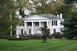
Gwynedd Hall
|
|||
|
|||
| Etymology: Gwynedd [ˈɡʊɨnɛð] | |||
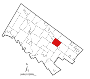
Location of Pennsylvania in the United States
|
|||
| Country | United States | ||
| State | Pennsylvania | ||
| County | Montgomery | ||
| Area | |||
| • Total | 9.31 sq mi (24.1 km2) | ||
| • Land | 9.31 sq mi (24.1 km2) | ||
| • Water | 0.01 sq mi (0.03 km2) | ||
| Elevation | 348 ft (106 m) | ||
| Population
(2010)
|
|||
| • Total | 11,405 | ||
| • Estimate
(2016)
|
11,558 | ||
| • Density | 1,225.0/sq mi (472.99/km2) | ||
| Time zone | UTC-5 (EST) | ||
| • Summer (DST) | UTC-4 (EDT) | ||
| Area codes | 215, 267, and 445 | ||
| FIPS code | 42-091-44920 | ||
Lower Gwynedd Township is a community in Montgomery County, Pennsylvania, United States. It is known for its beautiful countryside and horse-riding areas. In 2010, about 11,405 people lived here.
The township includes four small villages: Gwynedd, Gwynedd Valley, Penllyn, and Spring House. Lower Gwynedd offers a peaceful, country-like lifestyle. Yet, it is still close to bigger towns and Philadelphia. Even though its mailing address is Ambler, Pennsylvania, it is a separate place.
Lower Gwynedd Township was officially started in 1698.
Contents
History of Lower Gwynedd Township
Gwynedd was first settled in 1698 by a group of Quakers from Wales. These early settlers helped shape the area. Later, in 1891, the original Gwynedd area was divided. This created two separate townships: Lower Gwynedd and Upper Gwynedd.
Historic Buildings and Landmarks
Lower Gwynedd is home to some important historic places. Two of these are listed on the National Register of Historic Places. These are Gwynedd Hall and the Jacob Kastner Loghouse. They help tell the story of the township's past.
Geography and Natural Spaces
Lower Gwynedd Township covers about 9.4 square miles (24.2 square kilometers). Most of this area is land. Only a very small part is water.
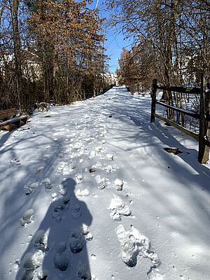
The township is proud of its many outdoor spaces. It has twenty miles of trails for walking, biking, or horse riding. There are also 120 acres of parkland for everyone to enjoy.
Getting Around: Transportation in Lower Gwynedd
As of 2018, Lower Gwynedd Township had over 64 miles of public roads. About 16 miles of these roads are kept up by the Pennsylvania Department of Transportation (PennDOT). The township itself takes care of the other 47 miles of roads.
Major Roads and Highways
Several main highways pass through Lower Gwynedd Township.
- U.S. Route 202 runs through the northwestern part of the township. It follows Dekalb Pike.
- Pennsylvania Route 63 (Welsh Road) forms part of the township's northeastern border.
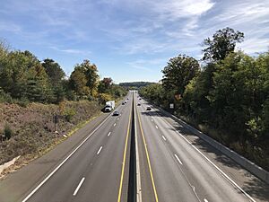
- Pennsylvania Route 309 (Fort Washington Expressway) goes through the eastern part. It then joins Bethlehem Pike before leaving the township.
Public Transportation Options
Public transport is available through SEPTA Regional Rail and Suburban Bus services.
- The Lansdale/Doylestown Line train runs through the township. It has stations at Gwynedd Valley and Penllyn.
- SEPTA also offers bus routes. Route 94 connects Chestnut Hill in Philadelphia to Montgomery Mall.
- Route 96 travels between the Norristown Transportation Center in Norristown and Lansdale.
People of Lower Gwynedd: Demographics
| Historical population | |||
|---|---|---|---|
| Census | Pop. | %± | |
| 1930 | 1,847 | — | |
| 1940 | 1,992 | 7.9% | |
| 1950 | 2,475 | 24.2% | |
| 1960 | 4,546 | 83.7% | |
| 1970 | 6,361 | 39.9% | |
| 1980 | 6,902 | 8.5% | |
| 1990 | 9,958 | 44.3% | |
| 2000 | 10,422 | 4.7% | |
| 2010 | 11,405 | 9.4% | |
| 2020 | 12,076 | 5.9% | |
In 2010, the population of Lower Gwynedd Township was 11,405 people. Most residents, about 84%, were White. About 7% were Black or African American, and another 7% were Asian. About 1.5% of the population identified as two or more races. People of Hispanic or Latino background made up about 1.9% of the population.
In 2000, there were 4,177 households in the township. About 29% of these households had children under 18 living there. The average household had 2.39 people. The average family size was 3.03 people.
The population's age groups were spread out. About 23% were under 18 years old. About 22% were 65 years or older. The median age was 45 years.
Education in Lower Gwynedd
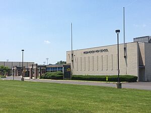
Students in Lower Gwynedd Township attend schools in the Wissahickon School District. The main high school for the district is Wissahickon High School.
See also
 In Spanish: Municipio de Lower Gwynedd para niños


