Lower Salem, Ohio facts for kids
Quick facts for kids
Lower Salem, Ohio
|
|
|---|---|
|
Village
|
|

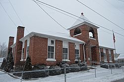
Village Hall on Main Street
|
|

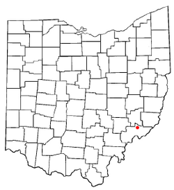
Location of Lower Salem, Ohio
|
|

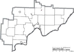
Location of Lower Salem in Washington County
|
|
| Country | United States |
| State | Ohio |
| County | Washington |
| Area | |
| • Total | 0.06 sq mi (0.16 km2) |
| • Land | 0.06 sq mi (0.15 km2) |
| • Water | 0.00 sq mi (0.01 km2) |
| Elevation | 696 ft (212 m) |
| Population
(2020)
|
|
| • Total | 75 |
| • Density | 1,271.19/sq mi (493.25/km2) |
| Time zone | UTC-5 (Eastern (EST)) |
| • Summer (DST) | UTC-4 (EDT) |
| ZIP code |
45745
|
| Area code(s) | 740 |
| FIPS code | 39-45220 |
| GNIS feature ID | 2399196 |
Lower Salem is a small village located in Washington County, Ohio, in the United States. In 2020, about 75 people lived there. It's a quiet place with a rich history.
Contents
History of Lower Salem
Lower Salem started when a special road was built through it. This road was called the Old Plank Road. It was a "corduroy road," meaning it was made from logs placed side-by-side. This helped people travel to Marietta.
The village itself was officially planned in 1850. Many early settlers were immigrants from Germany. Over time, Lower Salem had several important businesses. These included a hotel, a doctor's office, and a general store. There was also a gas station and an auto parts shop. Today, these buildings are still standing, but the businesses have closed.
Geography of Lower Salem
Lower Salem is a very small village. According to the United States Census Bureau, its total area is about 0.06 square miles (0.16 square kilometers). All of this area is land.
Population and People
| Historical population | |||
|---|---|---|---|
| Census | Pop. | %± | |
| 1870 | 187 | — | |
| 1880 | 198 | 5.9% | |
| 1900 | 190 | — | |
| 1910 | 187 | −1.6% | |
| 1920 | 138 | −26.2% | |
| 1930 | 135 | −2.2% | |
| 1940 | 135 | 0.0% | |
| 1950 | 126 | −6.7% | |
| 1960 | 143 | 13.5% | |
| 1970 | 106 | −25.9% | |
| 1980 | 110 | 3.8% | |
| 1990 | 103 | −6.4% | |
| 2000 | 109 | 5.8% | |
| 2010 | 86 | −21.1% | |
| 2020 | 75 | −12.8% | |
| U.S. Decennial Census | |||
In 2010, there were 86 people living in Lower Salem. These people lived in 31 different homes. About 21 of these homes were families. The village had 39 housing units in total.
Most of the people living in Lower Salem were White (93.0%). A smaller number were African American (7.0%). About 1.2% of the population identified as Hispanic or Latino.
The average age of people in the village was 41 years old. About 23.3% of residents were under 18. About 14% were 65 years old or older. The population was slightly more female (55.8%) than male (44.2%).
Education in Lower Salem
Lower Salem has its own elementary school. It is called Salem-Liberty Elementary School. The school is located just north of Ohio State Route 821. It sits across from the East Fork of Duck Creek. This school serves over 100 students. These students are part of the Fort Frye Local School District.
See also
 In Spanish: Lower Salem (Ohio) para niños

