Loyston, Tennessee facts for kids
Quick facts for kids
Loyston, Tennessee
Loy's Crossroads
|
|
|---|---|
| Loyston | |
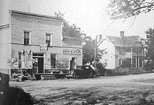
Filling station in Loyston, 1933
|
|
| Country | United States |
| State | Tennessee |
| County | Union |
| Settled | 1800s |
| Impounded | 1935 |
| Founded by | Stooksbury Family |
| Named for | John Loy |
| Elevation | 1,152 ft (351 m) |
| Population
(1935)
|
|
| • Total | 70 |
| Time zone | UTC-5 (Eastern (EST)) |
| • Summer (DST) | UTC-4 (EDT) |
| GNIS feature ID | 1315598 |
Loyston was a small town in Union County, Tennessee, United States. It is now a ghost town because it was covered by water from the Clinch River. This happened after the Norris Dam was finished in 1936.
The town started in the early 1800s around a metal workshop (called a foundry) built by John Loy. The town was named after him. Over time, Loyston grew because it was located on State Highway 61. This made it a good place for local farmers to trade goods.
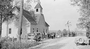
By the early 1930s, about 70 people lived in Loyston. It had a post office and several small businesses. When the Tennessee Valley Authority (TVA) planned to build Norris Dam, they studied the town and its people. Photographer Lewis Hine took many pictures of Loyston.
Most people in Loyston had to move because the government needed their land for the dam. Many of them moved to nearby hills and started a new community called New Loyston. Loyston itself was located where Mill Creek flowed into the Clinch River. Today, Loyston is under a wide part of Norris Lake, which is sometimes called the "Loyston Sea."
Loyston's Early Days
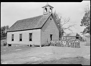
In the 1780s, an immigrant named Henry Sharp built a fort nearby. This area was known to early explorers. By 1933, Sharp's family members were still important in the Loyston area. For example, there was a church called "Sharp's Station Methodist Episcopal Church" close to town.
Another early settler, Robert Stooksbury, moved to the Loyston area around 1800. Many of his family members still lived there in the early 1930s. Some of them even ran one of the town's general stores.
In the early 1800s, John Loy built a foundry in the area. He used the iron found at the bottom of Big Ridge. The community that grew around his workshop was first called "Loy" or "Loy's Crossroads." In 1866, a post office opened and was named "Loy's Cross Roads." Later, in 1894, the name was changed to Loyston.
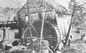
By the early 1930s, Loyston had a post office, two general stores, a gas station, a cafe, a mill, and a barbershop. A special power system called Delco Light gave electricity to the businesses and some homes.
The Norris Dam Project
The Tennessee Valley Authority (TVA) was created to help improve life in the Tennessee Valley. Part of their plan was to build dams like Norris Dam. This dam would help control floods and provide electricity. However, building the dam meant that many towns, including Loyston, would be flooded.
TVA studies showed that many people in the Norris Dam area were not very rich. But Loyston residents were doing a bit better because their farmland was good. For example, the Stooksbury general store made a good profit each year.
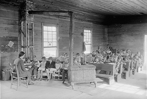
Homes in Loyston were different sizes. Some were simple two-room log cabins. Others were larger, with up to eight rooms. Most houses used fireplaces for heat, but some had coal stoves. Children in Loyston went to Loyston Elementary School or the nearby one-room Oakdale School.
TVA helped families from Loyston find new places to live. They drove families around to look at farms for sale. Some families needed many trips before they found a new home they liked.
Even though TVA talked about the benefits of moving to better farmland, most Loyston residents wanted to stay close. Many of them moved just a few miles south to start a new community called New Loyston. Others moved to bigger cities like Knoxville or to nearby counties.
A group called the Civilian Conservation Corps (CCC) also helped in the area. CCC Company 4495, which built Big Ridge State Park, had its main camp in Loyston.
Loyston's Legacy
Today, the valley where Loyston once stood is under the widest part of Norris Lake. This area is known as the "Loyston Sea." When building the Norris reservoir, engineers needed to build a special dam. This "saddle dam," called the "Loyston Dike," stops water from flowing into another valley. It is located near Highway 61, close to Big Ridge State Park.
There is also a recreation area along the lake named after Loyston. In 2008, the Museum of Appalachia received a special gift. It was a children's playhouse that used to be in Loyston. It is believed to be the last building still standing from the original community.
 | William M. Jackson |
 | Juan E. Gilbert |
 | Neil deGrasse Tyson |


