
Lupfig facts for kids
Quick facts for kids
Lupfig
|
||
|---|---|---|
 |
||
|
||

Lupfig
Location in Switzerland

Lupfig
Location in Canton of Aargau
|
||
| Country | Switzerland | |
| Canton | Aargau | |
| District | Brugg | |
| Area | ||
| • Total | 5.15 km2 (1.99 sq mi) | |
| Elevation | 399 m (1,309 ft) | |
| Population
(Dec 2020 )
|
||
| • Total | 12,679 | |
| • Density | 2,461.9/km2 (6,376/sq mi) | |
| Postal code |
5242
|
|
| Surrounded by | Birr, Birrhard, Hausen, Holderbank, Möriken-Wildegg, Mülligen, Scherz | |


Lupfig is a small town, also called a municipality, located in the Aargau canton of Switzerland. It's part of the Brugg district. On January 1, 2018, another town called Scherz joined with Lupfig, making it a bit bigger.
Contents
Lupfig's Past: A Look at History
Lupfig has a long and interesting history. Near where Lupfig is today, there was once a Roman aqueduct. This aqueduct carried water to a Roman army camp called Vindonissa.
Early Settlements and Ownership
Scientists have also found graves from the Alamanni people near the village. The name "Lupfig" was first written down around the year 1273 as Lupfanch.
Lupfig was an important part of the land owned by the Habsburg family. It is very close to their famous Habsburg Castle. In the 1300s, some of the rights and property in Lupfig went to a place called Königsfelden Abbey. When this abbey closed down, the property then belonged to the city of Bern.
Changes in Religion and Economy
For a long time, Lupfig was part of the Windisch church area. Then, in 1526, it became part of the Birr church area. By 1715, Lupfig had its own church leader. Since 1966, there has also been a Catholic chapel in the village.
For many years, farming was the main way people made a living in Lupfig. But in the mid-1700s, people started making cotton goods at home to earn more money. In the 1800s, two new industries came to Lupfig. These were making things from straw and cutting stone. The stone cutting was for the watch industry and happened from about 1880 to 1940.
Modern Growth and Transportation
In 1936, a local airport opened at Birrfeld. Lupfig also has great connections to major roads, like the A1 and A3 highways. It's also on the Swiss Federal Railways Gotthard train line. Because of these good transport links, Lupfig has become a center for industry and distribution since the 1950s. In the 1980s, many new homes were built for people who travel to work from Lupfig.
Lupfig's Landscape: Geography

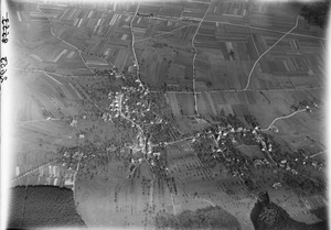
Lupfig covers an area of about 5.15 square kilometers (about 2 square miles). A large part of this land, almost half (48.9%), is used for farming. About 23.7% of the area is covered by forests.
The rest of the land is built up with buildings and roads, making up about 26.8% of Lupfig. A very small part, 0.4%, includes rivers or lakes. Most of the water in Lupfig is found in its rivers and streams.
Lupfig is located in the Brugg district. The village of Lupfig has grown so much that it has joined with the nearby town of Birr.
Lupfig's Symbol: Coat of Arms
The official symbol, or coat of arms, for Lupfig shows a blue shield. On this shield, there are three golden ears of wheat. The two outer ears have leaves.
People of Lupfig: Demographics
Lupfig has a population of about 2,500 people. As of June 2009, about 17.9% of the people living in Lupfig were from other countries. Over ten years, from 1997 to 2007, the number of people living in Lupfig grew by 31%.
Languages and Age Groups
Most people in Lupfig (89.4%) speak German. Italian is the second most common language (3.5%), followed by Serbo-Croatian (1.3%).
In 2008, the population of Lupfig included:
- 10.9% were children aged 0 to 9 years old.
- 10.7% were teenagers aged 10 to 19.
- 11.2% were young adults aged 20 to 29.
- 14.7% were adults aged 30 to 39.
- 18.9% were adults aged 40 to 49.
- 13.8% were adults aged 50 to 59.
- 10.7% were older adults aged 60 to 69.
- 6.3% were seniors aged 70 to 79.
- 2.3% were seniors aged 80 to 89.
- 0.5% were seniors aged 90 and older.
Education in Lupfig
People in Switzerland generally have a good education. In Lupfig, about 76.5% of adults (aged 25–64) have finished high school or gone on to higher education, like university. In the 2008/2009 school year, 170 students attended primary school in Lupfig. There were also 68 students attending secondary school in the town.
Historical Population Growth
Here's how Lupfig's population has changed over time:
| Historical population | ||
|---|---|---|
| Year | Pop. | ±% |
| 1764 | 363 | — |
| 1850 | 736 | +102.8% |
| 1900 | 582 | −20.9% |
| 1950 | 637 | +9.5% |
| 1975 | 913 | +43.3% |
| 1980 | 963 | +5.5% |
| 1990 | 1,355 | +40.7% |
| 2000 | 1,819 | +34.2% |
Working in Lupfig: Economy
In 2007, Lupfig had a low unemployment rate of 1.59%. This means most people who wanted to work had jobs.
Types of Jobs
In 2005, there were different types of jobs in Lupfig:
- Primary sector: 53 people worked in farming or related jobs. There were about 12 businesses in this area.
- Secondary sector: 648 people worked in manufacturing or construction. There were 30 businesses in this area.
- Tertiary sector: 1,159 people worked in services, like shops, offices, or healthcare. There were 93 businesses in this area.
Commuting to Work
In 2000, about 1,072 people lived in Lupfig and worked. Most of them (77.8%) traveled outside Lupfig for their jobs. However, 1,207 people came into Lupfig to work. This means Lupfig is an important place for jobs.
To get to work, 10.7% of people used public transportation, like buses or trains. A larger number, 53.9%, used their own cars to get to work.
Beliefs in Lupfig: Religion
Based on the 2000 census:
- 32.2% of people were Roman Catholic.
- 49.1% belonged to the Swiss Reformed Church (a Protestant church).
- A small number, about 0.27%, belonged to the Christian Catholic Church of Switzerland.
See also
 In Spanish: Lupfig para niños
