Lurín River facts for kids
Quick facts for kids Lurin River |
|
|---|---|

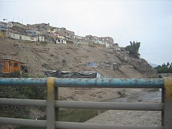
Housings near the Lurin river
|
|
|
Location of mouth
|
|
| Native name | Río Lurín (Spanish) |
| Country | Peru |
| Physical characteristics | |
| River mouth | Pacific Ocean 12°16′30″S 76°54′13″W / 12.2750°S 76.9036°W |
| Length | 108.57 km (67.46 mi) |
| Basin features | |
| Basin size | 1,670 km2 (640 sq mi) |
The Lurín River is a cool river in Peru. It is about 108.57 kilometers (67.46 miles) long. This river starts high up in the Andes mountains. It flows through the Lima Region before reaching the Pacific Ocean.
Contents
About the Lurín River
The Lurín River is an important waterway in Peru. It helps provide water for many areas. The river's journey begins far up in the mountains. It then flows through different parts of the Lima region.
Where Does It Begin?
The Lurín River starts in the western Andes mountains. It gets its water from melting glaciers and mountain lagoons. At first, it is called the Chalilla River. After it joins with the Taquía creek, it becomes known as the Lurín River.
River Friends: Tributaries
A tributary is a smaller stream or river that flows into a larger one. The Lurín River has several important tributaries. On its left side, it is joined by the Taquía, Llacomayqui, Tinajas, Numinkancha, and Kanchawara rivers. The Chamacna river joins it on its right side.
The River's Journey
The Lurín River flows through two main provinces in the Lima region. These are the Huarochirí Province and the Lima Province. After its long journey, the river finally empties into the Pacific Ocean. The total area that collects water for the Lurín River is called its drainage basin. This basin covers about 1670 square kilometers (645 square miles).
See also
 In Spanish: Río Lurín para niños
 | Delilah Pierce |
 | Gordon Parks |
 | Augusta Savage |
 | Charles Ethan Porter |


