Madras, Oregon facts for kids
Quick facts for kids
Madras, Oregon
|
|
|---|---|

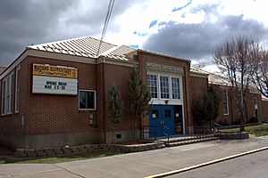
Elementary school in Madras
|
|

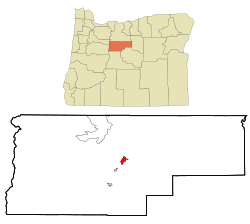
Location in Oregon
|
|
| Country | United States |
| State | Oregon |
| County | Jefferson |
| Incorporated | 1911 |
| Area | |
| • Total | 8.16 sq mi (21.13 km2) |
| • Land | 8.16 sq mi (21.13 km2) |
| • Water | 0.00 sq mi (0.00 km2) |
| Elevation | 2,242 ft (683 m) |
| Population
(2020)
|
|
| • Total | 7,456 |
| • Density | 913.95/sq mi (352.88/km2) |
| Time zone | UTC-8 (Pacific) |
| • Summer (DST) | UTC-7 (Pacific) |
| ZIP code |
97741
|
| Area code(s) | 541 |
| FIPS code | 41-45250 |
| GNIS feature ID | 1145724 |
| Website | ci.madras.or.us |
Madras is a city in Oregon, United States. It is the main city of Jefferson County, Oregon. The city was first called "The Basin" because it sits in a round valley.
It's not fully clear how Madras got its name in 1903. It might be named after a special cotton fabric called "Madras". This fabric came from a city in India that was also called Madras (now Chennai). The city's population was 6,046 people in 2010. By 2020, it had grown to 7,456 people.
Contents
History of Madras
The first plans for Madras were made on July 18, 1902. A person from Scandinavia named John A. Palmehn created them. The town was first going to be called "Palmain" after him.
However, the U.S. Postal Service said no to this name. It was too much like another post office called Parmen. So, the name "Madras" was chosen instead. This name was inspired by the "Madras" fabric, which was named after the city in India.
Madras officially became a city in 1911. During World War II, an Army Air Corps base was built nearby. Today, this old airfield is known as the Madras Municipal Airport. Farmers living about 5 miles (8 km) north of the city grew wheat without irrigation.
Special Plant Incident
In 2003, a company called Scotts Company was testing a special type of bentgrass near Madras. This grass was changed to be resistant to a weed killer called Roundup. Pollen from this grass spread over an area of about 120 square miles (310 km2).
Because the company could not remove all of these changed plants, the U.S. Department of Agriculture fined them $500,000 in 2007. This was for not following the rules.
2017 Solar Eclipse Event
On August 21, 2017, a total solar eclipse passed right over Madras. The city is in a high desert area. This means it often has clear skies in August. Because of this, Madras was a perfect place to watch the eclipse.
All the hotel rooms in the area were booked years in advance. The town got ready for about 100,000 visitors who came to see the eclipse.
Fun Places to Visit
Madras is home to the Erickson Aircraft Collection. This is a private collection of old airplanes that can still fly. You can visit the collection Tuesday through Sunday, from 10 a.m. to 5 p.m.
The Jefferson County Fair is also held in Madras. This yearly fair happens in late July. It takes place on county land along Fairgrounds Road.
Geography and Climate
The city of Madras covers a total area of about 5.02 square miles (13.00 square kilometers). All of this area is land.
Madras has a steppe climate. This means it is a semi-dry area.
| Climate data for Madras | |||||||||||||
|---|---|---|---|---|---|---|---|---|---|---|---|---|---|
| Month | Jan | Feb | Mar | Apr | May | Jun | Jul | Aug | Sep | Oct | Nov | Dec | Year |
| Record high °F (°C) | 70 (21) |
76 (24) |
82 (28) |
91 (33) |
101 (38) |
111 (44) |
112 (44) |
109 (43) |
104 (40) |
93 (34) |
80 (27) |
68 (20) |
112 (44) |
| Mean daily maximum °F (°C) | 41.7 (5.4) |
47.6 (8.7) |
55.2 (12.9) |
62.2 (16.8) |
70.3 (21.3) |
77.7 (25.4) |
87.1 (30.6) |
86.0 (30.0) |
77.9 (25.5) |
65.3 (18.5) |
50.6 (10.3) |
42.5 (5.8) |
63.7 (17.6) |
| Mean daily minimum °F (°C) | 22.1 (−5.5) |
25.0 (−3.9) |
27.3 (−2.6) |
30.0 (−1.1) |
35.9 (2.2) |
41.6 (5.3) |
45.1 (7.3) |
43.6 (6.4) |
38.0 (3.3) |
31.2 (−0.4) |
27.1 (−2.7) |
23.2 (−4.9) |
32.5 (0.3) |
| Record low °F (°C) | −40 (−40) |
−34 (−37) |
−7 (−22) |
6 (−14) |
11 (−12) |
19 (−7) |
26 (−3) |
21 (−6) |
9 (−13) |
−2 (−19) |
−15 (−26) |
−40 (−40) |
−40 (−40) |
| Average precipitation inches (mm) | 1.15 (29) |
0.82 (21) |
0.74 (19) |
0.7 (18) |
0.95 (24) |
0.8 (20) |
0.34 (8.6) |
0.33 (8.4) |
0.48 (12) |
0.71 (18) |
1.28 (33) |
1.26 (32) |
9.56 (243) |
| Average snowfall inches (cm) | 4.8 (12) |
2.1 (5.3) |
0.7 (1.8) |
0.1 (0.25) |
0 (0) |
0 (0) |
0 (0) |
0 (0) |
0 (0) |
0 (0) |
1.4 (3.6) |
3 (7.6) |
12.1 (31) |
| Average precipitation days | 9 | 8 | 7 | 6 | 7 | 5 | 2 | 2 | 3 | 5 | 9 | 9 | 72 |
People in Madras
| Historical population | |||
|---|---|---|---|
| Census | Pop. | %± | |
| 1910 | 364 | — | |
| 1920 | 337 | −7.4% | |
| 1930 | 291 | −13.6% | |
| 1940 | 412 | 41.6% | |
| 1950 | 1,258 | 205.3% | |
| 1960 | 1,515 | 20.4% | |
| 1970 | 1,689 | 11.5% | |
| 1980 | 2,235 | 32.3% | |
| 1990 | 3,443 | 54.0% | |
| 2000 | 5,078 | 47.5% | |
| 2010 | 6,046 | 19.1% | |
| 2020 | 7,456 | 23.3% | |
| source: | |||
2010 Census Information
In 2010, there were 6,046 people living in Madras. There were 2,198 households and 1,430 families. The city had about 1,204 people per square mile (465 per square kilometer).
About 66.4% of the people were White. About 6.9% were Native American. People from other backgrounds made up 19.7% of the population. Also, 38.5% of the people were of Hispanic or Latino heritage.
In the households, 41.2% had children under 18 living with them. About 42.5% were married couples. The average household had 2.69 people. The average family had 3.31 people.
The average age in the city was 31.2 years old. About 30.8% of residents were under 18. About 10.3% were 65 or older. The population was almost evenly split between males (49.3%) and females (50.7%).
City Connections
How to Get Around
- Highways
- U.S. Route 26
- U.S. Route 97
- Trains
- BNSF Railway (used to be Oregon Trunk Railway)
- Union Pacific Railroad also uses the same tracks
- Airports
Madras has the public City-County Airport. There are also a few private airports nearby:
- Bombay Farms Airport
- St. Charles Madras Heliport
- Ochs Private Airport
- Six Springs Ranch Airport
Famous People from Madras
- Jacoby Ellsbury (born 1983) — A professional baseball player.
- Boyd R. Overhulse (1909–1966) — A lawyer and state lawmaker.
- River Phoenix (1970–1993) — An actor who was born in Madras.
Sister City
Madras has one sister city. This is a special friendship between cities in different countries.
 Tōmi, Nagano, Japan (Tōmi was formed in 2004. It joined two towns, Kitamimaki and Tōbu. Kitamimaki was already a sister city with Madras.)
See also
 In Spanish: Madras (Oregón) para niños
 | Selma Burke |
 | Pauline Powell Burns |
 | Frederick J. Brown |
 | Robert Blackburn |


