Mamores facts for kids
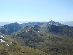
The Mamores are a cool group of mountains in the Scottish Highlands. They are found in the Lochaber area. These mountains stretch for about 15 kilometers from east to west. They sit between Glen Nevis in the north and Loch Leven in the south.
Tall Peaks of the Mamores
Ten of the mountains in the Mamores are called Munros. A Munro is a mountain in Scotland that is over 3,000 feet (914.4 meters) tall. Climbing all of them is a big challenge for many hikers!
Here are the ten Munros in the Mamores, listed from west to east:
- Mullach nan Coirean (939 meters)
- Stob Bàn (999 meters)
- Sgurr a' Mhàim (1099 meters)
- Am Bodach (1032 meters)
- Stob Coire a' Chàirn (981 meters)
- An Gearanach (982 meters)
- Na Gruagaichean (1056 meters)
- Binnein Mòr (1130 meters)
- Binnein Beag (943 meters)
- Sgurr Eilde Mòr (1010 meters)
Mountain Shapes and Views
The main part of the Mamores is like a long backbone. It stretches from Meall a' Chaorainn in the west to Sgòr Eilde Beag in the east. This main ridge is about 10 kilometers long.
Three narrow ridges, called arêtes, stick out from the main ridge. They connect to the tops of Sgurr a' Mhàim, An Gearanach, and Binnein Mòr. At the far eastern end of the Mamores, there are two steep mountains. These are Binnein Beag and Sgurr Eilde Mòr.
These two peaks are quite remote. They are located between the quiet upper part of Glen Nevis and two lochs, Loch Eilde Mòr and Loch Eilde Beag.
Exploring the Mamores
People who love hiking can easily reach the Mamores from different directions. The village of Kinlochleven is on the south side. From the north, you can get there through upper Glen Nevis.
Walking across the entire Mamores range is a big adventure. It can take a whole long day for very fit hikers. Some people even make it a multi-day trip.
Since it's fairly easy to get to, you can also combine a few peaks for shorter hikes. One of the most famous shorter routes is called the Ring of Steall. This is a circular path around a special bowl-shaped valley, or corrie, above Steall Falls.
The Ring of Steall route includes four of the Munro peaks: Sgurr a' Mhàim, Am Bodach, Stob Coire a' Chàirn, and An Gearanach. This route is also used for the exciting Ring of Steall Skyrace!
 | Lonnie Johnson |
 | Granville Woods |
 | Lewis Howard Latimer |
 | James West |


