Manhattan, Montana facts for kids
Quick facts for kids
Manhattan, Montana
|
|
|---|---|
| Motto(s):
Heart of the Gallatin Valley
|
|

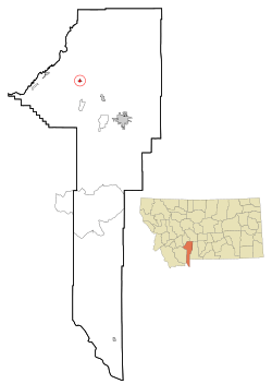
Location of Manhattan, Montana
|
|
| Country | United States |
| State | Montana |
| County | Gallatin |
| Area | |
| • Total | 1.74 sq mi (4.50 km2) |
| • Land | 1.74 sq mi (4.50 km2) |
| • Water | 0.00 sq mi (0.00 km2) |
| Elevation | 4,246 ft (1,294 m) |
| Population
(2020)
|
|
| • Total | 2,086 |
| • Density | 1,199.54/sq mi (463.22/km2) |
| Time zone | UTC-7 (Mountain (MST)) |
| • Summer (DST) | UTC-6 (MDT) |
| ZIP code |
59741
|
| Area code(s) | 406 |
| FIPS code | 30-47575 |
| GNIS feature ID | 0773857 |
Manhattan is a small town located in Gallatin County, Montana, in the United States. In 2020, about 2,086 people lived there. It is considered part of the larger Bozeman area.
Contents
History of Manhattan
The town of Manhattan has had a few different names over the years. In 1865, it was first known as Hamilton.
Later, in 1883, its name changed to Moreland. This name came from the Moreland Irrigation Canal, an important waterway nearby.
Finally, the town was named Manhattan. This happened because of a malting company. This company was part of the growing barley industry in the area.
Geography and Climate

Manhattan is located in a beautiful area of Montana. The town covers about 1.74 square miles (4.50 square kilometers) of land. There is no water area within the town limits.
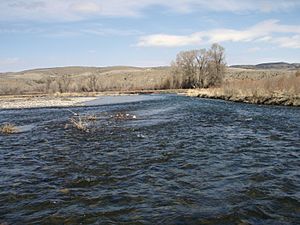
The Gallatin River flows to the east and north of Manhattan. You can see the Bridger Mountains to the north. To the south, you'll find the Gallatin Mountains.
Manhattan's Climate
Manhattan experiences a humid continental climate. This means the weather changes a lot with the seasons. Summers are usually warm to hot, and sometimes humid. Winters are cold, and can be very cold at times.
Population and People
| Historical population | |||
|---|---|---|---|
| Census | Pop. | %± | |
| 1920 | 591 | — | |
| 1930 | 501 | −15.2% | |
| 1940 | 646 | 28.9% | |
| 1950 | 716 | 10.8% | |
| 1960 | 889 | 24.2% | |
| 1970 | 816 | −8.2% | |
| 1980 | 988 | 21.1% | |
| 1990 | 1,034 | 4.7% | |
| 2000 | 1,396 | 35.0% | |
| 2010 | 1,520 | 8.9% | |
| 2020 | 2,086 | 37.2% | |
| U.S. Decennial Census | |||
Population in 2010
In 2010, the town had 1,520 people living in 622 households. About 405 of these were family households. The population density was about 787 people per square mile.
Most of the people living in Manhattan were White (96.2%). A small number were from other racial backgrounds. About 2.6% of the population identified as Hispanic or Latino.
About 31.2% of households had children under 18 living with them. Many households (54.3%) were married couples. The average household had 2.40 people. The average family had 3.02 people.
The average age of people in Manhattan was 41.2 years old. About 25.8% of residents were under 18. About 15.2% were 65 years old or older. The town had slightly more males (51.1%) than females (48.9%).
Education in Manhattan
Manhattan has its own school system, called Manhattan Public Schools. This system includes both elementary and high school districts.
Manhattan School District #3 teaches students from kindergarten all the way through 12th grade. The sports teams at Manhattan High School are called the Tigers. In 2022, the high school had 260 students.
There is also a private school nearby called Manhattan Christian High School. It is located in Churchill.
Manhattan also has a public library. The Manhattan Community Library is located within the high school building.
Media and Communications
Manhattan is part of the Bozeman media market. This means it receives TV and radio broadcasts from that area.
Two FM radio stations are licensed in Manhattan. KKQX plays classic rock music. KPWS-LP is a low-power station owned by the school district.
Transportation
Interstate 90 is a major highway that passes by Manhattan. You can get to the town using exit 288.
The closest airport for air travel is Bozeman Yellowstone International Airport.
See also
 In Spanish: Manhattan (Montana) para niños
 | Misty Copeland |
 | Raven Wilkinson |
 | Debra Austin |
 | Aesha Ash |

