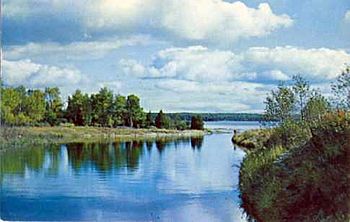
Manitou River (Manitoulin Island) facts for kids
Quick facts for kids Manitou River |
|
|---|---|
 |
|
| Country | Canada |
| Province | Ontario |
| Region | Ontario North |
| District | Manitoulin District |
| Island | Manitoulin Island |
| Physical characteristics | |
| Main source | Manitou Lake Central Manitoulin township 222 units? 45°42′13″N 81°59′49″W / 45.70361°N 81.99694°W |
| River mouth | Lake Huron Tehkummah township 176 metres (577 ft) 45°35′59″N 82°06′12″W / 45.59972°N 82.10333°W |
| Length | 20.1 kilometres (12.5 mi) |
| Basin features | |
| Progression | Lake Huron, Saint Lawrence River |
| River system | Saint Lawrence River |
| Tributaries |
|
| Waterbodies | Unidentified lake |
The Manitou River is a cool river located on Manitoulin Island in Ontario, Canada. It flows through two townships: Central Manitoulin and Tehkummah. This river is an important part of the Manitoulin District in the Northern Ontario region. People in the area mainly work in forestry (managing forests) and agriculture (farming).
Where the Manitou River Flows
The Manitou River starts at a dam on the south side of Lake Manitou. This lake is in Sandfield, within the Central Manitoulin township on Manitoulin Island. Lake Manitou is a popular spot for fun and tourism. It covers about 104 km (64.62 mi) and is about 198 km (123 mi) long. The lake is 6 km (3.7 mi) wide and sits 222 m (728 ft) above sea level.
The Manitou River flows mostly southwest for about 20.1 kilometres (12.5 mi). It drops about 46 m (151 ft) in height along its path. The river flows through thick boreal forests, which are northern evergreen forests. It also crosses a few farming areas closer to where it starts.
The River's Journey
The river's journey can be split into a few parts:
- It flows about 6.2 km (3.9 mi) westward. First, it goes under the Highway 542 bridge. Then it turns southwest and passes under the Case Road bridge. It crosses a small lake that gets water from a stream. It also crosses the southwestern part of White Lake.
- Next, it travels about 8.4 km (5.2 mi) generally southwest. It goes under the Townline Road West bridge near Snowville. It also crosses Sideroad 20, Concession Road 2, and Government Road. It then reaches where water from Smoky Hollow Lake flows into it.
- Finally, it winds about 5.5 km (3.4 mi) southward. It collects water from another small lake coming from the west.
The Manitou River eventually empties into Lake Huron at Michael's Bay. This bay is on the north shore of Lake Huron, at the southern tip of Manitoulin Island.
What's in a Name?
The names "Manitou Lake" and "Manitou River" are connected. The word "Manitou" comes from the Huron people. The Huron were a large group of Indigenous people who used to live around Lake Huron.
 | Audre Lorde |
 | John Berry Meachum |
 | Ferdinand Lee Barnett |


