Mankato, Kansas facts for kids
Quick facts for kids
Mankato, Kansas
|
|
|---|---|
|
City and County seat
|
|

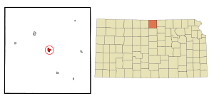
Location within Jewell County and Kansas
|
|

|
|
| Country | United States |
| State | Kansas |
| County | Jewell |
| Founded | 1870s |
| Platted | 1872 |
| Incorporated | 1880 |
| Named for | Mankato, Minnesota |
| Area | |
| • Total | 0.97 sq mi (2.53 km2) |
| • Land | 0.97 sq mi (2.53 km2) |
| • Water | 0.00 sq mi (0.00 km2) |
| Elevation | 1,765 ft (538 m) |
| Population
(2020)
|
|
| • Total | 836 |
| • Density | 862/sq mi (330.4/km2) |
| Time zone | UTC-6 (CST) |
| • Summer (DST) | UTC-5 (CDT) |
| ZIP code |
66956
|
| Area code | 785 |
| FIPS code | 20-44300 |
| GNIS ID | 2395832 |
Mankato is a city in Kansas, United States. It is the main town, or county seat, of Jewell County. In 2020, about 836 people lived there.
Contents
A Look Back: Mankato's History
Mankato started as a town called Jewell Center in 1872. It was renamed Mankato in 1880. The new name came from Mankato, Minnesota. In the same year, 1880, Mankato officially became a city.
The first post office opened in August 1872 as Jewell Center. It was also renamed Mankato in April 1880.
Mankato's Location and Land
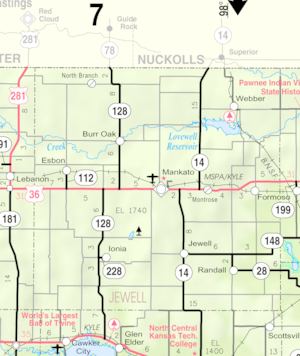
Mankato is located in Kansas. The city covers about 1 square mile (2.53 square kilometers) of land. There is no water within the city limits.
Mankato's Weather and Climate
Mankato has a type of weather called a hot-summer humid continental climate. This means it has warm, humid summers and cold winters.
The hottest temperature ever recorded in Mankato was 111°F (44°C) on July 5, 1964. The coldest temperature was -25°F (-32°C) on January 10, 1982.
| Climate data for Mankato, Kansas, 1991–2020 normals, extremes 1893–2005 | |||||||||||||
|---|---|---|---|---|---|---|---|---|---|---|---|---|---|
| Month | Jan | Feb | Mar | Apr | May | Jun | Jul | Aug | Sep | Oct | Nov | Dec | Year |
| Record high °F (°C) | 77 (25) |
80 (27) |
89 (32) |
99 (37) |
100 (38) |
108 (42) |
111 (44) |
110 (43) |
108 (42) |
96 (36) |
84 (29) |
78 (26) |
111 (44) |
| Mean daily maximum °F (°C) | 37.1 (2.8) |
41.8 (5.4) |
53.0 (11.7) |
63.3 (17.4) |
73.4 (23.0) |
84.7 (29.3) |
90.5 (32.5) |
87.8 (31.0) |
79.3 (26.3) |
67.2 (19.6) |
52.7 (11.5) |
39.9 (4.4) |
64.2 (17.9) |
| Daily mean °F (°C) | 25.7 (−3.5) |
29.6 (−1.3) |
39.8 (4.3) |
50.0 (10.0) |
60.7 (15.9) |
72.4 (22.4) |
78.2 (25.7) |
75.3 (24.1) |
66.0 (18.9) |
53.8 (12.1) |
39.9 (4.4) |
29.1 (−1.6) |
51.7 (11.0) |
| Mean daily minimum °F (°C) | 14.2 (−9.9) |
17.5 (−8.1) |
26.7 (−2.9) |
36.7 (2.6) |
48.0 (8.9) |
60.0 (15.6) |
65.9 (18.8) |
62.7 (17.1) |
52.7 (11.5) |
40.5 (4.7) |
27.0 (−2.8) |
18.3 (−7.6) |
39.2 (4.0) |
| Mean minimum °F (°C) | — | — | — | — | — | — | — | — | — | 40.5 (4.7) |
— | — | 40.5 (4.7) |
| Record low °F (°C) | −25 (−32) |
−19 (−28) |
−13 (−25) |
11 (−12) |
19 (−7) |
37 (3) |
42 (6) |
42 (6) |
22 (−6) |
10 (−12) |
−5 (−21) |
−23 (−31) |
−25 (−32) |
| Average precipitation inches (mm) | 0.78 (20) |
0.91 (23) |
1.63 (41) |
2.60 (66) |
4.24 (108) |
3.78 (96) |
4.17 (106) |
3.55 (90) |
2.38 (60) |
1.98 (50) |
1.30 (33) |
0.96 (24) |
28.28 (717) |
| Average snowfall inches (cm) | 5.0 (13) |
7.7 (20) |
3.5 (8.9) |
1.0 (2.5) |
0.0 (0.0) |
0.0 (0.0) |
0.0 (0.0) |
0.0 (0.0) |
0.0 (0.0) |
0.4 (1.0) |
2.0 (5.1) |
5.4 (14) |
25.0 (64) |
| Average precipitation days (≥ 0.01 in) | 3.6 | 3.5 | 5.7 | 7.4 | 9.8 | 8.3 | 7.8 | 7.6 | 6.3 | 5.3 | 4.1 | 3.8 | 73.2 |
| Average snowy days (≥ 0.1 in) | 2.4 | 2.4 | 1.4 | 0.4 | 0.0 | 0.0 | 0.0 | 0.0 | 0.0 | 0.1 | 0.8 | 2.2 | 9.7 |
| Source 1: NOAA | |||||||||||||
| Source 2: National Weather Service | |||||||||||||
Mankato's People: Demographics
| Historical population | |||
|---|---|---|---|
| Census | Pop. | %± | |
| 1880 | 506 | — | |
| 1890 | 800 | 58.1% | |
| 1900 | 890 | 11.3% | |
| 1910 | 1,155 | 29.8% | |
| 1920 | 1,326 | 14.8% | |
| 1930 | 1,404 | 5.9% | |
| 1940 | 1,426 | 1.6% | |
| 1950 | 1,462 | 2.5% | |
| 1960 | 1,231 | −15.8% | |
| 1970 | 1,287 | 4.5% | |
| 1980 | 1,205 | −6.4% | |
| 1990 | 1,037 | −13.9% | |
| 2000 | 976 | −5.9% | |
| 2010 | 869 | −11.0% | |
| 2020 | 836 | −3.8% | |
| U.S. Decennial Census | |||
Population in 2020
The 2020 United States census counted 836 people living in Mankato. There were 404 households, which are groups of people living together. About 217 of these were families.
Most people (92.22%) were white. A small number were African-American, Native American, or Asian. Some people (5.14%) were from two or more races. About 2.63% of the population was Hispanic or Latino.
About 22% of households had children under 18. Many households (43.1%) were married couples. About 24.8% of households had someone aged 65 or older living alone. The average household had 2.1 people.
The average age in Mankato was 50.0 years. About 20.5% of the people were under 18. About 28.1% were 65 or older.
Population in 2010
In the 2010 census, 869 people lived in Mankato. There were 405 households. Most people (97.0%) were white.
About 22.0% of households had children under 18. Many (50.9%) were married couples. About 37.5% of households had only one person living there.
The average age was 51.5 years. About 19.2% of residents were under 18. About 28.3% were 65 or older.
Learning in Mankato: Education
The public schools in Mankato are part of the Rock Hills USD 107 school district. The sports teams at Rock Hills High School are called the Grizzlies.
Before this district was formed, Mankato had its own high school. Its teams were called the Mankato Cougars. The Mankato Cougars boys' basketball team won the state championship in 1943.
Famous People from Mankato
- Wint Smith (1892–1976) – He was a Congressman, which means he represented Kansas in the U.S. government from 1947 to 1961.
- Ernest Tippin (1890–1958) – He was an Olympic sharpshooter, meaning he was very good at shooting targets.
- Gregg Doud – He served as the Chief Agricultural Negotiator for the United States. This means he helped make important deals about farming and food with other countries.
See also
 In Spanish: Mankato (Kansas) para niños
 | Jewel Prestage |
 | Ella Baker |
 | Fannie Lou Hamer |

