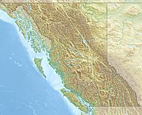
Maple Mountain (British Columbia) facts for kids
Quick facts for kids Maple Mountain |
|
|---|---|
| Highest point | |
| Elevation | 506 m (1,660 ft) |
| Prominence | 476 m (1,562 ft) |
| Geography | |
| Location | British Columbia, Canada |
| Parent range | Vancouver Island Ranges |
| Topo map | NTS 92B/13 |
Maple Mountain is a mountain found on Vancouver Island in British Columbia, Canada. This awesome peak is located near Maple Bay in the North Cowichan area. It sits just northeast of the city of Duncan.
Discover Maple Mountain
Maple Mountain is a great place to explore the outdoors. It stands at 506 meters (about 1,660 feet) tall. This makes it a noticeable landmark in the local area. The mountain is part of the Vancouver Island Ranges.
Hiking Adventures
One of the best ways to experience Maple Mountain is by hiking its trails. There is a clearly marked hiking trail that leads to the top. This trail offers amazing views of the surrounding area.
What You'll See
From the trail, you can look out over the sparkling water. You might even spot Salt Spring Island in the distance. On a clear day, you can see the snowy peaks of the mainland far away. It's a perfect spot for taking cool photos!
Finding the Trailhead
Getting to the start of the trail is quite easy.
- First, follow Osborne Bay Road north. Head towards a place called Crofton.
- Next, turn right onto Chilco Road.
- Follow Chilco Road all the way to its very end.
- You can park your car there.
- Then, walk past the yellow gate.
- Look for blue flagging tape. This tape marks the trail. The trail is kept in good shape, so it's easy to follow.


