Mapping California facts for kids
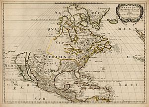
California is a truly special place! For a long time, people in Europe thought California was an island. Many old maps even showed it that way. But by the 1700s, enough information proved this idea wrong. As more people moved to California, mapping its lands became very important. When gold was found in 1848, and California became a U.S. state in 1851, mapping really took off! Today, with modern tools like GIS (Geographic Information Systems), we can map almost anything about California. This includes not just physical features, but also information about its people.

Contents
Mapping California's Past

Early Explorers and Mapmakers
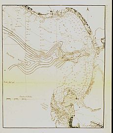
In 1841, Cadwalader Ringgold, a U.S. Navy officer, spent 20 days mapping the San Francisco Bay area. In 1849, he started a bigger survey of the San Francisco Bay and the Sacramento River. He created maps that showed the depth of the Sacramento River and San Francisco Bay. His maps also showed the sizes and locations of towns along the Sacramento River.
In 1852, Ringgold published a book called A Series of Charts with Sailing Directions. This book included his 1849 maps and colorful pictures of ports and important landmarks. It also had notes for sailors about magnetic changes and a table of locations for different places.
Discovering Underwater Features
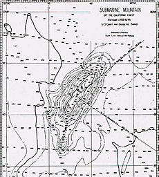
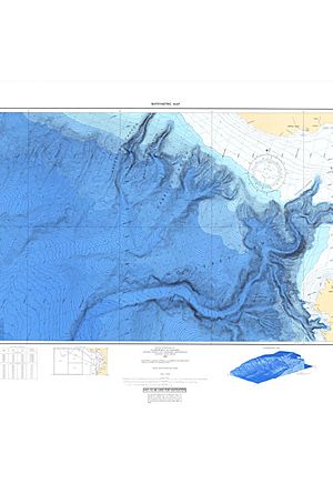
In 1857, the U.S. Coast Survey Steamer Active found a very deep underwater valley in the middle of Monterey Bay. They called it a "submarine gulch." This was the first known deep-sea canyon, and today it's called the Monterey Canyon.
From the 1850s to the 1860s, the U.S. Coast Survey (now part of NOAA) published colorful maps. These maps showed five different types of rock layers in California. They also made detailed nautical charts for the entire California coast.
California's First Geologists
Soon after California became a state, its government hired its first State Geologist. This person's job was to study the Earth's rocks and landforms. John B. Trask was the first State Geologist from 1850 to 1856. He wrote a report about the geology of the Sierra Nevada mountains.
The second State Geologist was Josiah Whitney, who served from 1860 to 1873. Whitney organized the first full survey of California. The first complete maps showing the land's features were made under his leadership. Mount Whitney, the tallest mountain in California, is named after him!
In 1880, the State Mining Bureau was created. The State Geologist's job title changed to State Mineralogist. In 1891, the first state geologic map was published. It showed eight different rock regions in color. A second geologic map was published in 1916, showing 21 different rock regions.
The State Mining Bureau later changed its name to the Division of Mines and Geology in 1962. Today, it's known as the California Geologic Survey, established in 2002.
In 1869, George Davidson, a coast surveyor, put together a book called Pacific Coast: Coast Pilot of California, Oregon, and Washington Territory. This 262-page book had pictures, location tables, notes on magnetic changes, and information about ocean depths.
Mapping California Today

Mapping California continues today with the help of amazing modern technology. Today's mapping uses electronic tools to make the information even more accurate. Many organizations and government groups are involved in collecting and mapping data in California. They help us understand our state better than ever before!
 | Charles R. Drew |
 | Benjamin Banneker |
 | Jane C. Wright |
 | Roger Arliner Young |


