Marsh Lake facts for kids
Quick facts for kids Marsh Lake |
|
|---|---|

Marsh Lake, Yukon
|
|
| Location | Yukon |
| Coordinates | 60°26′10″N 134°15′02″W / 60.43611°N 134.25056°W |
| Primary inflows | Yukon River |
| Primary outflows | Yukon River |
| Basin countries | Canada |
| Max. length | 30 km (19 mi) |
| Max. width | 4 km (2.5 mi) |
| Surface elevation | 2,147 ft (654 m) |
| Settlements | Marsh Lake |
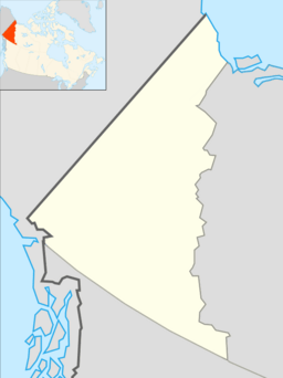
Marsh Lake, also known as Mud Lake, is a large part of the Yukon River in Yukon, Canada. It is located southeast of Whitehorse. The lake is about 30 kilometers (18.6 miles) long and 3 to 4 kilometers (1.9 to 2.5 miles) wide.
Marsh Lake sits high up, about 2,147 feet (654 meters) above sea level. It is one of several "Southern Lakes" that form the very beginning, or headwaters, of the Yukon River. The small community of Marsh Lake, Yukon is found along the northern shores of the lake.
Contents
History of Marsh Lake: Gold Rush and More
Marsh Lake has an interesting past, especially during the exciting time of the Klondike Gold Rush.
Gold Rush Travel on the Yukon River
During the Klondike Gold Rush in the late 1800s, the Yukon River was a super important way to travel. Gold seekers would arrive at Bennett Lake after tough journeys. From there, they had to build their own boats. They would then float down the windy and sometimes dangerous Bennett Lake, Tagish Lake, and "Mud Lake" (which is now Marsh Lake). This was all before they even reached the main Yukon River!
Soon, steamboats started running on the lakes and river. These boats carried people and supplies. They would take passengers to Canyon City, Yukon, which was close to where Whitehorse is today.
The Crystal Palace Stop
Steamboats needed a lot of firewood to keep going. One place where they stopped to get more fuel was at the southeast end of Marsh Lake. This stop was called the Crystal Palace, Yukon. Passengers could get off the boat for a bit while the crew loaded up more wood.
How Marsh Lake Got Its Name
The lake was originally called "Mud Lake." But a surveyor named Frederick Schwatka changed its name to Marsh Lake. He named it after another surveyor, Frederick Marsh.
World War II and Army Beach
During World War II, a big road project called the Alaska Highway was built near Marsh Lake. The military engineers working on this project were based in Whitehorse. One summer day, the daughters of an officer went exploring a swampy area near the northwest end of Marsh Lake. They found a beautiful, warm bay with a huge, clean sand beach! This spot became popular for cottages, first for military families and then for local residents. It's still known as Army Beach today.
The Story of Judas Creek
During the gold rush, people tried to find gold in a place called Judas Creek. They found a sparkly mineral called Pyrite. This mineral looks a lot like gold, but it's not real gold. It's often called "fool's gold." When the miners found out that what they thought was gold was just pyrite, they were very disappointed. Because of this big disappointment, they named the creek Judas Creek.
Marsh Lake as a Community
In the late 1900s, more people wanted to live outside of Whitehorse. The government created new areas along Marsh Lake where people could build cabins. As things like electricity and water were added, Marsh Lake became a "bedroom community." This means many people who live there travel to Whitehorse for work or school.
 | Janet Taylor Pickett |
 | Synthia Saint James |
 | Howardena Pindell |
 | Faith Ringgold |


