Marysville, Iowa facts for kids
Quick facts for kids
Marysville, Iowa
|
|
|---|---|

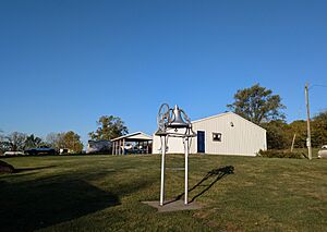
The Town Hall in Marysville
|
|

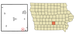
Location of Marysville, Iowa
|
|
| Country | |
| State | |
| County | Marion |
| Area | |
| • Total | 0.54 sq mi (1.40 km2) |
| • Land | 0.54 sq mi (1.40 km2) |
| • Water | 0.00 sq mi (0.00 km2) |
| Elevation | 745 ft (227 m) |
| Population
(2020)
|
|
| • Total | 44 |
| • Density | 81.63/sq mi (31.53/km2) |
| Time zone | UTC-6 (Central (CST)) |
| • Summer (DST) | UTC-5 (CDT) |
| ZIP code |
50116
|
| Area code(s) | 641 |
| FIPS code | 19-50070 |
| GNIS feature ID | 2395036 |
Marysville is a small city in Marion County, Iowa, United States. It's a quiet place with a population of 44 people, according to the 2020 census.
Contents
Discovering Marysville's Location
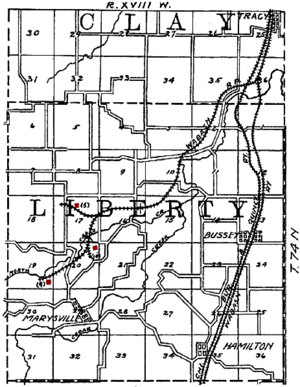
Marysville is found on the north side of Cedar Creek. It is about 15 miles southeast of Knoxville. Knoxville is the main town, or county seat, of Marion County. The city covers a total area of about 0.54 square miles (1.40 square kilometers). All of this area is land.
Marysville's Past: A Look at History
Marysville has an interesting history, especially with coal. Long ago, in 1846, a coal deposit south of Marysville caught fire. This fire burned for five years until heavy rains put it out in 1851.
The town of Marysville was officially planned on March 4, 1851. It was named after five members of the Brobst family who were all named Mary. Over time, Marysville grew. A church was built in 1867, and a local newspaper, the Marysville Miner, started in 1871. By 1910, Marysville had several stores, a post office, a school, and even telephone service.
The Coal Mining Boom
The area around Marysville was rich in coal. Miners found a thick layer of coal about two miles north of town. By 1867, several mines were open. One mine, owned by Jacob Kline, had coal that was 10 feet thick!
Many mines operated in the Marysville area. The Mammoth Vein Coal Company was a major player. To help move the coal, the Wabash Railroad built a special 7-mile spur line to reach the mines.
Life in the Everist Coal Camp
About two miles north of Marysville was a coal camp called Everist. This was a small town built just for miners and their families. The camp had its own post office from 1905 to 1918.
Mines in Everist were busy, shipping up to 800 carloads of coal per day around 1914. The coal company often owned the houses in Everist. They also ran a company store where residents could buy what they needed. Sometimes, special scrip tokens were used instead of regular money at these stores. Miners in Everist were part of a union, United Mine Workers local 981, which had many members. Their daily wages ranged from $1.13 to $2.56.
Marysville's Population Over Time
| Historical populations | ||
|---|---|---|
| Year | Pop. | ±% |
| 1860 | 75 | — |
| 1870 | 266 | +254.7% |
| 1880 | 340 | +27.8% |
| 1890 | 348 | +2.4% |
| 1900 | 322 | −7.5% |
| 1910 | 319 | −0.9% |
| 1920 | 234 | −26.6% |
| 1930 | 149 | −36.3% |
| 1940 | 203 | +36.2% |
| 1950 | 165 | −18.7% |
| 1960 | 113 | −31.5% |
| 1970 | 91 | −19.5% |
| 1980 | 84 | −7.7% |
| 1990 | 65 | −22.6% |
| 2000 | 54 | −16.9% |
| 2010 | 66 | +22.2% |
| 2020 | 44 | −33.3% |
| Source: and Iowa Data Center Source: |
||
Recent Population Figures
In 2020, Marysville had 44 residents. There were 11 households and 9 families living in the city. Most residents, about 97.7%, were White. The average age in Marysville was 48 years old. Many residents, 34.1%, were under 20 years old. About 45.5% were between 45 and 64 years old. The population was almost evenly split between males (52.3%) and females (47.7%).
Back in 2010, the city had 66 people living there. There were 23 households. The racial makeup was mostly White (93.9%). The median age was 37.3 years. About 30.3% of residents were under 18.
Education in Marysville
Students in Marysville attend public schools operated by the Twin Cedars Community School District.
See also
 In Spanish: Marysville (Iowa) para niños
 | James B. Knighten |
 | Azellia White |
 | Willa Brown |


