Maseru facts for kids
Quick facts for kids
Maseru
|
|
|---|---|
|
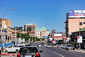
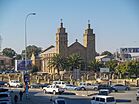
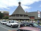
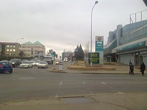
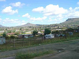
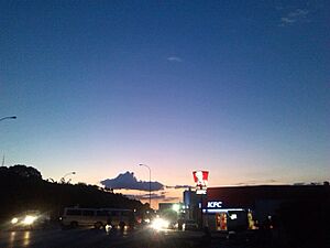
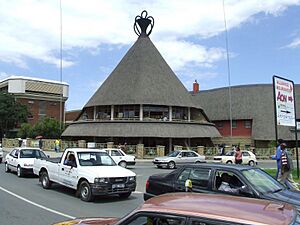
Top: Downtown Maseru; Middle: Our Lady of Victories Cathedral, Basotho Hat Shop; Bottom: Honeymoon Park, Lesotho Parliament Building
|
|
| Country | |
| District | Maseru |
| Constituency | Maseru |
| Established | 1869 |
| Area | |
| • Total | 138 km2 (53 sq mi) |
| Elevation | 1,600 m (5,200 ft) |
| Population
(2016 census)
|
|
| • Total | 330,760 |
| • Density | 2,397/km2 (6,210/sq mi) |
| Time zone | UTC+02:00 (South African Standard Time) |
| • Summer (DST) | (Not Observed) |
| Climate | Cwb |
Maseru is the capital city and the largest city in Lesotho. It is also the main city of the Maseru District. Maseru is located right on the border between Lesotho and South Africa, along the Caledon River. In 2016, about 330,760 people lived there.
The city started as a police camp in 1869. This was after Lesotho became a British protectorate, which meant it was protected and controlled by Britain. Maseru became the capital at that time. When Lesotho became an independent country in 1966, Maseru stayed its capital. The name "Maseru" comes from the Sesotho language and means "red sandstones."
Contents
History of Maseru
Maseru was founded by the British in 1869. It began as a small police camp. This happened after some wars, when Basutoland (which is now Lesotho) came under British protection. Maseru was placed near the land that was given to the Orange Free State (now a province in South Africa).
It was about 24 kilometers (15 miles) west of King Moshoeshoe I's old stronghold, Thaba Bosiu. Thaba Bosiu used to be the main center of power. Soon, a busy market town grew around Maseru.
Maseru as a Capital City
Maseru was the administrative capital from 1869 to 1871. Then, the British moved the administration of Basutoland to the Cape Colony. During this time (1871-1884), Basutoland was treated like other areas that Britain had taken over. This made the Basotho people unhappy.
It led to a conflict called the Gun War in 1881, and many buildings in Maseru were burned. In 1884, Basutoland became a Crown colony again, directly ruled by the British Crown. Maseru was made the capital once more. When Basutoland gained its independence in 1966 and became the Kingdom of Lesotho, Maseru remained the country's capital.
Growth and Challenges
Before Lesotho became independent, Maseru was quite small. It had clear colonial borders and not much space to grow. The British also did not focus much on developing the city. After 1966, Maseru grew very quickly. Its size increased about seven times, from around 20 square kilometers (8 sq mi) to 138 square kilometers (53 sq mi) today. This was because nearby villages became part of the city.
The number of people living in Maseru grew by about 7% each year for many decades. This growth slowed down to about 3.5% between 1986 and 1996.
In 1998, there were political problems in Lesotho. This led to damage and unrest in Maseru. It cost a lot of money, about two billion South African rand (US$350 million), to fix the city. The effects of this damage could still be seen until almost 2008.
Geography and Location
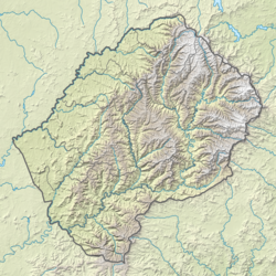
Maseru is located in the northwest part of Lesotho. It is right on the border with South Africa. The Mohokare River, also known as the Caledon River, marks this border. The two countries are connected by the Maseru Bridge border post, which crosses this river. On the South African side, the town closest to Maseru is Ladybrand.
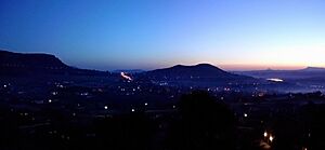
The city sits in a shallow valley. It is at the foot of the Hlabeng-Sa-Likhama, which are small hills leading up to the Maloti Mountains. Maseru is about 1,600 meters (5,200 feet) above sea level. The city covers an area of about 138 square kilometers (53 square miles).
Climate in Maseru
Maseru has a subtropical highland climate. This means it has warm, rainy summers and cool, dry winters. Summer in the Southern Hemisphere is from December to March. During these months, the average daily temperature is about 22°C (72°F).
Winter is from June to September. The average temperature then is about 9°C (48°F). January is the hottest month, with temperatures usually between 15°C and 33°C (59°F and 91°F). July is the coldest month, with temperatures from -3°C to 17°C (27°F to 63°F). The amount of rain changes a lot. It can be as little as 3 millimeters (0.1 inches) in July and up to 111 millimeters (4.4 inches) in January.
| Climate data for Mejametala Airport (1981–2010) | |||||||||||||
|---|---|---|---|---|---|---|---|---|---|---|---|---|---|
| Month | Jan | Feb | Mar | Apr | May | Jun | Jul | Aug | Sep | Oct | Nov | Dec | Year |
| Mean daily maximum °C (°F) | 28.7 (83.7) |
27.6 (81.7) |
25.7 (78.3) |
22.9 (73.2) |
19.7 (67.5) |
16.7 (62.1) |
16.9 (62.4) |
19.7 (67.5) |
23.3 (73.9) |
24.8 (76.6) |
26.3 (79.3) |
27.9 (82.2) |
23.4 (74.0) |
| Mean daily minimum °C (°F) | 14.8 (58.6) |
14.6 (58.3) |
12.5 (54.5) |
8.6 (47.5) |
3.7 (38.7) |
0.2 (32.4) |
−0.5 (31.1) |
2.4 (36.3) |
6.9 (44.4) |
10.1 (50.2) |
11.9 (53.4) |
13.4 (56.1) |
8.2 (46.8) |
| Average rainfall mm (inches) | 121.7 (4.79) |
92.1 (3.63) |
86.2 (3.39) |
46.9 (1.85) |
26.1 (1.03) |
12.1 (0.48) |
5.7 (0.22) |
18.2 (0.72) |
16.1 (0.63) |
62.2 (2.45) |
73.2 (2.88) |
81.0 (3.19) |
641.5 (25.26) |
| Average rainy days (≥ 0.5 mm) | 12 | 10 | 10 | 7 | 4 | 2 | 1 | 2 | 3 | 8 | 8 | 10 | 77 |
| Source: World Meteorological Organization | |||||||||||||
| Climate data for Maseru (1931–1960) | |||||||||||||
|---|---|---|---|---|---|---|---|---|---|---|---|---|---|
| Month | Jan | Feb | Mar | Apr | May | Jun | Jul | Aug | Sep | Oct | Nov | Dec | Year |
| Mean daily maximum °C (°F) | 28 (82) |
27 (81) |
25 (77) |
21 (70) |
18 (64) |
15 (59) |
16 (61) |
19 (66) |
23 (73) |
24 (75) |
26 (79) |
28 (82) |
23 (72) |
| Mean daily minimum °C (°F) | 14 (57) |
14 (57) |
12 (54) |
8 (46) |
3 (37) |
0 (32) |
−1 (30) |
2 (36) |
6 (43) |
9 (48) |
12 (54) |
13 (55) |
8 (46) |
| Average precipitation mm (inches) | 114 (4.5) |
89 (3.5) |
96 (3.8) |
67 (2.6) |
29 (1.1) |
12 (0.5) |
14 (0.6) |
15 (0.6) |
19 (0.7) |
63 (2.5) |
80 (3.1) |
93 (3.7) |
691 (27.2) |
| Average precipitation days (≥ 0.1 mm) | 13 | 10 | 11 | 8 | 6 | 3 | 3 | 3 | 3 | 8 | 10 | 10 | 88 |
| Average relative humidity (%) | 37 | 42 | 43 | 42 | 38 | 35 | 32 | 27 | 24 | 30 | 34 | 35 | 35 |
| Mean monthly sunshine hours | 287 | 263 | 259 | 241 | 247 | 232 | 254 | 279 | 278 | 276 | 279 | 307 | 3,202 |
| Source: Danish Meteorological Institute | |||||||||||||
Population and Demographics
The most recent count of people in Maseru was in 2016. It showed that 330,760 people lived in the city. This is about one-tenth of all the people in Lesotho. It is also half of everyone who lives in cities in the country.
In 1986, the city's population was 98,017. By 1996, it had grown to 137,837. These numbers show how fast the city grew after Lesotho became independent.
Transportation in Maseru
A railway line was built in 1905. It crosses the Mohokare River and connects Maseru to Marseilles in South Africa. Marseilles is on South Africa's main railway line between Bloemfontein and Bethlehem.
Kingsway was the first paved road in Lesotho. It connects the old Leabua Jonathan Airport (now Mejametalana Airport) and the Royal Palace in Maseru. Before 1947, it was just a dirt path. It was paved for a visit by the British Royal Family. Kingsway was the only paved road in Lesotho until the country became independent in 1966.
Two main roads lead out of Maseru. Main North 1 goes northeast, and Main South 1 goes southeast towards Mazenod and Roma. The South African N8 road starts at the Maseru Bridge border post. It goes west towards Ladybrand and Bloemfontein.
The Moshoeshoe I International Airport is an international airport located nearby. It is in Thoteng-ea-Moli, Mazenod. The National University of Lesotho is in Roma, about 32 kilometers (20 miles) from Maseru.
Economy of Maseru
The city's business activities are focused on two main areas. These areas are called central business districts. They are located near Kingsway and offer many jobs. The western business district has larger office buildings, big stores, and several banks. The eastern business district has mostly smaller shops, markets, and street sellers. These central areas are where most people in the city find work.
Maseru's economy is growing very quickly. This is especially true for foreign investments and tourism since Lesotho became independent. The city's economy faced problems when political unrest happened in 1998. Since then, the city has worked hard to recover from the damage.
Maseru's industries are in two main parts of the city. One is north of the central business districts along Moshoeshoe Road. It has flour mills and other large companies. The other industrial area is south of the central business districts, in the Thetsane district. This area mainly has companies that make textiles (cloth) and footwear (shoes).
Until 2004, Maseru had a growing textile industry. Chinese companies invested in and supported it. However, after an agreement called the Multi Fibre Arrangement ended, the textile industry in Lesotho became smaller. The city used to make things like candles, carpets, and mohair products. But now, industries in South Africa have become more dominant.
Places of Worship
Most places of worship in Maseru are Christian churches and temples. These include churches from the Apostolic Faith Mission of South Africa, Zion Christian Church, Anglican Church of Southern Africa, and the Roman Catholic Archdiocese of Maseru. The Roman Catholic Archdiocese has its main church, Our Lady of Victories Cathedral, in the city. There are also Muslim mosques in Maseru.
Architecture and Buildings
Many traditional round, mud-brick houses with thatched roofs, called rondavels, have been replaced. Now, there are modern houses and office buildings. These new buildings sometimes include elements of traditional design. Recently, some new buildings have appeared in the city center. One new building across from the LNDC center now has a cafe, a Vodacom shop, and offices. A new building for the Ministry of Health was finished in late 2007.
Buildings that were damaged during the 1998 political unrest have been rebuilt. These new buildings now house shops like Fruits and Veg City, Woolworths, and Mr Price. The New Lehakoe National Sports Centre is located between the Central Bank of Lesotho and the old parliament building. It has tennis courts, swimming pools, meeting rooms, bars, and gyms. In November 2009, Pioneer Mall opened. This gave Maseru a modern shopping mall like those in South Africa, with many stores and restaurants. Pioneer Mall led to even more modern buildings in the city, such as Maseru Mall and City Square Centre.
There are still some buildings from the colonial era in the city center. The most notable ones are the Cathedral of Our Lady of Victories (a Catholic church) and the Anglican St. John's Church. Other important sights include the Royal Palace, the Parliament building, and the State House.
Sports in Maseru
Lesotho's national stadium is called the Setsoto Stadium. It is located in Maseru. This stadium can hold between 20,000 and 25,000 people. It is mostly used for football matches and is the home of the Lesotho national football team. The stadium also hosts athletics events.
Out of the 16 teams in the Lesotho Premier League, 12 are from Maseru. As of 2020, Maseru-based teams have won 36 out of the 51 championships in the league. The most successful teams are Matlama FC, with ten championship wins, and the football team of the Royal Lesotho Defence Force, with eight wins.
Twin Towns and Sister Cities
Maseru has sister cities around the world. These are cities that have special friendly relationships.
See also
 In Spanish: Maseru para niños
 | May Edward Chinn |
 | Rebecca Cole |
 | Alexa Canady |
 | Dorothy Lavinia Brown |


