Mathoura facts for kids
Quick facts for kids MathouraNew South Wales |
|||||||||
|---|---|---|---|---|---|---|---|---|---|
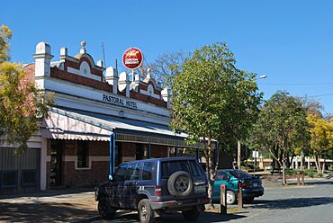
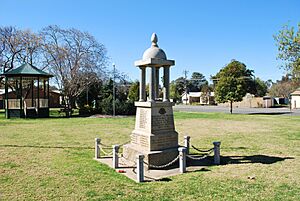
Pastoral Hotel, with the Soldiers Memorial Garden and the Tattersalls Club Hotel in the background
|
|||||||||
| Population | 938 (20162016 census) | ||||||||
| Established | 1860 | ||||||||
| Postcode(s) | 2710 | ||||||||
| Elevation | 105 m (344 ft) | ||||||||
| Location |
|
||||||||
| LGA(s) | Murray River Council | ||||||||
| County | Cadell | ||||||||
| State electorate(s) | Murray | ||||||||
| Federal Division(s) | Farrer | ||||||||
|
|||||||||
Mathoura /məˈθaʊərə/ is a small town in the Riverina area of southern New South Wales, Australia. It is part of the Murray River Council local government area. In 2016, Mathoura had 938 people living there. By 2021, the population grew to 1,002.
The town's name might come from a Yorta Yorta word meaning 'windy'. The Yorta Yorta people are the traditional owners of the land around Mathoura. Their lands are on both sides of the Murray River, including towns like Echuca and Shepparton.
Contents
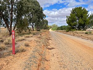
Traveling Through Mathoura: The Cobb Highway
Mathoura is located on the Cobb Highway. This highway is named after the famous Cobb & Company Coach services. These coaches used to travel along the same route. They went from the Murray River all the way to Wilcannia on the Darling River.
Cobb & Co started running coaches between Moama and Deniliquin in 1864. This was after the Melbourne-Echuca railway line opened. They continued this service until the Echuca-Deniliquin railway opened in 1876. Along this route, horses were changed at places like Mathoura.
Mathoura's Early Days: The 1800s
In 1848, a special area was set aside near Gulpa Creek. This spot became known as Redbank. By 1853, a man named W. Moore Carter opened an inn (a type of hotel) at Redbank. He later bought some land there. By 1860, Carter was growing crops, including grapes for wine.
People wanted the government to sell more land in Redbank. However, some thought a better place for a village was at Hill Plain. In 1860, the town of Redbank was planned near Carter's inn.
A traveler in 1865 described Carter's brick public-house by Gulpa Creek. The traveler also saw fruit trees that had dried up. In 1865, Henry Burton, who owned a circus, bought the Redbank Inn.
The Mathoura Post Office opened on 1 September 1867.
The Redbank Railway Station
On 4 July 1876, the Deniliquin & Moama Railway opened. The train station in Mathoura was first called Redbank. This railway line was very flat. Redbank Station was the highest point on the line. It had a large water tank that could be filled from Gulpa Creek.
By 1877, the station had a new crane and a refreshment room. There was also a drinking fountain with fresh water from Gulpa Creek. Redbank had two hotels, a butcher, a general store, and a blacksmith. Fish caught from Gulpa Creek were sold in Melbourne. Local sawmills supplied timber to Deniliquin.
On 2 June 1879, the Redbank Railway Station was renamed Mathoura. This was because Mathoura was the official name for the town. Also, goods meant for other places called Redbank often ended up in Mathoura by mistake.
By 1879, the village had about six houses. It mainly relied on the timber industry. By 1882, Mathoura had a flour mill, two hotels, a school, and a church.
Mathoura in the 1900s
Protecting Birds: The Feather Trade Campaign
In 1906 and 1907, a bird expert and photographer named A. H. E. Mattingley visited the St Helena swampland near Mathoura. He was studying birds.
On his second trip, he made a shocking discovery. He found 50 white and plumed egrets that had been shot by 'plume hunters'. These hunters killed birds to sell their feathers for the fashion industry. Mattingley also saw 70 baby birds that had died and 200 more left to starve.
Mattingley was very upset. He published his story and shared his photographs. This news spread across Australia and the world. His work helped a long campaign to stop using bird feathers in clothing. This led to new laws, like the US 1918 Migratory Bird Treaty Act.
Mathoura and the First World War
The first man from Mathoura to join the First World War was Samuel Gardiner. He enlisted on 16 September 1914, when he was 22 years old.
Gardiner was honored at a ceremony in Mathoura. People praised his bravery for joining the army. They said he would help protect the nation. Gardiner promised to do his best for Australia. He was given a wrist watch as a gift.
Gardiner fought at Gallipoli. He was there from the very beginning of the fighting. In August 1915, he was badly hurt and lost a leg. He returned to Australia in 1916. Later, he worked as a Rabbit Inspector in the Deniliquin area. He died in 1933 from his war injuries.
Celebrating Peace: Victory Picnic
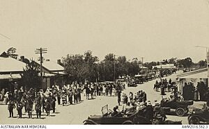
When the First World War ended in November 1918, Mathoura celebrated with a huge picnic. The day started with a parade. The Echuca Rangers' Band led the way. People dressed up as John Bull, Red Cross nurses, and soldiers. Girls represented all the Allied nations. Decorated cars, buggies, and carts followed. There was even a Scottish band with a piper!
Mathoura Today
Mathoura has an Australian Rules football team. They play in the Picola & District Football League. Golfers can also enjoy a game at the Mathoura Golf Club, which is located on the Cobb Highway.
The Cadell Tilt: A Natural Wonder
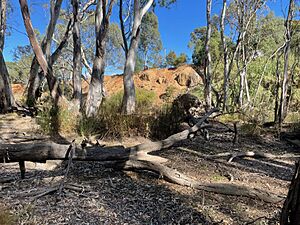
Mathoura's old name, 'Redbank', came from the red rocks seen near the town. These rocks are part of a small cliff formed by the Cadell Fault. This fault is also called the Tilt.
Thousands of years ago, about 65,000 to 45,000 years ago, earthquakes caused a crack in the Earth's crust. A large section of land, 60 kilometers wide and 250 meters thick, was pushed up. It tilted like a partly open trapdoor. Mathoura sits on the higher, eastern edge of this tilted land.
The edge of this tilted land is a few hundred meters east of the Cobb Highway. The Gulpa Creek, east of town, flows along the base of this tilted area. You can see the height of this land from a walking track on the other side of Gulpa Creek.
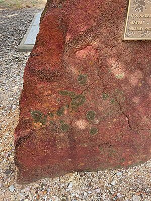
The heat from the forces that lifted the land melted sand into striking red rocks. These rocks gave the area its name. You can see these bright red rocks on the south side of Mitchell Street. One red rock holds a plaque marking the opening of the town's sewerage pumping works.
Green Gully: The Old Murray River
Many thousands of years ago, the Murray River flowed through the area where Mathoura is now. But when the Cadell Tilt formed, it acted like a huge dam. It blocked the river's path. The water backed up and formed large lakes. Eventually, the water found new ways to flow around the blockage.
Some water flowed north around the Tilt, forming what we now call the Edward River. The water that flowed around the southern end of the Tilt became today's Murray River.
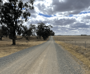
The original riverbed, now empty, is called Green Gully. You can still see this old river channel clearly in aerial photos. On the ground, just west of Mathoura, roads like Stirling Park Road and Solly Road cross over Green Gully.
Climate in Mathoura
| Climate data for Mathoura | |||||||||||||
|---|---|---|---|---|---|---|---|---|---|---|---|---|---|
| Month | Jan | Feb | Mar | Apr | May | Jun | Jul | Aug | Sep | Oct | Nov | Dec | Year |
| Record high °C (°F) | 44.7 (112.5) |
44.2 (111.6) |
40.8 (105.4) |
34.9 (94.8) |
27.2 (81.0) |
26.6 (79.9) |
19.4 (66.9) |
23.1 (73.6) |
33.3 (91.9) |
37.8 (100.0) |
41.7 (107.1) |
41.9 (107.4) |
44.7 (112.5) |
| Mean daily maximum °C (°F) | 31.4 (88.5) |
30.3 (86.5) |
27.5 (81.5) |
22.1 (71.8) |
16.9 (62.4) |
14.1 (57.4) |
12.9 (55.2) |
15.0 (59.0) |
18.1 (64.6) |
21.7 (71.1) |
25.6 (78.1) |
28.6 (83.5) |
22.0 (71.6) |
| Mean daily minimum °C (°F) | 15.5 (59.9) |
15.2 (59.4) |
13.2 (55.8) |
9.2 (48.6) |
6.1 (43.0) |
4.3 (39.7) |
3.3 (37.9) |
4.2 (39.6) |
5.9 (42.6) |
8.7 (47.7) |
10.7 (51.3) |
13.1 (55.6) |
9.1 (48.4) |
| Record low °C (°F) | 5.6 (42.1) |
5.8 (42.4) |
2.8 (37.0) |
1.3 (34.3) |
−1.1 (30.0) |
−3.3 (26.1) |
−3.8 (25.2) |
−2.6 (27.3) |
−1.4 (29.5) |
−0.7 (30.7) |
0.8 (33.4) |
4.4 (39.9) |
−3.8 (25.2) |
| Average precipitation mm (inches) | 32.3 (1.27) |
23.5 (0.93) |
35.8 (1.41) |
28.0 (1.10) |
40.6 (1.60) |
36.8 (1.45) |
42.6 (1.68) |
43.4 (1.71) |
41.8 (1.65) |
41.6 (1.64) |
34.7 (1.37) |
34.6 (1.36) |
436.3 (17.18) |
| Average precipitation days | 3.8 | 3.6 | 4.3 | 5.3 | 8.0 | 9.0 | 10.5 | 10.6 | 8.9 | 7.7 | 6.1 | 5.2 | 83.0 |
 | Emma Amos |
 | Edward Mitchell Bannister |
 | Larry D. Alexander |
 | Ernie Barnes |


