Matoaka, West Virginia facts for kids
Quick facts for kids
Matoaka, West Virginia
|
|
|---|---|
|
Census-designated place
|
|

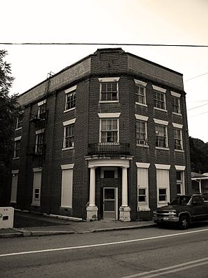
Bank of Matoaka West Virginia
|
|

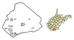
Location of Matoaka in Mercer County, West Virginia.
|
|
| Country | United States |
| State | West Virginia |
| County | Mercer |
| Area | |
| • Total | 0.26 sq mi (0.68 km2) |
| • Land | 0.26 sq mi (0.68 km2) |
| • Water | 0.00 sq mi (0.00 km2) |
| Elevation | 2,359 ft (719 m) |
| Population
(2020)
|
|
| • Total | 173 |
| • Density | 655.3/sq mi (253.0/km2) |
| Time zone | UTC-5 (Eastern (EST)) |
| • Summer (DST) | UTC-4 (EDT) |
| ZIP code |
24736
|
| Area code(s) | 304 |
| FIPS code | 54-52420 |
| GNIS feature ID | 1542868 |
Matoaka is a small community located in Mercer County, West Virginia, in the United States. It's called a "census-designated place" because it's a special area defined by the government for counting people.
In 2020, about 173 people lived in Matoaka. It is part of a larger area known as the Bluefield micropolitan area, which has over 100,000 residents.
The town gets its name from Chief Powhatan's daughter, Matoaka. She was better known by her nickname, "Pocahontas". Matoaka used to be an official town, but in May 2018, its residents voted to become an "unincorporated town." This means it no longer has its own local government.
Contents
Geography and Climate
Matoaka is located at these coordinates: 37°25′7″N 81°14′31″W / 37.41861°N 81.24194°W.
The United States Census Bureau says that Matoaka covers about 0.26 square miles (0.68 square kilometers) of land. There is no water area within the community.
Matoaka's Weather
The weather in Matoaka usually has mild differences between the highest and lowest temperatures. It also gets enough rain throughout the year. According to the Köppen Climate Classification system, Matoaka has a marine west coast climate. This type of climate is sometimes called "Cfb" on climate maps.
Population Changes Over Time
| Historical population | |||
|---|---|---|---|
| Census | Pop. | %± | |
| 1920 | 647 | — | |
| 1930 | 929 | 43.6% | |
| 1940 | 926 | −0.3% | |
| 1950 | 1,003 | 8.3% | |
| 1960 | 613 | −38.9% | |
| 1970 | 608 | −0.8% | |
| 1980 | 613 | 0.8% | |
| 1990 | 366 | −40.3% | |
| 2000 | 317 | −13.4% | |
| 2010 | 227 | −28.4% | |
| 2020 | 173 | −23.8% | |
| U.S. Decennial Census | |||
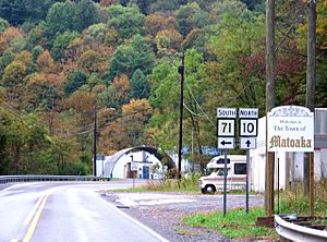
Matoaka in 2010
During the 2010 census, there were 227 people living in Matoaka. These people lived in 87 different homes, and 60 of those were families.
The population density was about 873 people per square mile (337 people per square kilometer). There were 145 housing units, which are places where people can live.
Most of the people living in Matoaka in 2010 were White (98.7%). A small number were African American (0.4%) or Asian (0.9%).
- About 35.6% of the homes had children under 18 living there.
- 55.2% of homes were married couples living together.
- 8.0% of homes had a female head of household with no husband.
- 5.7% of homes had a male head of household with no wife.
- 31.0% of homes were not families.
The average number of people in each home was 2.61. For families, the average size was 3.12 people.
The average age of people in Matoaka was 40.2 years.
- 26.4% of residents were under 18 years old.
- 7% were between 18 and 24 years old.
- 22.5% were between 25 and 44 years old.
- 25% were between 45 and 64 years old.
- 18.9% were 65 years or older.
The population was almost evenly split between males and females. About 50.2% were male, and 49.8% were female.
See also
- Matoaka (Virginia Occidental) para niños (This link is to a Spanish version of this article for kids.)
 | Stephanie Wilson |
 | Charles Bolden |
 | Ronald McNair |
 | Frederick D. Gregory |


