Mattatuck State Forest facts for kids
Quick facts for kids Mattatuck State Forest |
|
|---|---|
 |
|
| Location | Connecticut, United States |
| Area | 4,673 acres (18.91 km2) |
| Elevation | 594 ft (181 m) |
| Established | 1926 |
| Governing body | Connecticut Department of Energy and Environmental Protection |
| Website | Mattatuck State Forest |
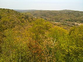
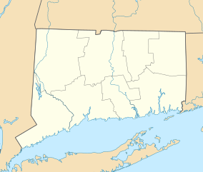
Mattatuck State Forest is a large natural area in Connecticut, United States. It's made up of over twenty separate pieces of land. These pieces are spread across several towns like Waterbury, Plymouth, Thomaston, Watertown, Litchfield, and Harwinton. The forest was officially created in 1926.
A part of the Naugatuck River flows through the forest. The biggest section of the forest is located about 1 mile (1.6 km) north of Waterbury. You can also find the famous Leatherman's Cave here. This cave is named after a mysterious traveler from the late 1800s called the Leatherman. The cave is in Thomaston, right on the Mattatuck Trail. It's just north of where the Jericho Trail meets it.
Contents
Exploring Mattatuck State Forest
Mattatuck State Forest is a fantastic place for outdoor adventures. It offers many ways to explore nature. You can go hiking, discover interesting rock formations, and enjoy the quiet beauty of the woods.
Fun Things to Do in the Forest
The forest has many trails for hiking and exploring. These trails are part of the "Blue-Blazed Trails" system. Some of the well-known trails include the Jericho Trail, Hancock Brook Trail, and Whitestone Cliffs Trail.
Trails West of Route 8
These trails are located on the west side of Connecticut Route 8.
- Jericho Trail: This trail is about 3.4 miles (5.5 km) long. It starts from Echo Lake Road in Watertown. It leads to where the Mattatuck Trail meets it. This spot is near Crane's Overlook and the Leatherman's Cave.
- Branch Brook Trail: Most of this 0.8-mile (1.3 km) trail is inside the forest. You can find it south of Reynolds Bridge Road in Watertown.
Trails East of Route 8
These trails are located on the east side of Route 8.
- Hancock Brook Trail: This trail is 2.8 miles (4.5 km) long. It runs next to the Waterbury Branch of Metro North.
- Whitestone Cliffs Trail: This trail is 1.7 miles (2.7 km) long. You can find it off Connecticut Route 262.
Trails on Both Sides of Route 8
Some trails connect areas on both sides of Connecticut Route 8.
- Jericho-Whitestone Connector: This trail is 1.6 miles (2.6 km) long. It connects Connecticut Route 262 to the Whitestone Cliffs Trail. This part is on the east side of Route 8 in Thomaston and Plymouth.
- The Jericho-Whitestone Connector also enters the forest north of the powerlines near Echo Lake Road in Watertown. It ends at the Jericho Trail.
The Mattatuck Trail
The Mattatuck Trail goes through several parts of the forest.
- In Plymouth: On the east side of Connecticut Route 8, the trail goes through a separate part of the forest south of Scott Road. It also passes another section south of Lake Plymouth, reaching Mount Tobe Road.
- In Thomaston: On the east side of Connecticut Route 8, the trail runs from Carter Road to Waterbury Road.
- In Watertown: On the west side of Connecticut Route 8, the trail goes near the highway. It's just south of Reynolds Bridge Road. It then extends to Bidwell Hill Road, where the trail enters Black Rock State Park.
Rock Climbing at Whitestone
The Whitestone rock climbing area is located within the largest part of the forest. It's just east of the Naugatuck River. Climbers use "top-roping" techniques here. The rock faces are about 50 feet (15 m) high. You can get to this climbing area from South Street.
 | Sharif Bey |
 | Hale Woodruff |
 | Richmond Barthé |
 | Purvis Young |


