
Harwinton, Connecticut facts for kids
Quick facts for kids
Harwinton, Connecticut
|
||
|---|---|---|
| Town of Harwinton | ||

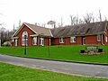
Harwinton Town Hall
|
||
|
||
 Litchfield County and Connecticut Litchfield County and Connecticut Northwest Hills Planning Region and Connecticut Northwest Hills Planning Region and Connecticut |
||
| Country | ||
| U.S. state | ||
| County | Litchfield | |
| Region | Northwest Hills | |
| Incorporated | 1737 | |
| Government | ||
| • Type | Selectman-town meeting | |
| Area | ||
| • Total | 31.2 sq mi (80.7 km2) | |
| • Land | 30.8 sq mi (79.8 km2) | |
| • Water | 0.3 sq mi (0.9 km2) | |
| Elevation | 794 ft (242 m) | |
| Population
(2020)
|
||
| • Total | 5,484 | |
| • Density | 178/sq mi (68.7/km2) | |
| Time zone | UTC−5 (Eastern) | |
| • Summer (DST) | UTC−4 (Eastern) | |
| ZIP code |
06791
|
|
| Area code(s) | 860/959 | |
| FIPS code | 09-37280 | |
| GNIS feature ID | 0213444 | |

Harwinton is a small town in Litchfield County, Connecticut, United States. About 5,484 people lived here in 2020. It's part of the Northwest Hills Planning Region. Students in Harwinton attend schools in Regional School District 10.
Contents
Harwinton's History and Beginnings
Before European settlers arrived, the land where Harwinton is now was home to different Native American tribes, like the Tunxis people. In May 1729, the Connecticut Colony gave parts of this land to the towns of Hartford and Windsor.
The first settler, Daniel Messenger, arrived in January 1730. Over the next few years, more formal settlements were created in the areas given to Hartford and Windsor. Harwinton officially became its own town in October 1737. Its name comes from a mix of "Hartford" (HAR) and "Windsor" (WIN), with "-ton" meaning "town."
Geography of Harwinton
Harwinton is located in the eastern part of Litchfield County. To its northwest is the city of Torrington. To the east, it borders Burlington in Hartford County.
The state capital, Hartford, is about 23 miles (37 km) to the east. The city of Bristol is about 11 miles (18 km) to the southeast.
Land and Water Features
Harwinton covers a total area of about 31.2 square miles (80.7 square kilometers). Most of this area, about 30.8 square miles (79.8 square kilometers), is land. The remaining 0.3 square miles (0.9 square kilometers), or 1.12%, is water.
The Naugatuck River forms the western border of the town. In the southeastern part of Harwinton, you can find the Roraback Wildlife Area and several reservoirs.
Main Communities in Harwinton
Harwinton has a few smaller communities within its borders:
- Campville
- Harwinton Center (which is part of the Northwest Harwinton Census-Designated Place)
Population and People of Harwinton
| Historical population | |||
|---|---|---|---|
| Census | Pop. | %± | |
| 1820 | 1,500 | — | |
| 1850 | 1,175 | — | |
| 1860 | 1,044 | −11.1% | |
| 1870 | 1,044 | 0.0% | |
| 1880 | 1,016 | −2.7% | |
| 1890 | 943 | −7.2% | |
| 1900 | 1,213 | 28.6% | |
| 1910 | 1,440 | 18.7% | |
| 1920 | 2,020 | 40.3% | |
| 1930 | 949 | −53.0% | |
| 1940 | 1,112 | 17.2% | |
| 1950 | 1,858 | 67.1% | |
| 1960 | 3,344 | 80.0% | |
| 1970 | 4,318 | 29.1% | |
| 1980 | 4,889 | 13.2% | |
| 1990 | 5,228 | 6.9% | |
| 2000 | 5,283 | 1.1% | |
| 2010 | 5,642 | 6.8% | |
| 2020 | 5,484 | −2.8% | |
| U.S. Decennial Census | |||
According to the 2020 Census, Harwinton had 5,484 people living in 1,641 family households. The town had about 178 people per square mile (68.7 per square kilometer). There were 2,313 homes in total.
Most of the people in Harwinton, about 93.0%, identified as White. About 0.67% were African American, and 0.16% were Native American. About 0.57% were Asian. People of Hispanic or Latino background made up 3.14% of the population.
There were 2,179 households with people living in them. About 25.5% of these households had children under 18. Most households, 62.6%, were married couples living together. The average household size was 2.52 people.
The population's age breakdown was:
- 20.3% were under 18 years old.
- 6.4% were from 18 to 24 years old.
- 18.7% were from 25 to 44 years old.
- 31.4% were from 45 to 64 years old.
- 23.2% were 65 years or older.
The median age in Harwinton was 48.7 years. The population was almost evenly split between males (50.3%) and females (49.7%).
Income and Economy
From 2018 to 2022, the average household income in Harwinton was about $102,078. The average income per person was $53,705. About 3.2% of the population lived below the poverty line.
Voter Registration and Political Parties
As of October 31, 2023, Harwinton had 4,603 registered voters. Here's how they were divided by political party:
| Voter registration and party enrollment as of October 31, 2023 | |||||
|---|---|---|---|---|---|
| Party | Active voters | Inactive voters | Total voters | Percentage | |
| Republican | 1,508 | 69 | 1,577 | 34.26% | |
| Democratic | 935 | 58 | 993 | 21.57% | |
| Unaffiliated | 1,816 | 133 | 1,949 | 42.34% | |
| Minor Parties | 77 | 7 | 84 | 1.82% | |
| Total | 4,336 | 267 | 4,603 | 100% | |
Transportation in Harwinton
Several roads help people travel in and out of Harwinton:
- Connecticut Route 4 connects Harwinton to Torrington in the northwest and to Hartford in the east.
- Route 118 goes west from Harwinton to Litchfield center. It also has a connection to the Route 8 expressway in western Harwinton.
- Route 222 runs south from Harwinton to Thomaston center.
- Route 72 goes south and then east to the city of Bristol.
Famous People from Harwinton
Many notable people have connections to Harwinton:
- Harry C. Bentley (1877–1967), who founded Bentley University.
- Jonathan Brace (1754–1837), a judge and a U.S. congressman.
- George S. Catlin (1808–1851), another U.S. congressman.
- Collis Potter Huntington (1821–1900), one of the four men who started the Central Pacific Railroad.
- Elam Luddington (1806–1893), an early Mormon pioneer to Utah and the first Mormon missionary in Thailand.
- Luman Watson (1790–1834), a skilled clockmaker.
- Abner Wilcox (1808–1869), a missionary teacher in the Kingdom of Hawaii.
Notable Places to Visit
Harwinton is home to several interesting historical locations:
- Burlington-Harmony Hills Roads Historic District
- Jason Skinner House
- Litchfield–South Roads Historic District
Images for kids
-
Harwinton Town Hall
-

Seal of Harwinton
See also
 In Spanish: Harwinton (Connecticut) para niños
