Thomaston, Connecticut facts for kids
Quick facts for kids
Thomaston, Connecticut
|
||
|---|---|---|
| Town of Thomaston | ||

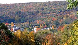
Autumn 2003 view of Thomaston from Plymouth
|
||
|
||
| Motto(s):
"A Town For All Time..."
|
||
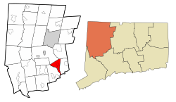
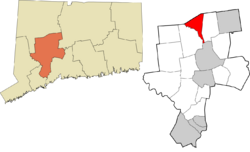
 Litchfield County and Connecticut Litchfield County and Connecticut |
||
| Country | ||
| U.S. state | ||
| County | Litchfield | |
| Region | Naugatuck Valley | |
| Incorporated | 1875 | |
| Government | ||
| • Type | Selectman-town meeting | |
| Area | ||
| • Total | 12.2 sq mi (31.6 km2) | |
| • Land | 12.0 sq mi (31.0 km2) | |
| • Water | 0.2 sq mi (0.6 km2) | |
| Elevation | 446 ft (136 m) | |
| Population
(2020)
|
||
| • Total | 7,442 | |
| • Density | 622/sq mi (240.1/km2) | |
| Time zone | UTC-5 (Eastern) | |
| • Summer (DST) | UTC-4 (Eastern) | |
| ZIP codes |
06787
|
|
| Area code(s) | 860/959 | |
| FIPS code | 09-75730 | |
| GNIS feature ID | 0213515 | |
Thomaston is a small and friendly town located in Litchfield County, Connecticut. It's part of the Naugatuck Valley Planning Region. In 2020, about 7,442 people lived here. The main part of the town, called the Thomaston census-designated place, had 1,928 residents in 2020.
Contents
History of Thomaston
How Thomaston Began
Thomaston was first settled around 1728 by Henry Cook. Back then, it was actually part of a nearby town called Plymouth. People used to call this area "Plymouth Hollow."
The Rise of Clockmaking
Thomaston became famous for making clocks. This industry started in 1803 when Eli Terry opened a factory. Terry was a pioneer who used mass production methods. This meant he could make many clocks quickly and cheaply.
His invention, the shelf clock, patented in 1814, changed everything. It made clocks much more affordable. A clock that once cost $25 could now be bought for just $5! Terry's clocks were sold all over the United States.
Becoming the Town of Thomaston
The town officially became its own separate town in 1875. It was named "Thomaston" after Seth Thomas. He was another important clockmaker who opened a factory here in 1812. The original Seth Thomas clock factory building is still standing today. However, clockmaking is no longer a major industry in Thomaston.
Geography of Thomaston
Where is Thomaston Located?
Thomaston is in the southeastern part of Litchfield County. To its south, it shares a border with the city of Waterbury. The town covers about 31.6 square kilometers (12.2 square miles). Most of this area is land, with a small part being water.
Rivers and Flood Control
Three important waterways meet in Thomaston: the Naugatuck River, Northfield Brook, and Black Rock Brook. After a big flood in 1955, the U.S. Army Corps of Engineers built dams on these waterways. These dams help protect the town from future floods.
Neighborhoods in Thomaston
Thomaston has several smaller communities within its borders. Some of these include:
- Reynolds Bridge
- Downtown
- Highwood Farms
- Hickory Hill
- High Street Ext
Neighboring Towns and Cities
Thomaston is surrounded by several other towns and one city:
- North: Litchfield and Northfield
- Northeast: Harwinton
- East: Plymouth
- South: Waterbury
- Southwest: Watertown
- West: Morris
Population of Thomaston
| Historical population | |||
|---|---|---|---|
| Census | Pop. | %± | |
| 1880 | 3,225 | — | |
| 1890 | 3,278 | 1.6% | |
| 1900 | 3,300 | 0.7% | |
| 1910 | 3,533 | 7.1% | |
| 1920 | 3,993 | 13.0% | |
| 1930 | 4,188 | 4.9% | |
| 1940 | 4,238 | 1.2% | |
| 1950 | 4,896 | 15.5% | |
| 1960 | 5,850 | 19.5% | |
| 1970 | 6,233 | 6.5% | |
| 1980 | 6,276 | 0.7% | |
| 1990 | 6,947 | 10.7% | |
| 2000 | 7,503 | 8.0% | |
| 2010 | 7,887 | 5.1% | |
| 2020 | 7,442 | −5.6% | |
| U.S. Decennial Census | |||
How Many People Live Here?
In 2000, Thomaston had 7,503 residents living in 2,916 households. About 34.3% of these households had children under 18. The average household had 2.57 people.
The median age in Thomaston was 38 years old. This means half the people were younger than 38 and half were older. About 25.3% of the population was under 18.
Getting Around Thomaston
Roads and Highways
The Route 8 expressway runs through the eastern part of Thomaston. It has three exits that connect to the town. Other important roads include U.S. Route 6, Connecticut Route 109, Route 222, and Route 254.
The Naugatuck Railroad
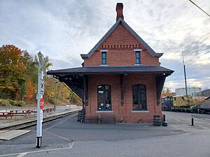
Thomaston is home to the Naugatuck Railroad. This is a special type of railway called a heritage railway. It also operates as a short line for freight. The railroad runs for about 21 miles between Waterbury and Torrington.
Schools in Thomaston
Thomaston has schools for students of all ages.
- Black Rock Elementary School teaches students from Pre-Kindergarten to 3rd grade.
- Thomaston Center School is for students in 4th, 5th, and 6th grade.
- Thomaston High School serves students from 7th to 12th grade. It has about 375 students.
Famous Places in Thomaston
Thomaston has several interesting landmarks to visit:
- Hose and Hook and Ladder Truck Building
- Railroad Museum of New England
- Thomaston Opera House
- Trinity Church
Notable People from Thomaston
Some well-known people have connections to Thomaston:
- Michael J. McGivney (1852–1890): A Roman Catholic priest who founded the Knights of Columbus. He passed away in Thomaston.
- Grattan O'Connell (1902–1942): An early professional football player who was born in Thomaston.
- Thomas James Reeves (1895–1941): A US Navy radioman who bravely died during the attack on Pearl Harbor. He was awarded the Medal of Honor after his death and was born in Thomaston.
- Seth Thomas (1785–1859): A famous 19th-century American clockmaker. He was a pioneer in mass production, and the town is named after him!
See also
 In Spanish: Thomaston (Connecticut) para niños
 | Audre Lorde |
 | John Berry Meachum |
 | Ferdinand Lee Barnett |


