Matthews, Missouri facts for kids
Quick facts for kids
Matthews, Missouri
|
|
|---|---|

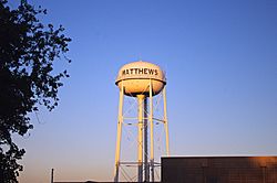
Water tower in Matthews
|
|

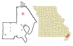
Location of Matthews, Missouri
|
|
| Country | United States |
| State | Missouri |
| County | New Madrid |
| Area | |
| • Total | 1.96 sq mi (5.07 km2) |
| • Land | 1.96 sq mi (5.07 km2) |
| • Water | 0.00 sq mi (0.00 km2) |
| Elevation | 312 ft (95 m) |
| Population
(2020)
|
|
| • Total | 534 |
| • Density | 272.87/sq mi (105.34/km2) |
| Time zone | UTC-6 (Central (CST)) |
| • Summer (DST) | UTC-5 (CDT) |
| ZIP code |
63867
|
| Area code(s) | 573 |
| FIPS code | 29-46730 |
| GNIS feature ID | 2395045 |
Matthews is a small city located in New Madrid County, Missouri, in the United States. According to the 2020 census, 534 people lived there.
Contents
History of Matthews
The town of Matthews got its name from C. D. Matthews, who was one of the first people to settle in the area. A post office has been open in Matthews since 1903. This means the community has been active for over a hundred years.
Geography of Matthews
Matthews is mainly located along County Road H, which is also known as Main Street. This road is mostly west of where it meets U.S. Routes 61 and 62, and also Missouri Route 80. However, the city's official boundaries stretch further east, all the way to Interstate 55.
U.S. Routes 61 and 62 are important roads. They connect Matthews to Sikeston in the north and New Madrid in the south. The U.S. Census Bureau says that Matthews covers a total area of about 1.96 square miles (5.07 square kilometers). All of this area is land.
People in Matthews
The population of Matthews has changed over the years. Here's how many people have lived there during different census counts:
| Historical population | |||
|---|---|---|---|
| Census | Pop. | %± | |
| 1910 | 237 | — | |
| 1920 | 378 | 59.5% | |
| 1930 | 359 | −5.0% | |
| 1940 | 448 | 24.8% | |
| 1950 | 498 | 11.2% | |
| 1960 | 450 | −9.6% | |
| 1970 | 538 | 19.6% | |
| 1980 | 547 | 1.7% | |
| 1990 | 614 | 12.2% | |
| 2000 | 605 | −1.5% | |
| 2010 | 628 | 3.8% | |
| 2020 | 534 | −15.0% | |
| U.S. Decennial Census | |||
Matthews in 2010
In 2010, the city of Matthews had 628 people living there. These people lived in 247 different homes, and 158 of these were families. The city had about 320 people per square mile. The average home had about 2.26 people, and the average family had about 2.77 people.
The average age of people in Matthews in 2010 was 48.8 years old.
- About 16.7% of the people were under 18 years old.
- About 21% of the people were 65 years old or older.
- More women lived in Matthews than men in 2010. About 54% of the population was female, and 46% was male.
Education in Matthews
Students in Matthews attend schools run by the New Madrid County R-I School District. The city has one school, which is Matthews Elementary School. Matthews also has a public library. It is a branch of the New Madrid County Library, where people can borrow books and other materials.
See also
 In Spanish: Matthews (Misuri) para niños

